The “warming effects” of the Arctic Ocean
The North Slope region of far northern Alaska had been abnormally cold for a number of days in late January 2011: for example, Barrow had minimum temperatures of -43ºF / -42ºC and -45ºF / -43ºC on 23 January and 24 January, respectively (the normal low temperature on those days is -20ºF/-29ºC). While the sun actually rose at Barrow on 23 January for the first time in 2011 (from 1:05 pm to 2:14 pm local time), it had little effect on warming the temperatures there (which were around -40ºF/-40ºC at the time).
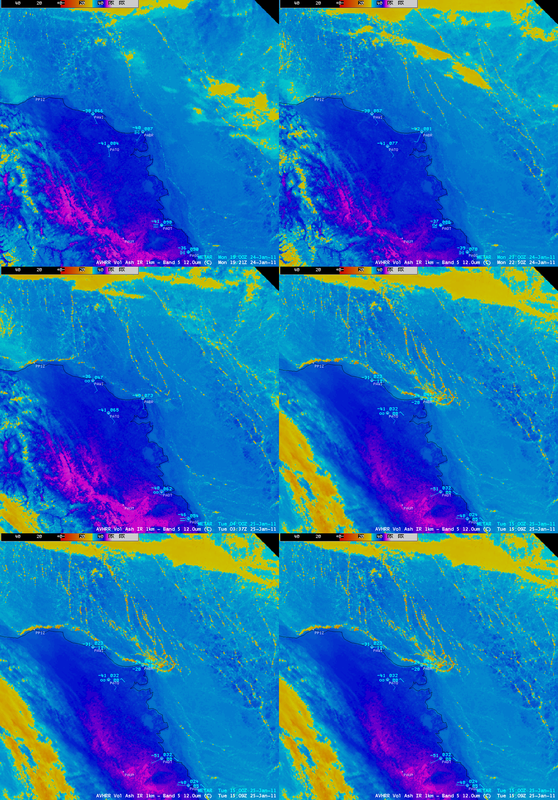
However, a sequence of AWIPS images of POES AVHRR 12.0 µm IR data (above) revealed something that did appear to have a pronounced effect on the warming of surface air temperatures at Barrow: a shift of winds from southerly (offshore, from the cold interior) on 24 January 2011 to northeasterly (onshore, from off the Arctic Ocean) on 25 January 2011. Around the same time as the northeasterly wind shift, a number of long, narrow features — resembling large “cracks” in the sea ice — began to exhibit significantly warmer IR brightness temperatures (-20º to -30ºC, yellow to orange color enhancement) just offshore of Barrow. Apparently a great deal of heat was able to “bleed upward” through these thinner areas of sea ice, which was then transported toward the coast of Alaska by northeasterly winds.
Although the temperature at Barrow (station identifier PABR) rose to -24ºF / -31ºC by 15:09 UTC on 25 January, farther to the southeast the temperature at Nuiqsut (station identifier PAQT) remained at a very cold -51ºF / -46ºC. Note that North is to the upper right, due to the AWIPS “North America” projection of these particular images.
The much larger yellow to orange colored features seen across the interior of Alaska and also over parts of the Arctic Ocean were clouds. The purple colored areas farther inland were regions that exhibited surface IR brightness temperatures of -47ºC or colder.


