The effect of Hurricane Earl on the axis of the Gulf Stream
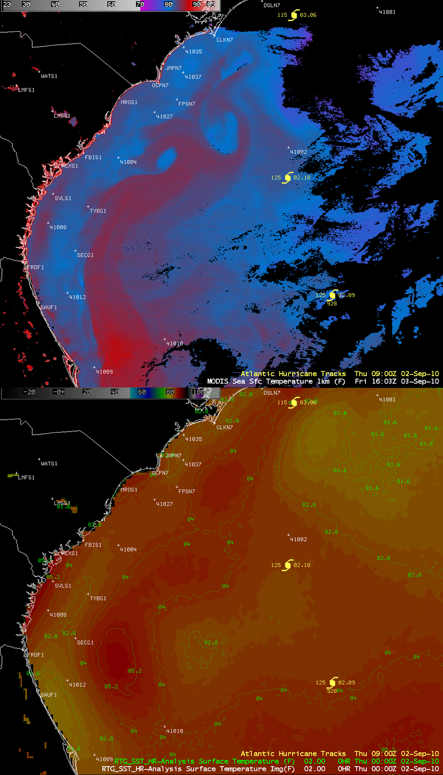
The image comparison above shows “before” and “after” views of the axis of the Gulf Stream off the southeast coast of the US. The “before” view is the Sea Surface Temperatue (SST) analysis from the RTG_SST High Resolution model at 00:00 UTC on 02 September 2010 (before Hurricane Earl arrived) — the axis of the Gulf Stream can be taken to be the wide ribbon of SST values of 84º F and warmer.
The “after” view is an AWIPS image of the 1-km resolution MODIS Sea Surface Temperature product at 16:03 UTC on 03 September 2010 (after Hurricane Earl had passed). One can see the effect that Hurricane Earl had on the axis of the Gulf Stream, with warm and cold eddies of water — the red colors on the MODIS image are SST values in the middle 80s F, while the blue colors are SST values in the upper 70s F.
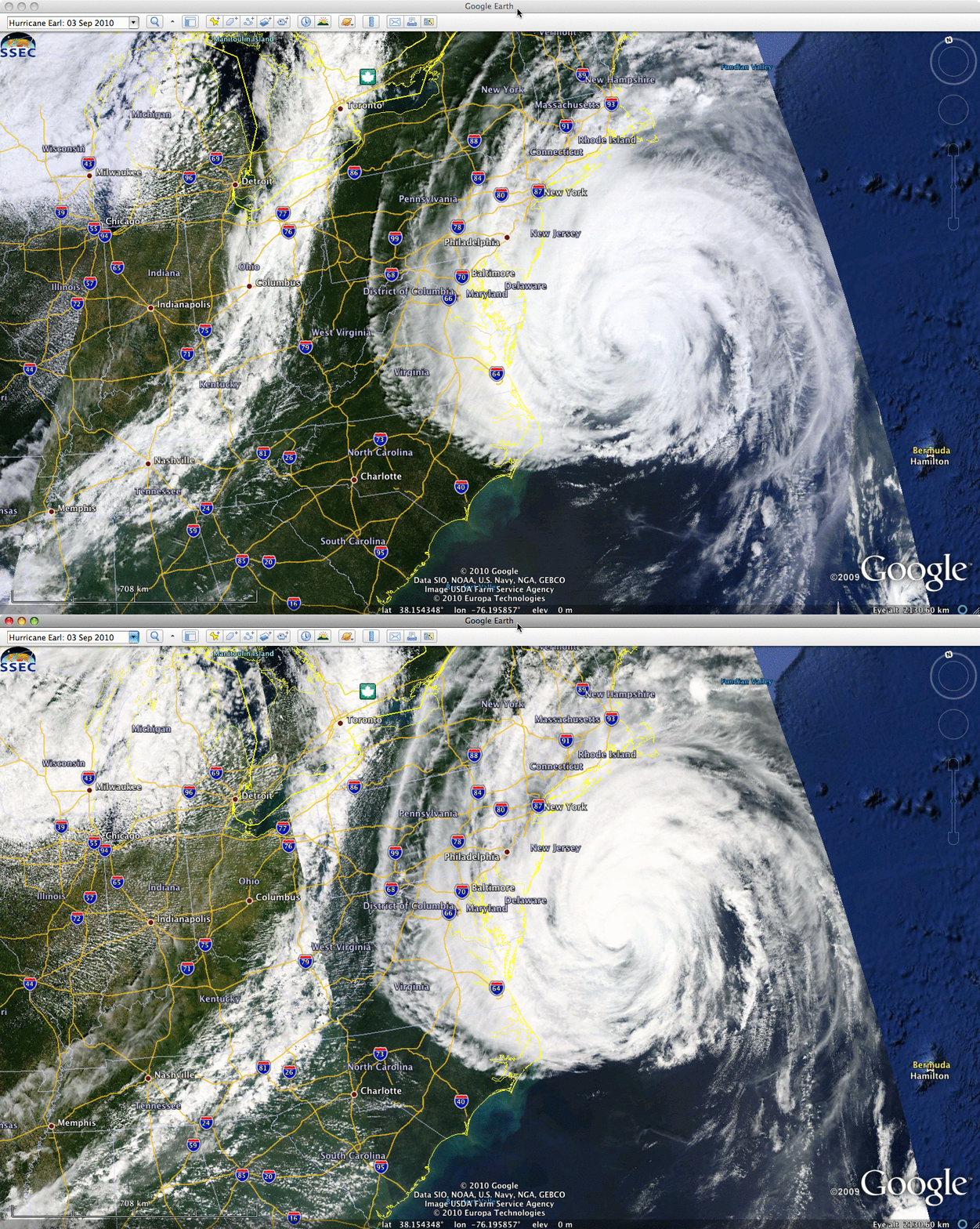
Terra and Aqua MODIS true color Red/Green/Blue (RGB) images from the SSEC MODIS Today site (below) showed Hurricane Earl moving along the East Coast of the US on 03 September. Note the increased amount of sediment flowing off the coast of North Carolina and South Carolina, due to heavy rainfall and strong offshore winds.


