South Dakota’s first February tornado on record
5-minute GOES-16 Red Visible (0.64 µm, left) and Clean Infrared Window (10.3 µm, right) images, with/without an overlay of GLM Flash Extent Density, from 2031-2221 UTC on 24 February [click to play MP4 animation]
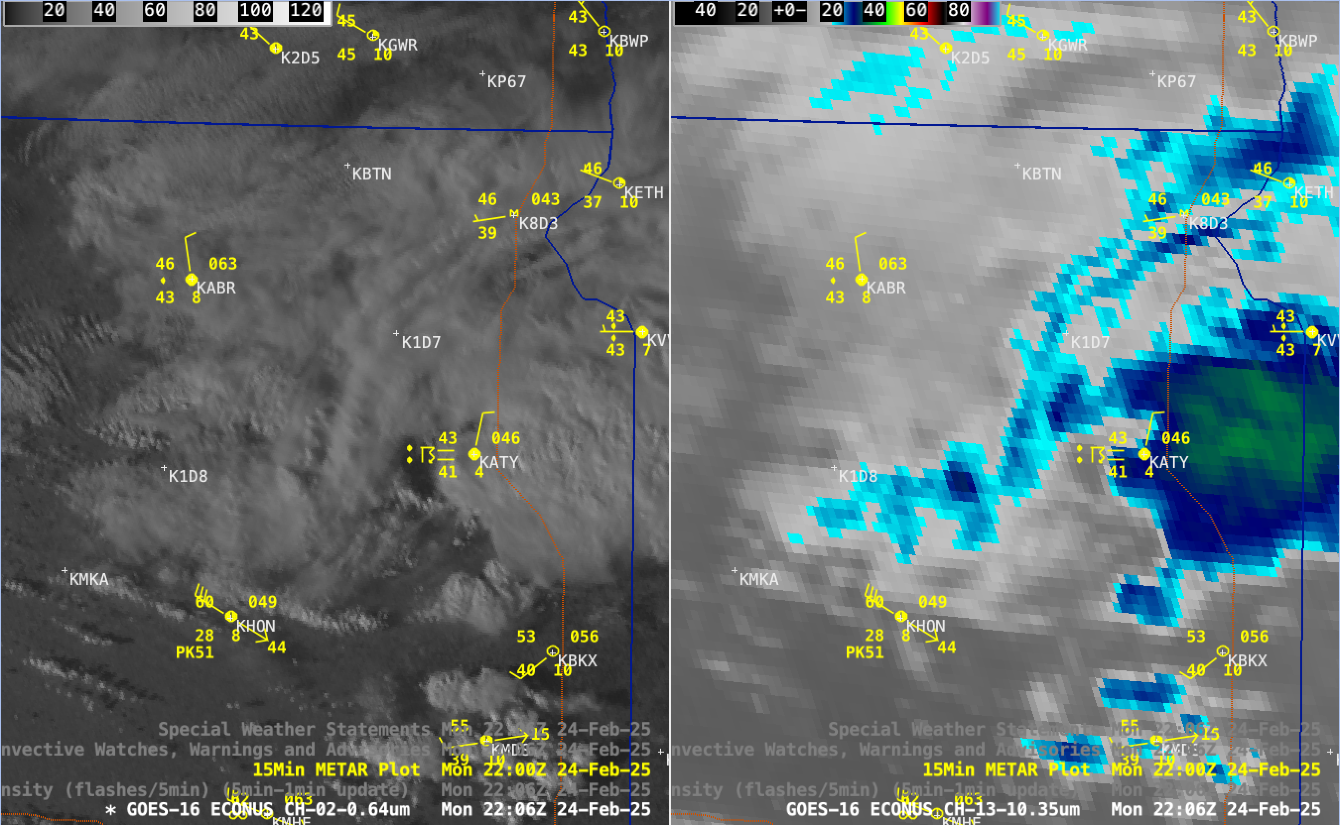
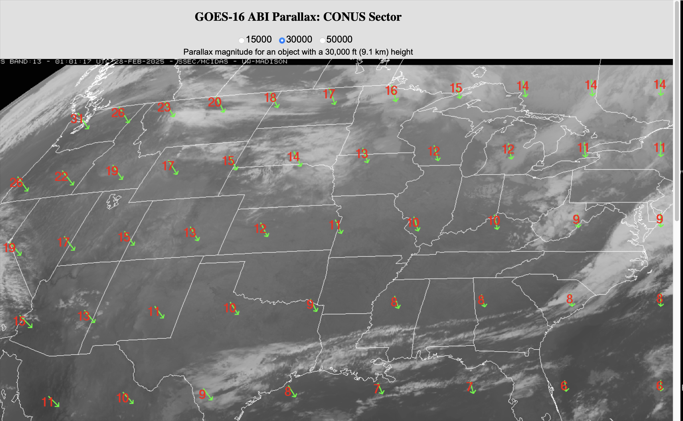
A Special Weather Statement was issued for this thunderstorm at 2058 UTC (below), advising on its potential to produce 50 mph winds and nickel-size hail. Note the slight northwest displacement of the Flash Extent Density pixels, compared to the thunderstorm overshooting top as seen in GOES-16 Visible and Infrared imagery — this is because the commonly-used Gridded GLM products (such as Flash Extent Density, Minimum Flash Area and Total Optical Energy) are not corrected for parallax. With this particular low-topped storm, the magnitude of GOES-16 parallax correction would be about 15 km (9 miles) to the southeast.
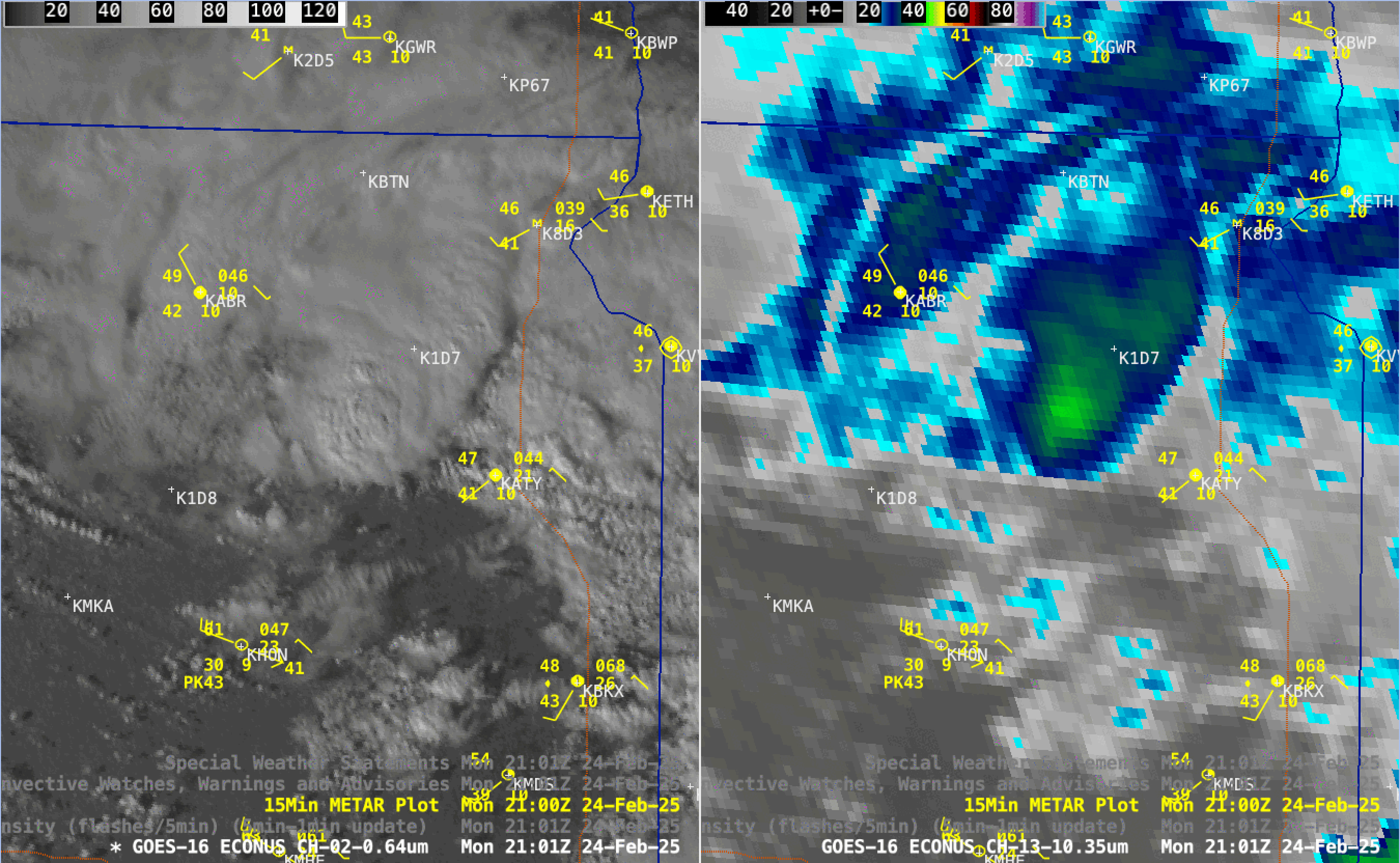
GOES-16 Red Visible (0.64 µm, left) and Clean Infrared Window (10.3 µm, right) images at 2101 UTC, with/without an overlay of a Special Weather Statement polygon and GLM Flash Extent Density [click to enlarge]

5-minute GOES-19 Red Visible (0.64 µm, left) and Clean Infrared Window (10.3 µm, right) images, from 2101-2211 UTC on 24 February. The location of the 2211 UTC tornado is plotted in red [click to play animated GIF | MP4]
_________
LightningCast probabilities (source), below, from 2042 – 2232 UTC, showed high probabilities confined to the storm that produced the tornado; those probabilities diminished quickly after the tornado occurred.