Warm air ahead of a cold frontal boundary
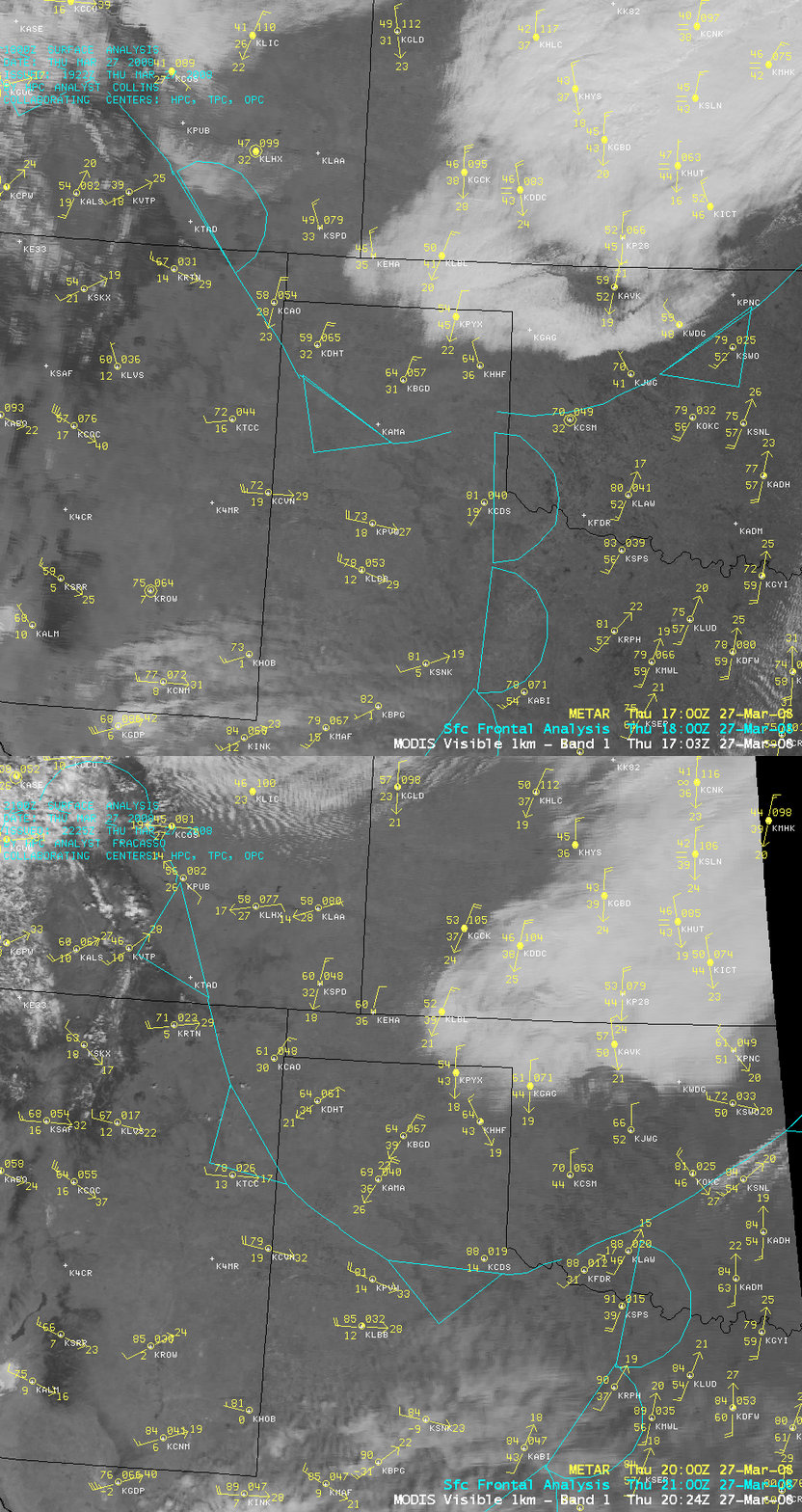
A cold frontal boundary was moving southward across the central and southern Plains on 27 March 2008. AWIPS images of the MODIS visible channel (above) showed that the leading edge of the front was generally cloud-free as it moved through the Oklahoma and Texas panhandle regions.
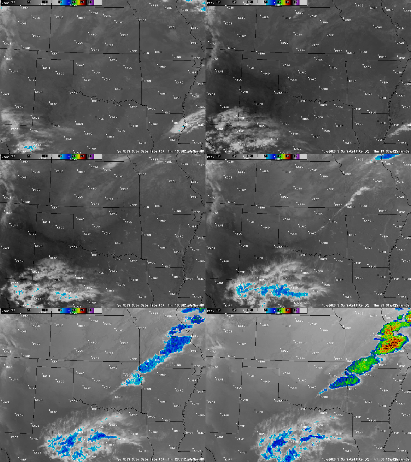
AWIPS images of the GOES-12 3.9µm shortwave IR channel (below) revealed a well-defined “warm air wedge” (darker gray to black colors) out ahead of the advancing cold frontal boundary; a line of convection was seen to form along the leading edge of the front from eastern Oklahoma into Arkansas and Missouri. Also note that there were several “hot spots” (black pixels) due to scattered fire activity that was burning briefly across the region; winds of 20-40 mph behind the front created an environment favorable for fire growth.
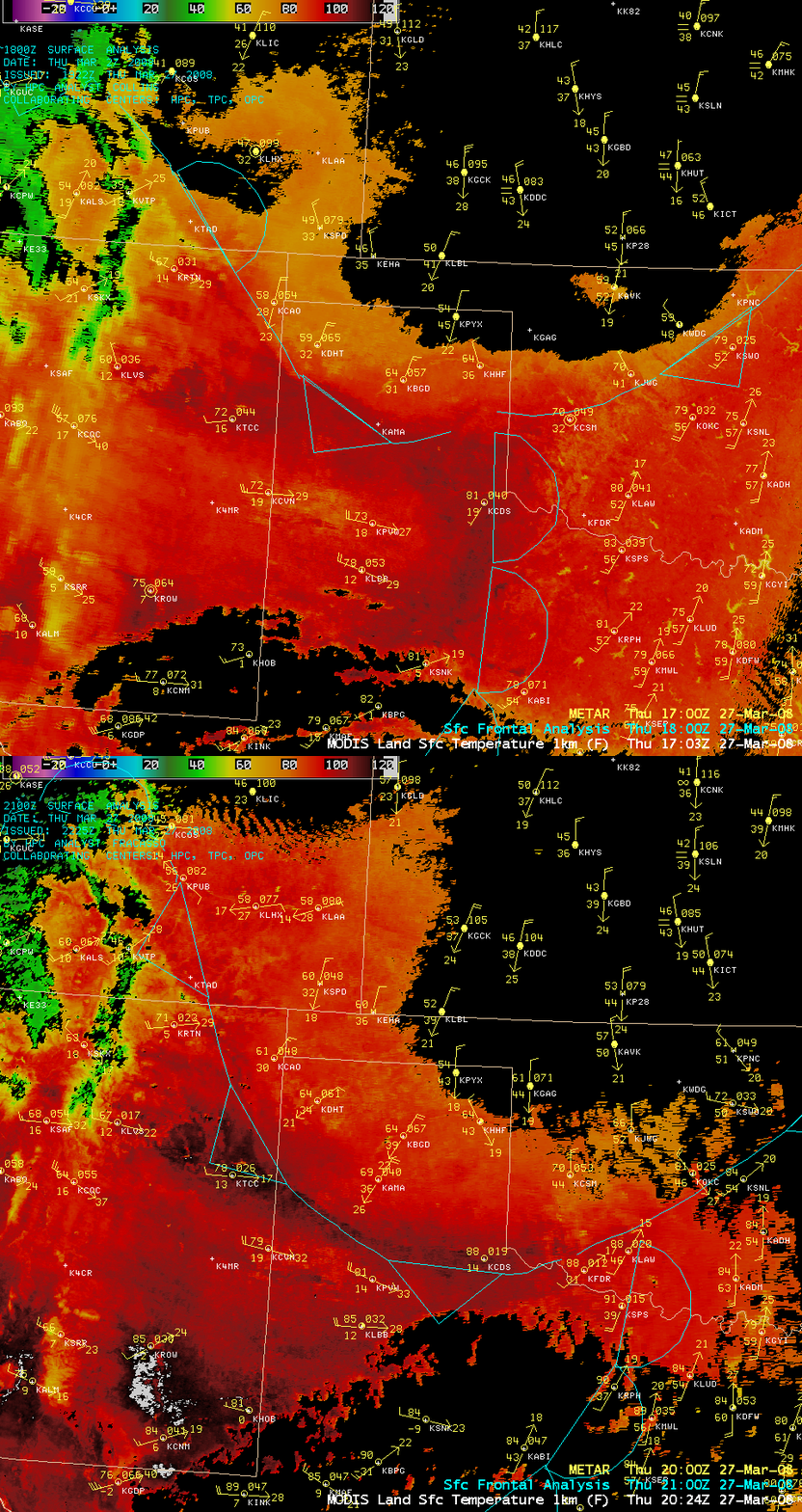
The effect of this “wedge” of warm air along and ahead of the cold front was very evident on AWIPS images of the MODIS Land Surface Temperature product (below) — a curved band of warmer land surfaces (100-115º F, darker red to black colors) showed up over parts of northeastern New Mexico, the Texas panhandle, and southwestern Oklahoma. Note that the MODIS LST values are surface “skin temperatures”, which can be several degrees warmer than the shelter air temperatures which are measured 5 feet above ground level — afternoon air temperatures reached 94ºF at Wichita Falls, Texas (KSPS) and 93ºF at Frederick, Oklahoma (KFDR) before the cold front passed those locations.


