Cold night-time temperatures in the Upper Midwest
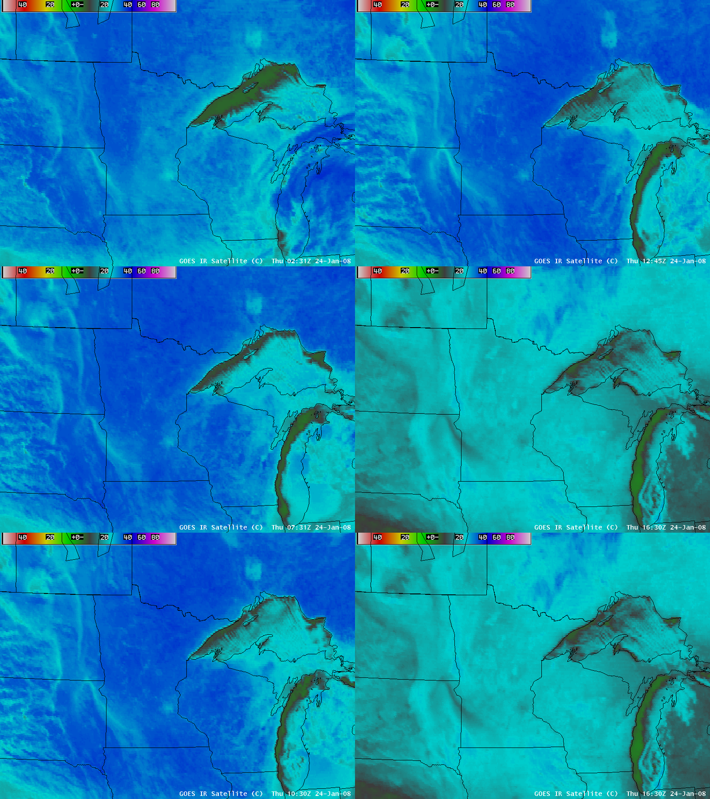
AWIPS images of the 4-km resolution GOES-12 10.7µm IR channel (above) showed that the land surfaces across the Upper Midwest region exhibited very cold brightness temperature values (darker blue enhancement) during the pre-dawn hours on 24 January 2008 — GOES IR brightness temperatures were as cold as -36ºC in northern Wisconsin, and -38ºC in northern Minnesota. Most of the area seen in the images above was cloud-free (except for the lake-effect cloud bands downwind of Lake Superior and Lake Michigan); the cloud-free surfaces could then be seen warming very quickly after sunrise. Much of the northcentral US had a deep snow cover of at least 5-10 inches, with snow depths of 15-30 inches common in northern Minnesota, Wisconsin, and Michigan; this deep snow cover (along with cloud-free skies and light winds) allowed for very strong radiational cooling of the air near the surface.
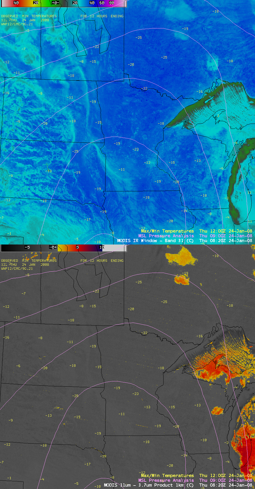
A higher-resolution (1-km) view using the MODIS 11.0µm IR channel and the MODIS fog/stratus product (below) revealed an amazing amount of structure in the surface brightness temperature field over the region (much of which was driven by terrain, with cold air drainage into low-lying areas such as river valleys); the coldest MODIS IR brightness temperatures sampled on the AWIPS images were -38ºC in northern Wisconsin and -42ºC in northern Minnesota. The MODIS fog/stratus product (created by computing the 11.0µm – 3.7µm brightness temperature difference) confirmed that there were no areas of fog or stratus cloud contributing to the interesting IR temperature structure seen across much of the Upper Midwest region around 08:20 UTC (2:20 AM local time). Note the appearance of “urban heat islands” (warmer IR temperatures, cyan enhancement) around cities such as Minneapolis, Minnesota and Sioux Falls, South Dakota.
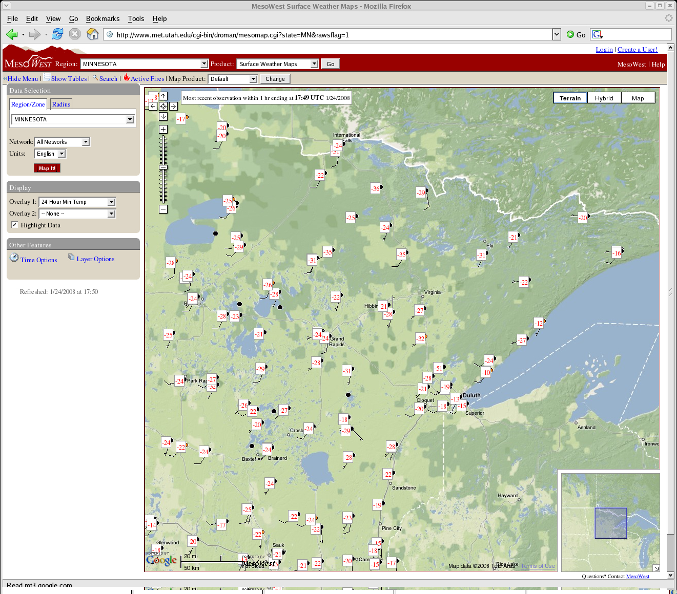
NWS cooperative observer overnight minimum temperatures were as cold as -31ºF (-35ºC) at Sparta, Wisconsin and -39ºF (-39ºC) at Embarrass, Minnesota. There was also a reported minimum temperature of -51ºF (-46ºC) at a Minnesota Department of Transportation site northwest of Duluth (below), but the temperature data from that particular site appeared to be suspect.
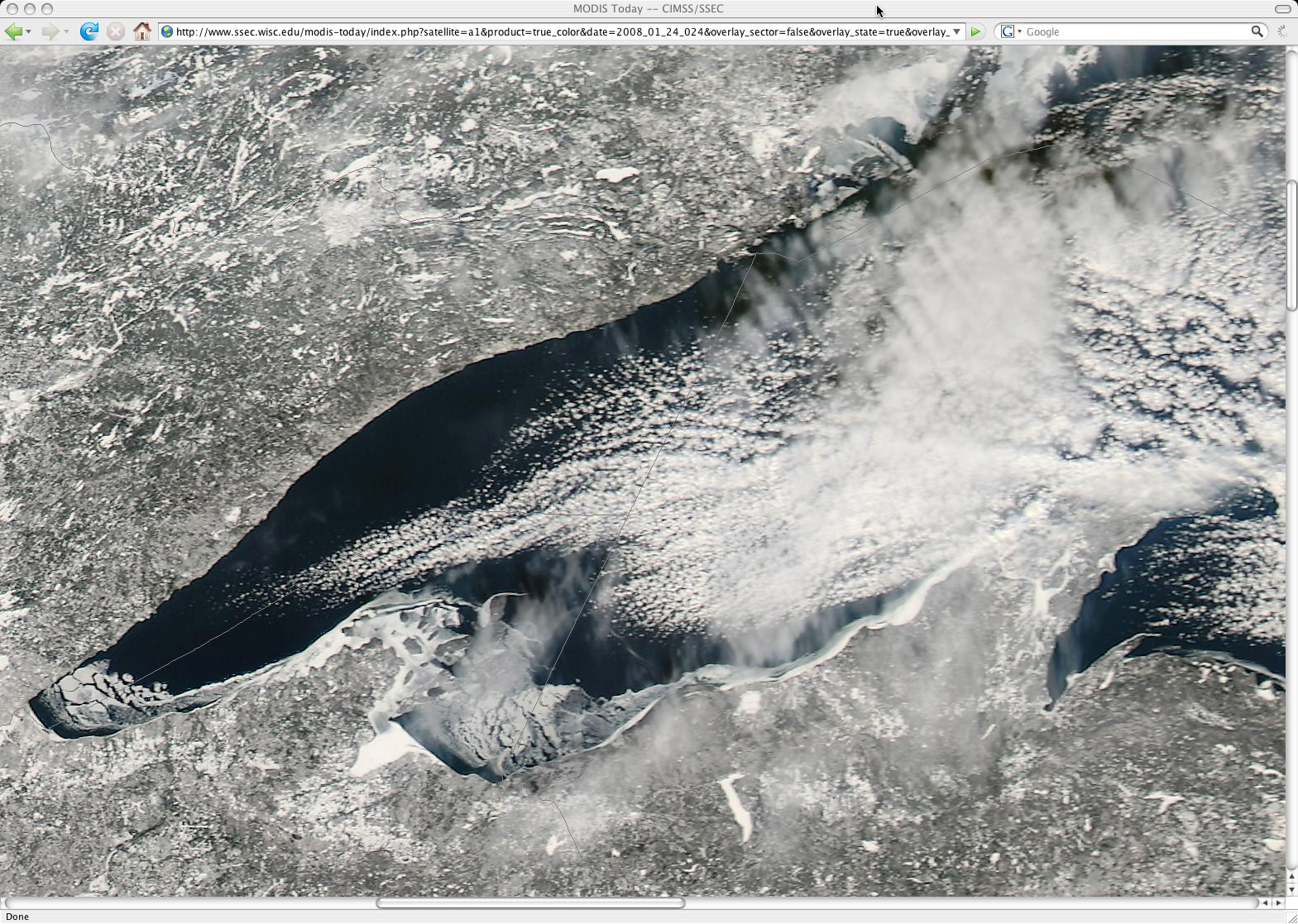
Such cold temperatures aided in the formation of ice along the near-shore waters of western Lake Superior, as seen the following afternoon in a 250m-resolution MODIS true color image from the MODIS Today site (below). Lake Superior is the largest and deepest of the Great Lakes, and is usually the last to experience significant ice formation during the winter months.


