Powerful Pacific storm begins to impact the US West Coast
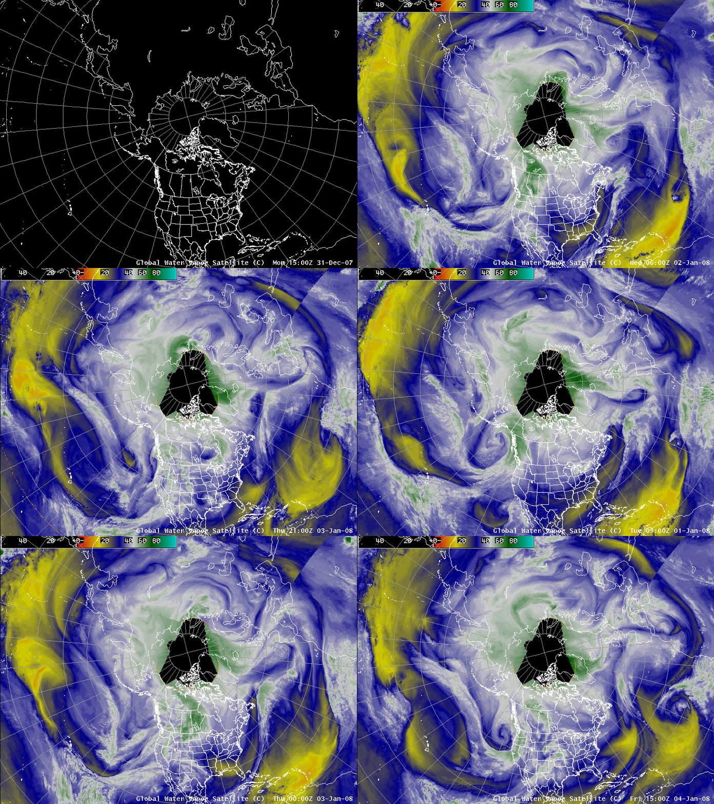
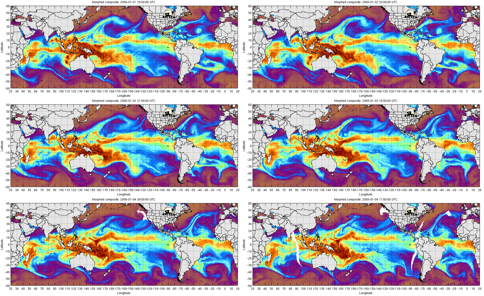
AWIPS images of global water vapor composites (above) showed a large and powerful Pacific storm that was beginning to impact the US West Coast on 04 January 2008. This storm was tapping a very long plume of high total precipitable water (TPW) originating from the western Pacific Ocean, as seen in an animation of MIMIC TPW (below).
![]()
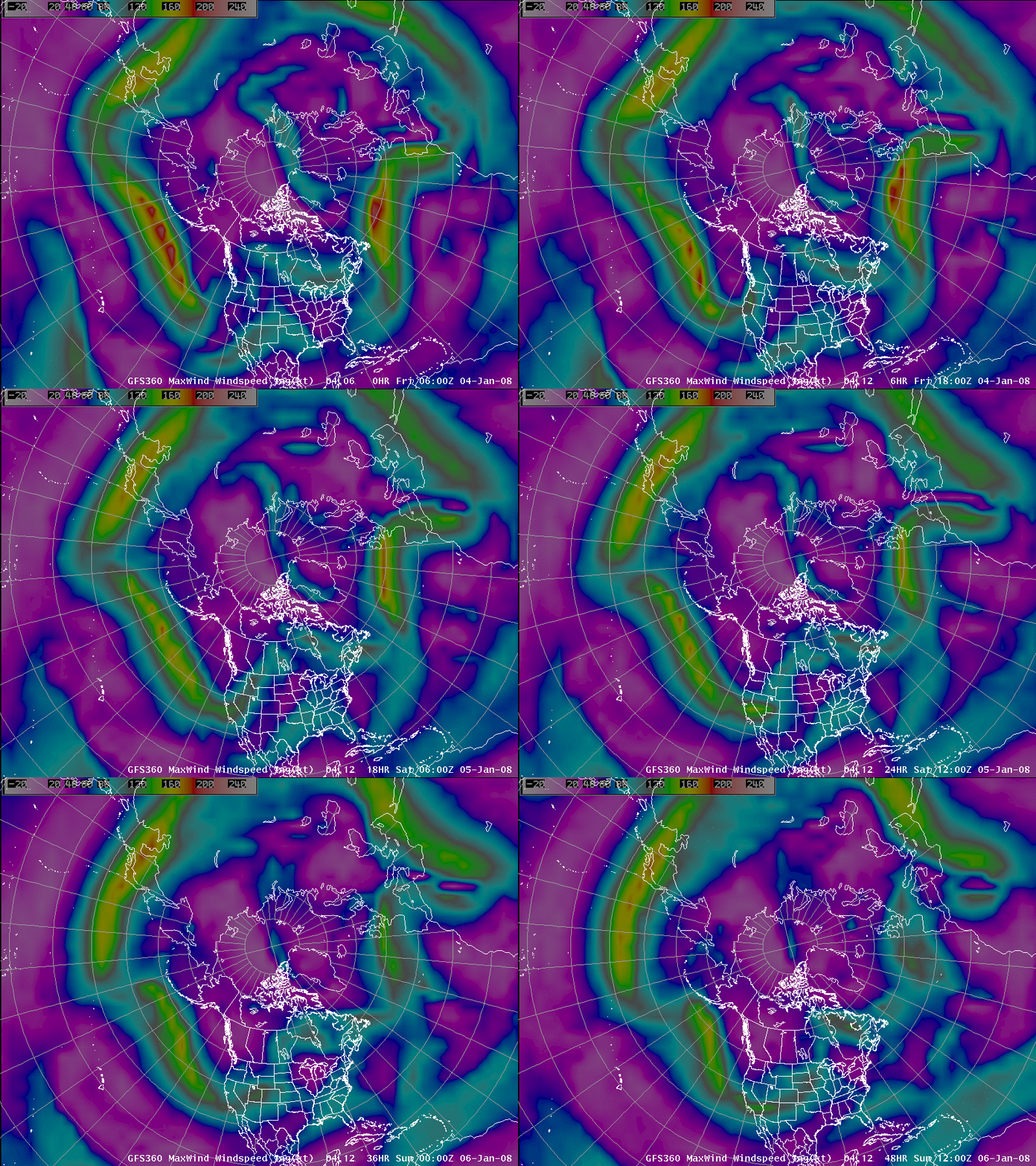
The dynamics associated with this storm were also impressive, with a very strong polar jet stream that stretched across the entire Pacific Ocean. AWIPS images of the GFS model Maximum Wind field (below) indicated jet stream wind speeds as high as 210 knots over the North Pacific (south of Alaska’s Aleutian Islands) and greater than 170 knots over Japan at 06:00 UTC on 04 January.
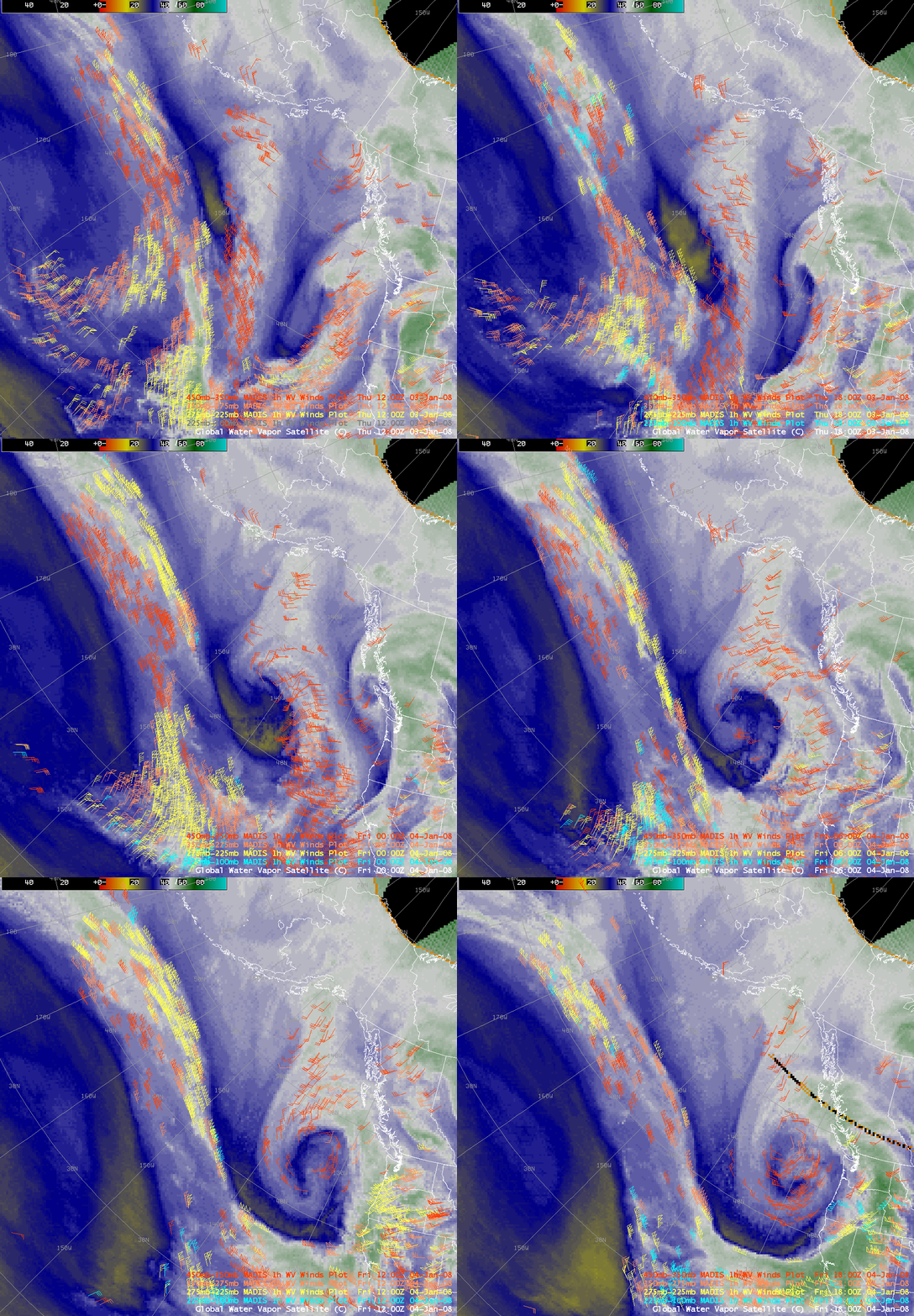
MADIS satellite-derived atmospheric motion vectors (AMVs) produced using hourly water vapor imagery (below) showed a large number of high-altitude wind targets having speeds of greater than 200 knots during the period between 03 January at 12:00 UTC and 04 January at 18:00 UTC. The highest satellite-derived water vapor wind speed seen was 252 knots at a pressure of 258 mb; satellite winds of greater that 100 knots had moved inland over California after 15:00 UTC on 04 January.
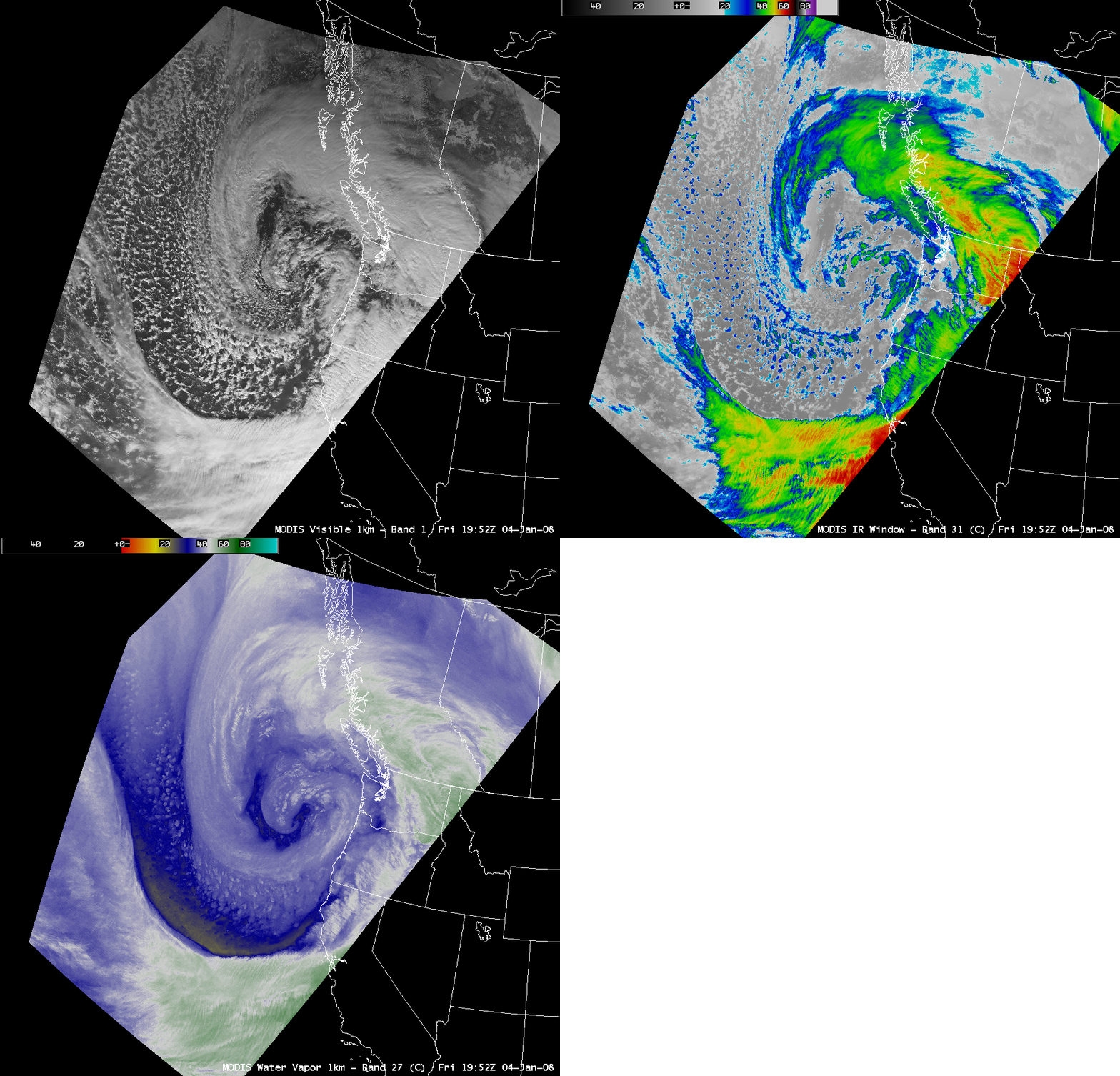
A beautiful view of the storm was captured on AWIPS images of the MODIS visible, IR window, and water vapor channels (below).


