Very large hail in the Texas Panhandle region
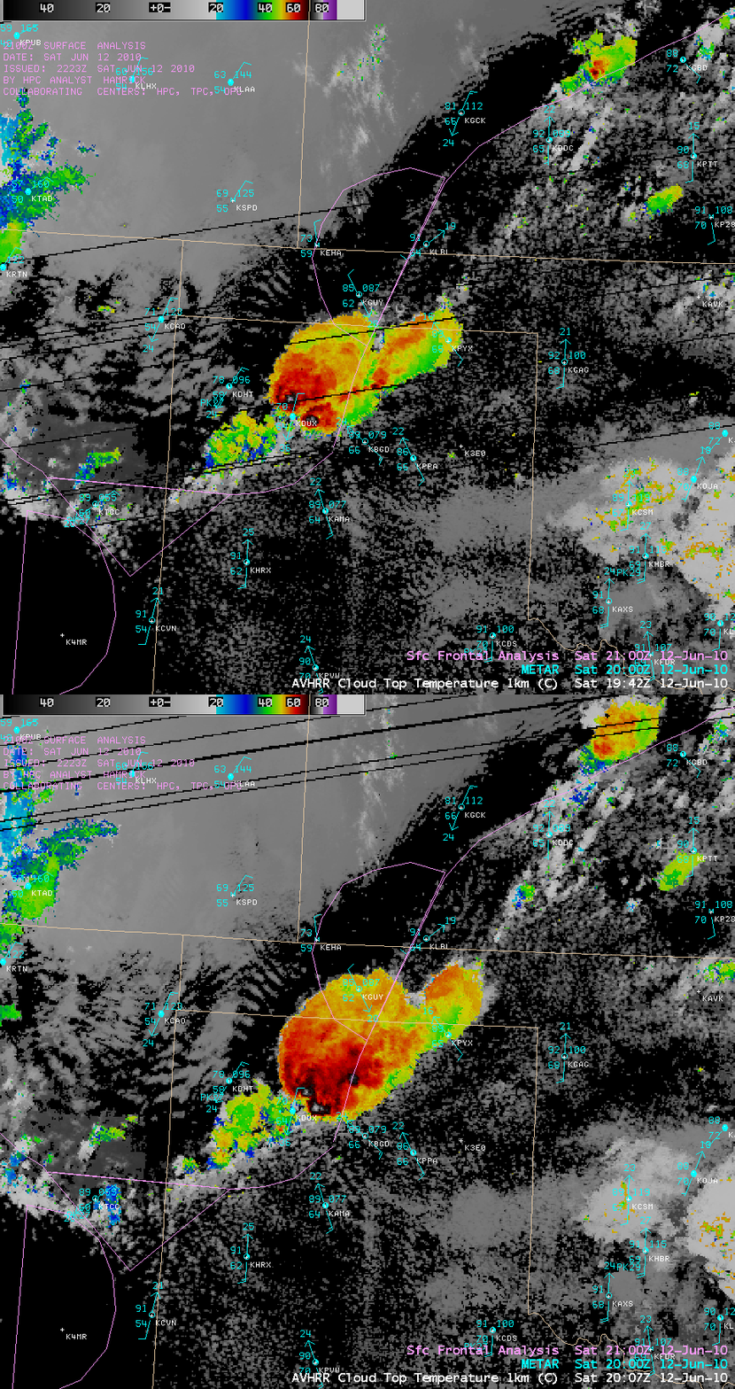
Severe thunderstorms that developed in the vicinity of a stationary frontal boundary over the northern Texas Panhandle region on 12 June 2010 produced unusually large hailstones (some as large as 5.5 to 6.0 inches in diameter) — additional details of this event can be found at the NWS Amarillo TX website. AWIPS images of the 1-km resolution POES AVHRR Cloud Top Temperature product (above) indicated that CTT values were as cold as -81º C at 19:42 UTC and -80º C at 20:07 UTC. By comparison, the coldest IR brightness temperatures seen on 4-km resolution GOES-13 10.7 µm imagery were -66º C.
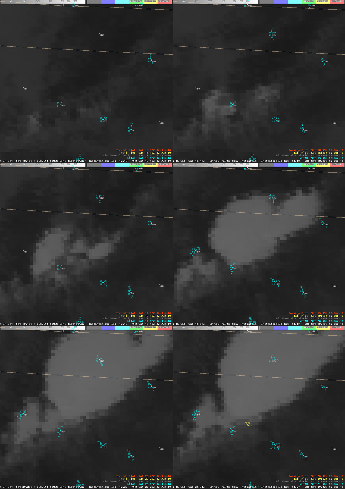
The University of Wisconsin Convective Initiation product (below) flagged that particular area of developing convection at 18:40 UTC — about an hour before it produced the first report of 1.0 inch diameter hail at 19:40 UTC (and almost 2 hours before the report of 6.0 inch diameter hail at 20:32 UTC):


