Satellite-based estimates of wind over Tropical Storm Mal on 14 November
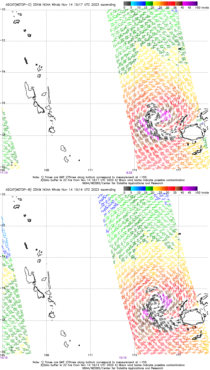
Metop-B and Metop-C both overflew Tropical Storm Mal as it approached the island of Fiji on 14 November. The toggle above shows the two wind plots from this website, MetopC from 0933 UTC and MetopB from 1013 UTC. The two swaths show the center of the storm moving southeast, skirting the main islands of Fiji. A shortcoming of ASCAT winds in tropical cyclones occurs when winds exceed 40 knots; the wind (and rain) perturbs the ocean surface sufficiently at those speeds to change the backscatter of microwave radiation back to the satellite. Still, ASCAT gives a good overall view of the outer wind fields, including where gales are occurring and where the circulation center sits.
RCM-1 (Radar Constellation Mission-1) overflew Mal at 0637 UTC on 14 November, and the Synthetic Aperture Radar (SAR) wind field from that is shown below (source). The wind analysis from the SAR data (here) suggests that the SW quadrant of the storm has the weakest winds. The blocking effect of the terrain from both Viti Levu (the largest island in the Republic of Fiji) and the Kadavu Islands is apparent in the imagery below, with weaker east-southeast winds in the lee of the islands.
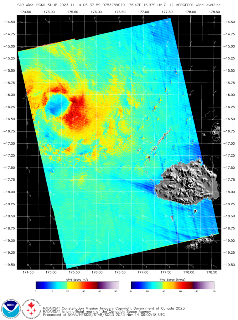
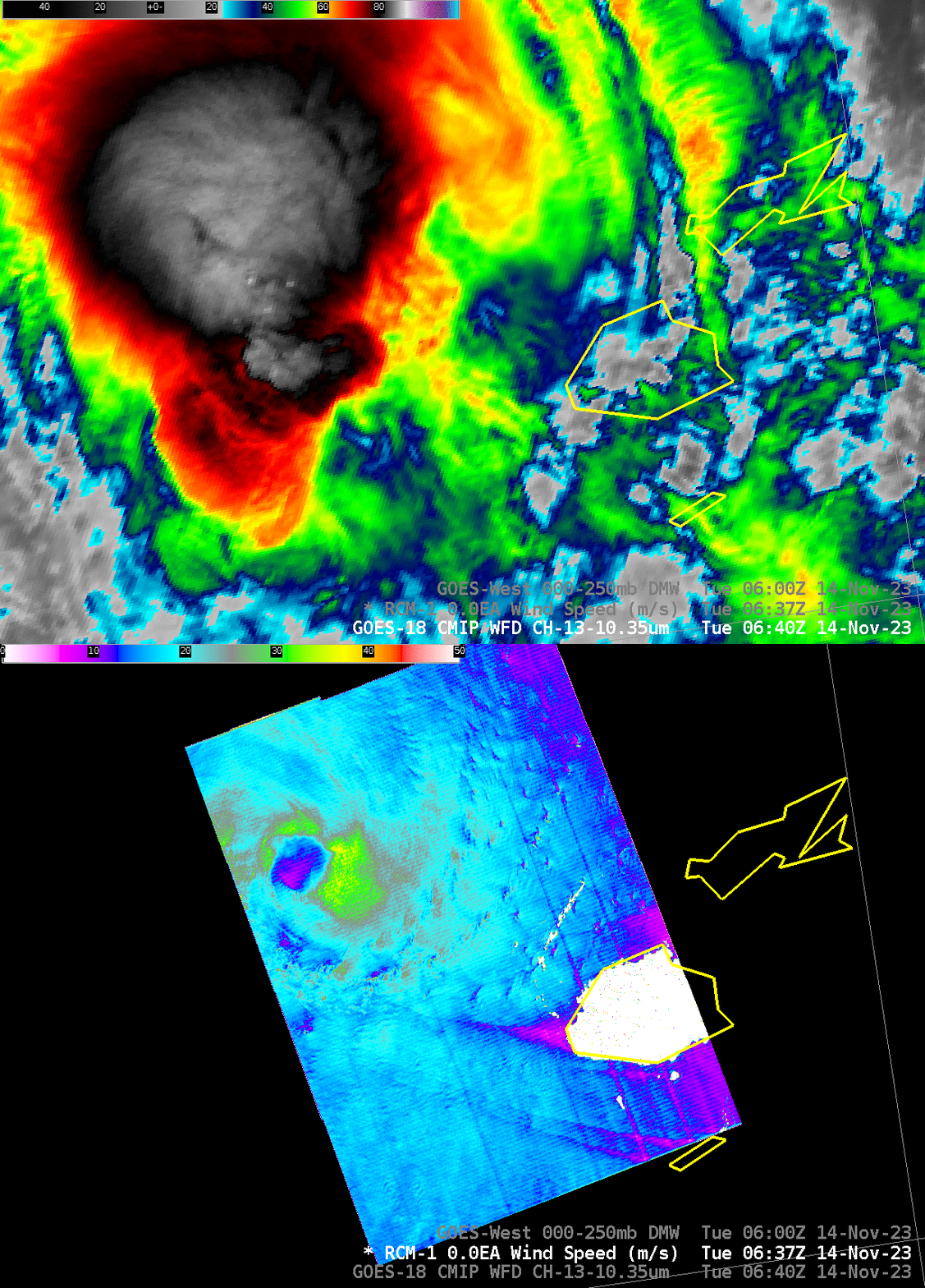
The toggle below compares the SAR winds with the GOES-18 Clean Window infrared (Band 13, 10.35 µm) imagery. There is a significant parallax shift in the infrared imagery; the Republic of Fiji is just east of the dateline, and GOES-West is overhead at the Equator at 137.2oW. The SAR-derived storm center is likely nearer to the center of the very cold clouds.
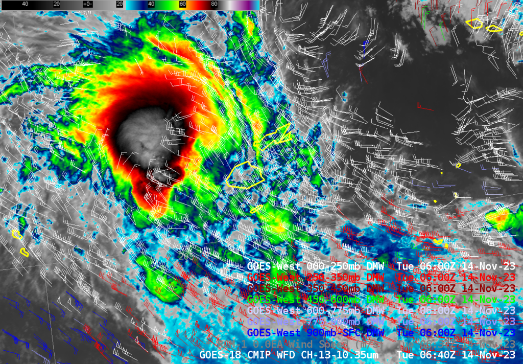
Satellite-derived winds are available hourly from GOES-18, and they are shown below. In the vicinity of Mal, only high-level winds can be generated, because only high-level cloud features can be tracked. The structure of Mal is acting as a blocking feature, and upper-level winds are diverted around it. In addition, a poleward outflow jet is apparent to the east and southeast of the storm. Note also the very strong shear at the southern edge of the domain. Low-level winds (in blue) are flowing in an opposite direction to the upper-level winds (in white).
A second SAR observation, this time from RCM-3, occurred at 1757 UTC. The toggle below shows the change in the infrared imagery between the two SAR observation times, one at 0640, one at 1750 UTC. The development of outer bands in the storm is most notable, as is the appearance of an eye-like structure at 1750 UTC.
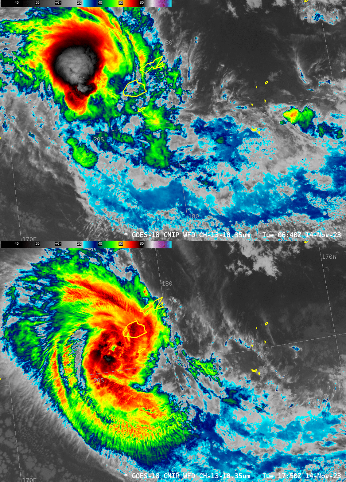
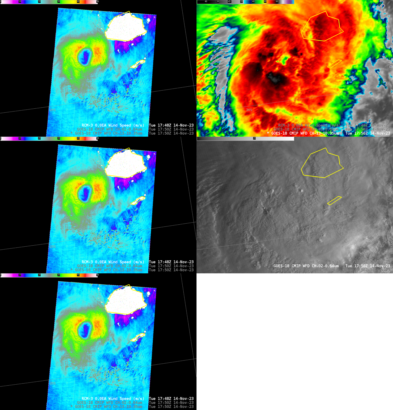
By 1750 UTC, SAR winds show a significantly strengthened system southwest of Fiji. A circular eye that is more symmetric is apparent in the SAR imagery, and hints of an eye are starting to develop in the GOES-18 imagery. Note that the GOES-18 Visible imagery has been brightened (0-30 vs. the default 0-130) in this near-sunrise image. (Here is a toggle of the RCM-1/RCM-2 SAR Winds).

