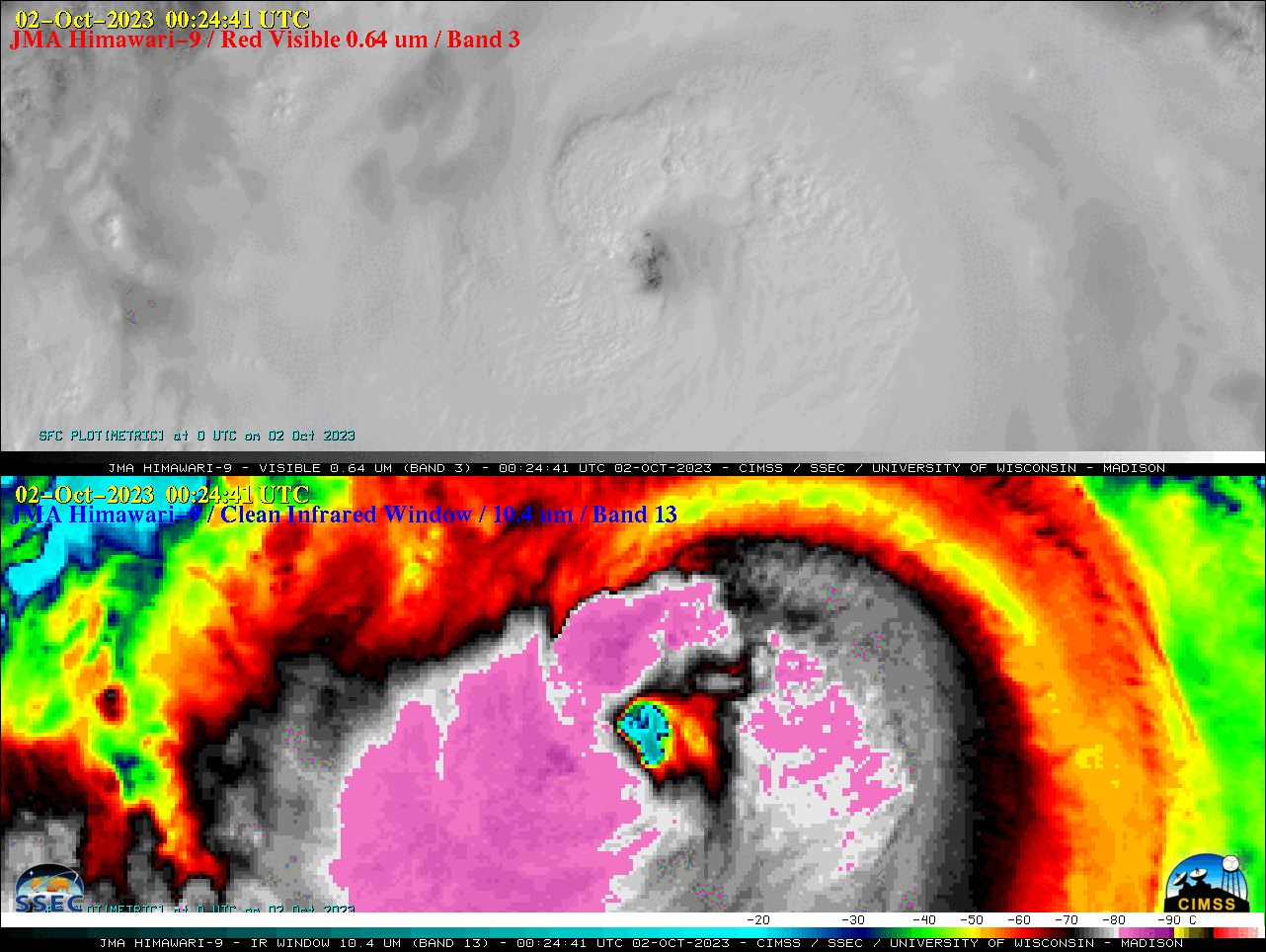
Typhoon Koinu in the Philippine Sea

JMA Himawari-9 “Red” Visible (0.64 µm, top) and “Clean” Infrared Window (10.4 µm, bottom) images, from 2132 UTC on 01 October to 0902 UTC on 02 October [click to play animated GIF | MP4]
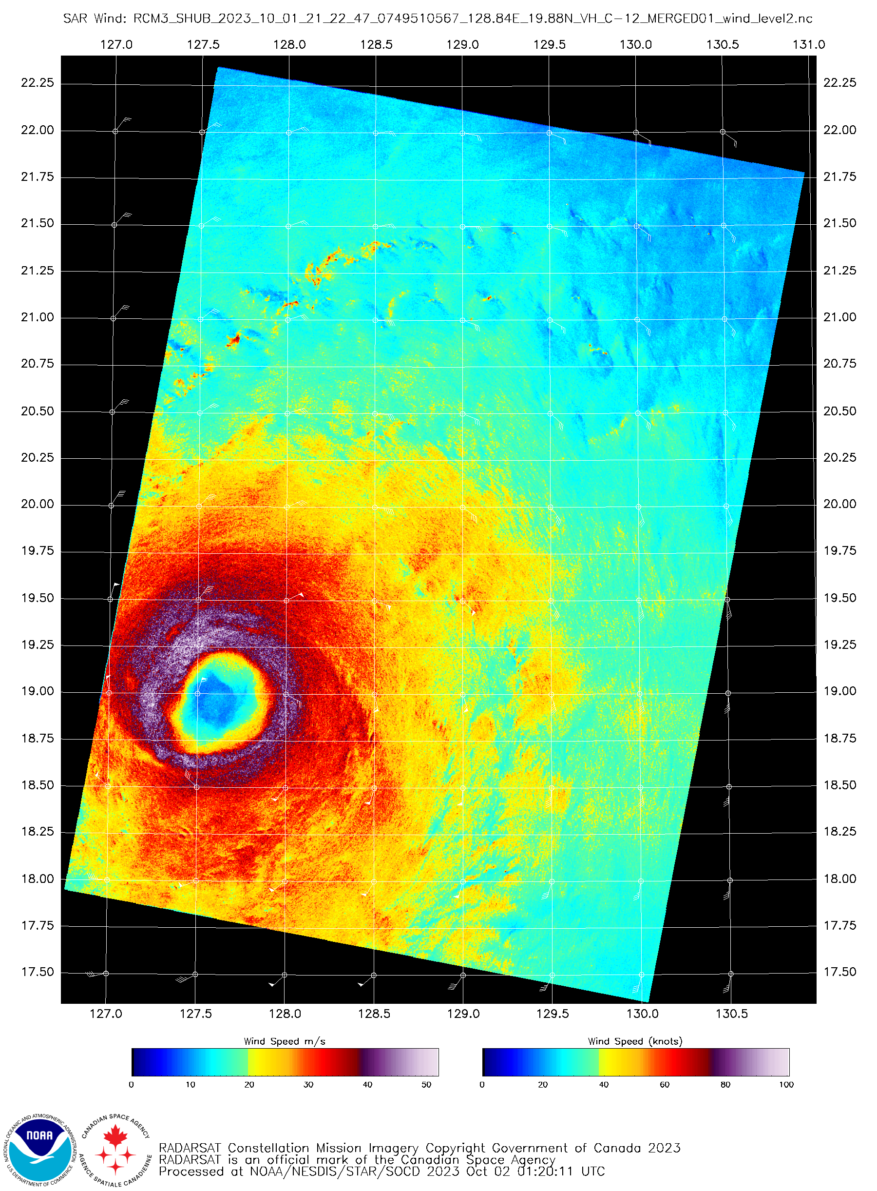
Just prior to the start of the Himawari-9 animation, an image of RCM-3 Synthetic Aperture Radar (SAR) winds at 2122 UTC on 01 October (source) is shown below — which depicted a narrow but fully closed eyewall.
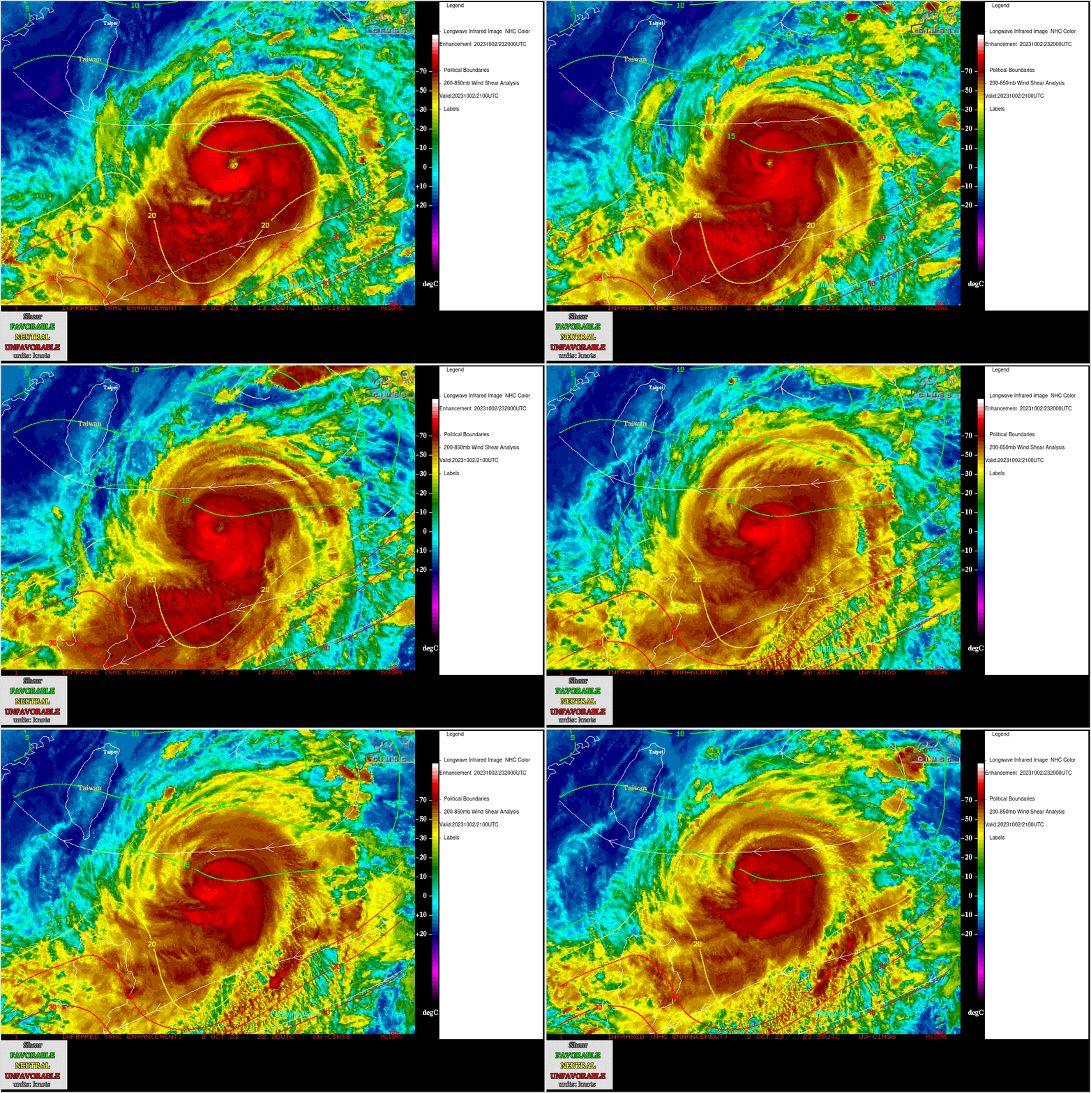
Later in the day, Himawari-9 Infrared Window (11.2 µm) images with an overlay of deep-layer wind shear at 2100 UTC — from the CIMSS Tropical Cyclones site (below) indicated that Koinu was moving through an environment where the shear (around 15 knots) was favorable. In addition, Koinu was traversing warm water (Ocean Heat Content | Sea Surface Temperature).


