Hurricane Lee passes west of Bermuda
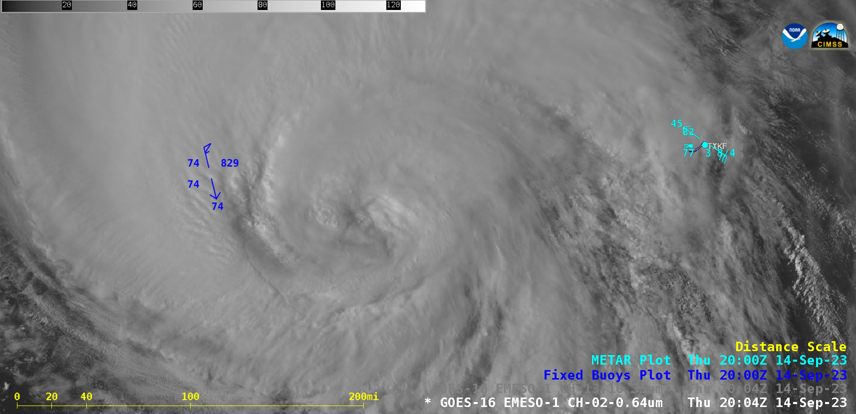
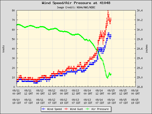
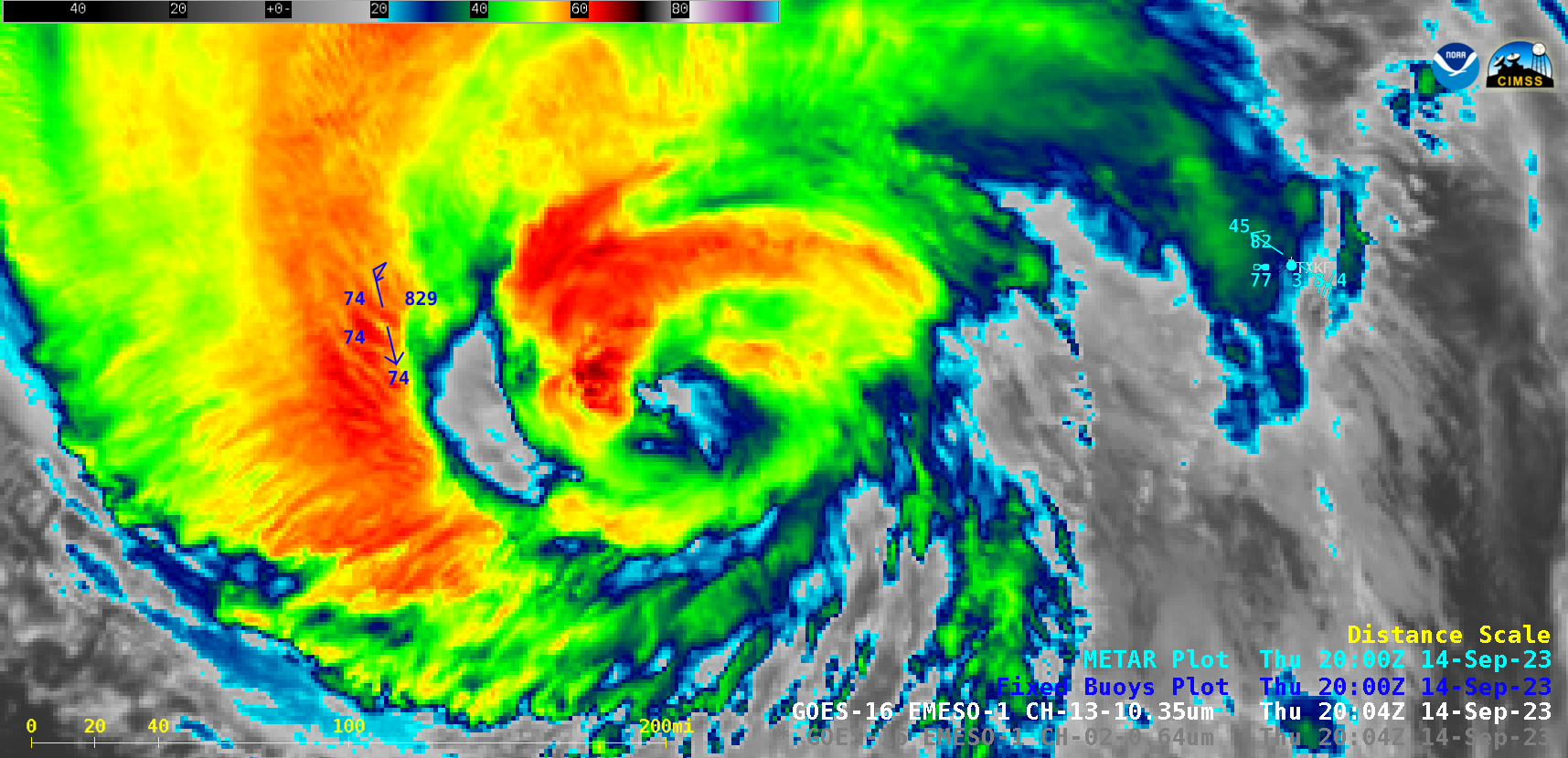
1-minute Mesoscale Domain Sector GOES-16 (GOES-East) “Red” Visible (0.64 µm) images (above) showed Category 1 Hurricane Lee as it moved northward between Buoy 41048 and Bermuda (station identifier TXKF) on 14 September 2023. As shown in the plot below, the highest wind gust at Buoy 41048 was 41.0 m/s (79.7 knots, or 97.7 mph) at 2010 UTC (data transmission from the buoy ceased after 2310 UTC). The strong winds from Lee produced wave heights to 32 ft — and produced upwelling that cooled the water temperature several degrees.In 1-minute GOES-16 “Clean” Infrared Window (10.3 µm) images (below), the coldest cloud tops exhibited infrared brightness temperatures around -80ºC (brighter shades of white embedded within darker black regions).
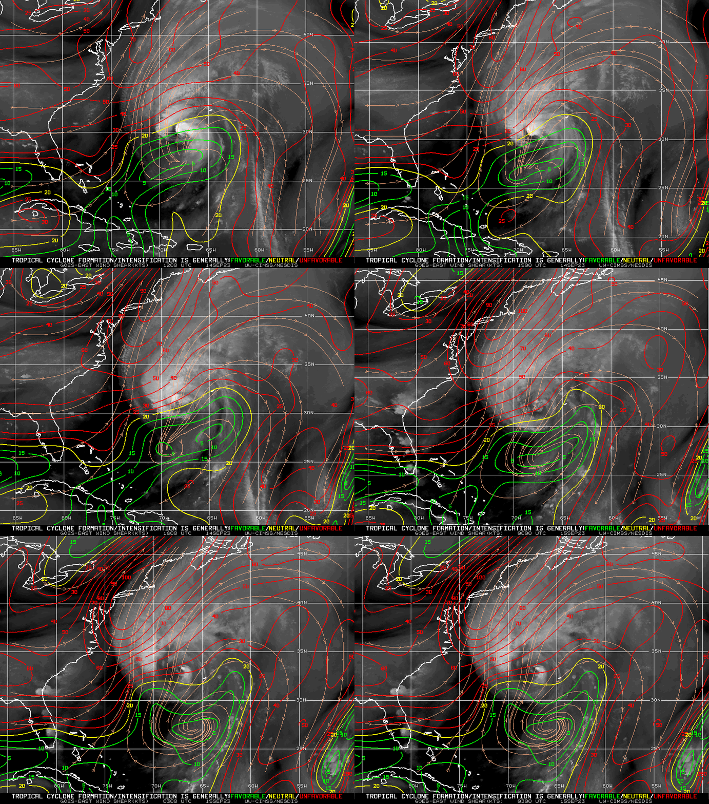
Analyses of deep-layer wind shear from the CIMSS Tropical Cyclones site (below) showed that Lee was moving into an environment of increasingly unfavorable shear as it gained latitude — which was acting to suppress the development of deep convection and the maintenance of a well-defined eye.