Using satellite data to describe a fire-prone environment
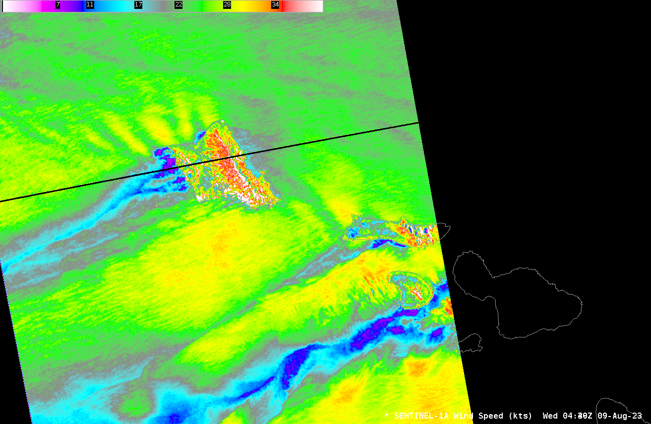
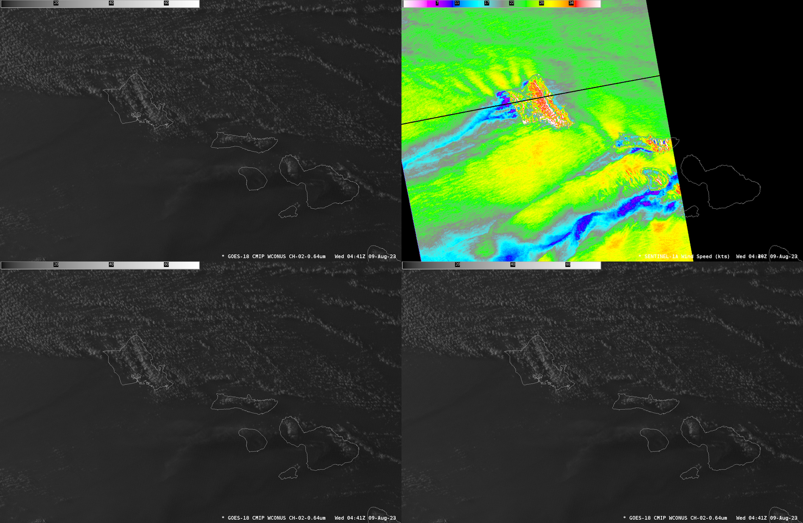
Deadly fires on the island of Maui occurred in an environment favorable to fire development: dry and windy. What kind of satellite data could be used to assess those conditions? Sentinel-1A overflew the western Hawai’ian islands near sunset on 8 August 2023 (that is, at 0440 UTC on 9 August), as shown above. Widespread 30-knot winds (yellow in the enhancement used) are indicated. The island of Maui was just missed by this scan. The SAR Winds are shown below in a toggle with GOES-18 Visible imagery. A smoke plume that extends west of Maui is faintly apparent. Low clouds are present east and north of the Hawai’ian islands, but are absent to the south and west. The motion of these low clouds can be tracked to infer winds.
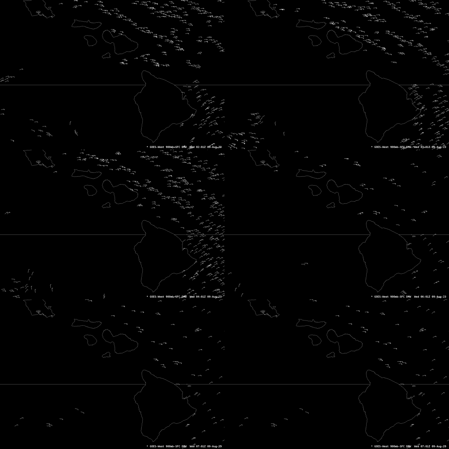
GOES-18 Derived Motion Wind vectors, shown below, hourly from 0201-0701 on 9 August, show widespread values of 30-35 knots to the east and north of the Hawai’ian island chain. The features tracked to infer the winds were from near-surface to 900 mb.
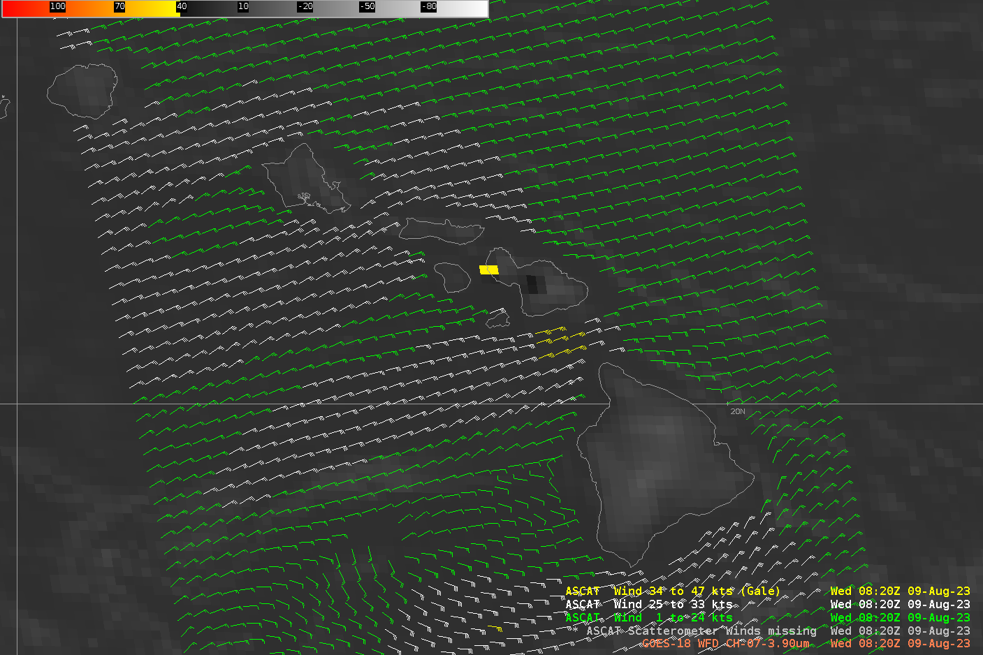
Metop-C overflew the Hawai’ian islands shortly after 0800 UTC on 9 August, and Advanced Scatterometer (ASCAT) winds from that pass are shown below, overlain on top of GOES-18 Band 7 (Shortwave Infrared, 3.9 µm) imagery that shows the signatures of the two fires (yellow and black) on Maui. Winds of 25-30 knots are widespread near the Hawai’ian islands, with somewhat weaker winds to the north and east. Stronger winds — gales — are detected in the Alenuihaha channel between Hawai’i and Maui.
Metop-B also sampled this region, but a bit earlier than Metop-C. Wind plots for both satellites (taken from this site) are shown below. Winds are strongest surrounding the Hawai’ian island chain.
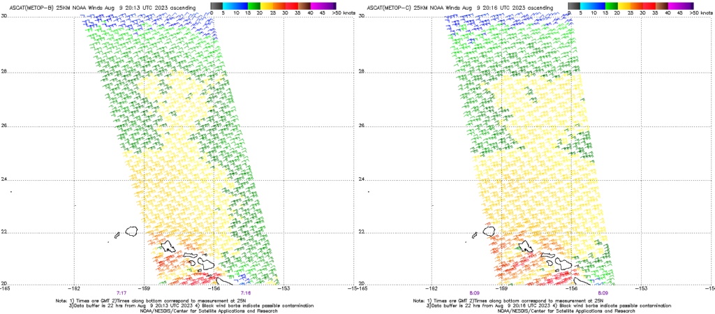
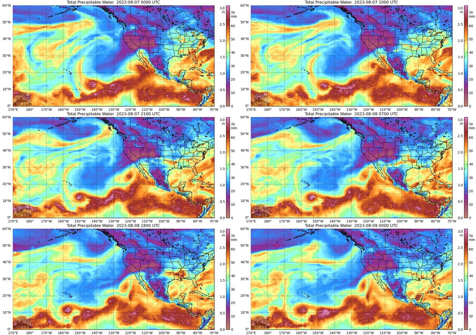
Three different wind data sources above highlight the strong environmental winds surrounding the Hawai’ian island chain. How dry was the environment? The MIMIC Total Precipitable Water animation below, shows significant drying occurring between 0000 UTC 7 August and 0000 UTC 9 August as the moisture associated with Hurricane Dora moves south of the islands.
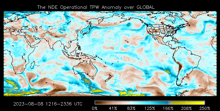
The percent-of-normal TPW values surrounding Hawai’i (source) around 0000 UTC on 9 August,shown below, were 40-50%.
The 0000 UTC Sounding from Hilo (here, from this source), shows a computed TPW of 1.36″. This SPC site shows that value to be dryer than normal.
NOAA-20 NUCAPS data can be used to assess moisture at various levels. NOAA-20 overflies Hawai’i at around 0000 and 1200 UTC daily, and the toggle below shows gridded NUCAPS estimates of relative humidity in the 925-700 mb layer at 2338 UTC on 8 August and 1205 UTC on 9 August. Sounding availability points are also shown, and the NUCAPS retrievals were converging (green points) over most of the domain shown.
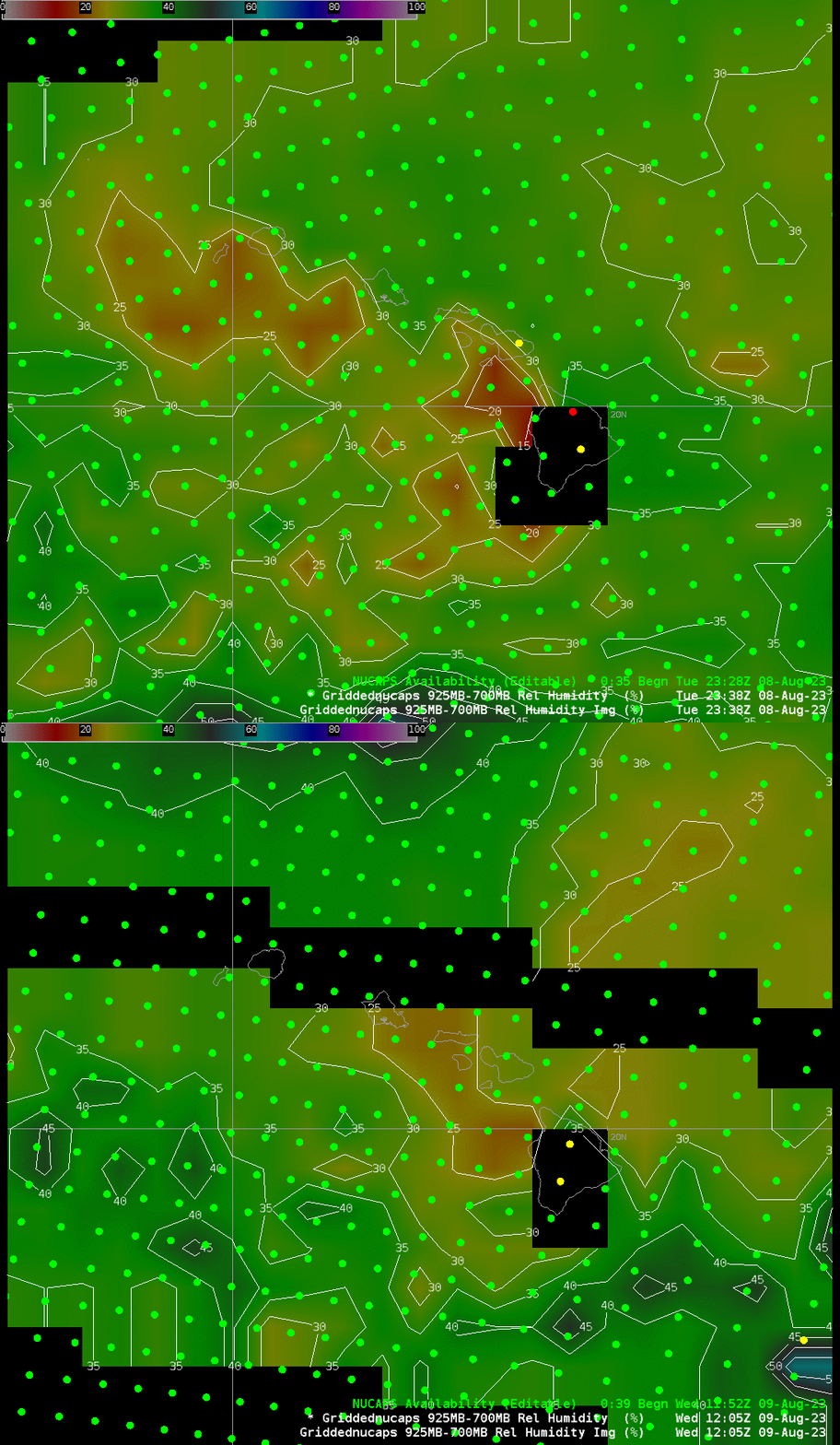
At 2338 UTC on 08 August, a successful retrieval is indicated just west of Maui; at 1205 UTC on 09 August, a successful retrieval is apparent near the northern shore of Maui. The two NUCAPS soundings at those points are shown below.
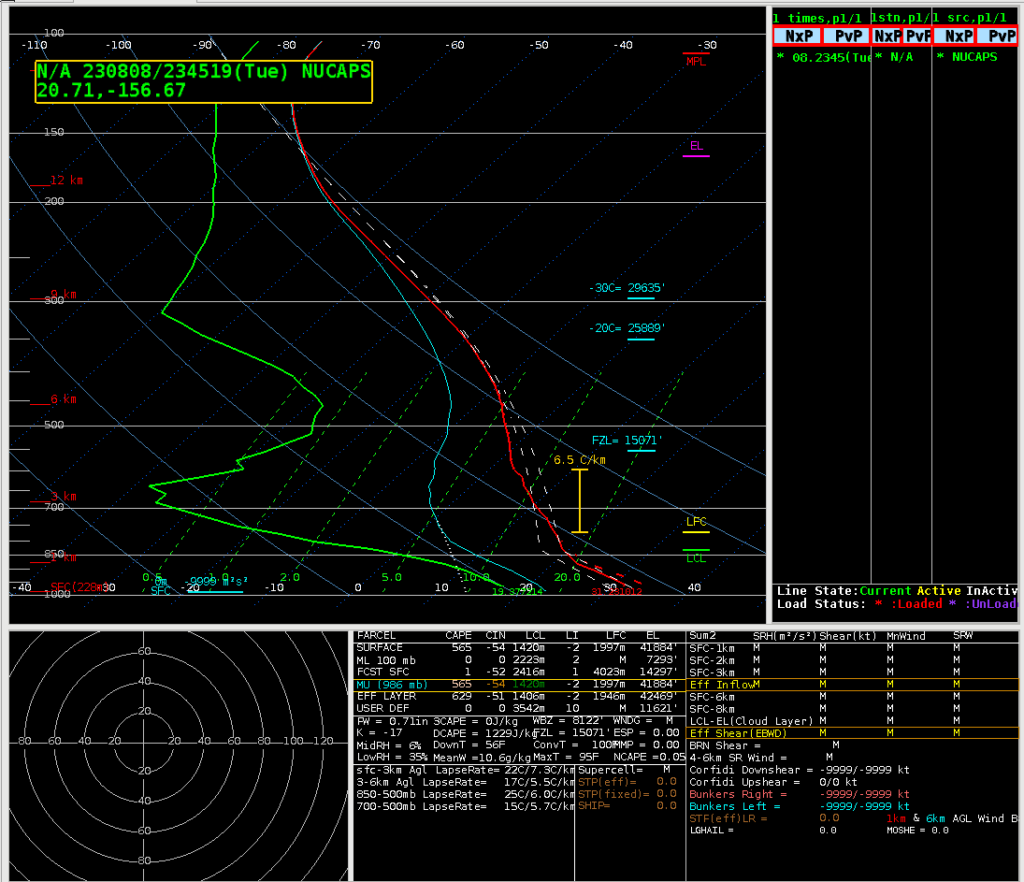
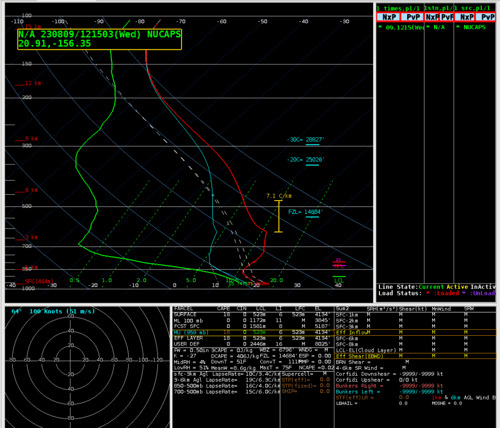
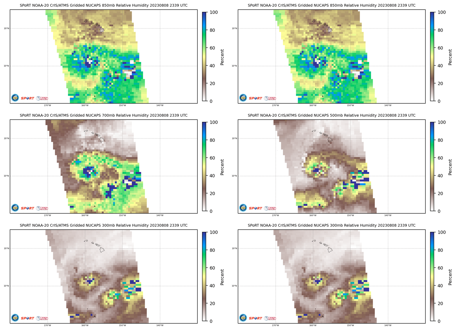
Gridded NUCAPS data are also available online for Hawaii at this website. The animation below toggles through relative humidity estimates at 850, 700, 500 and 300 mb. Dry air is indicated.
Many satellite products can help a forecaster understand the environment when dangerous weather is expected. This snippet from a Forecast Discussion from late on 3 August shows that Fire Weather was anticipated to occur over the Hawai’ian Islands long before the fires occurred.

