Eruption of Mount Shishaldin

GOES-18 SO2 RGB and Ash RGB images, 0700-1900 UTC [click to play animated GIF | MP4]
A toggle between the SO2 RGB and Ash RGB images at 1000 UTC is shown below.
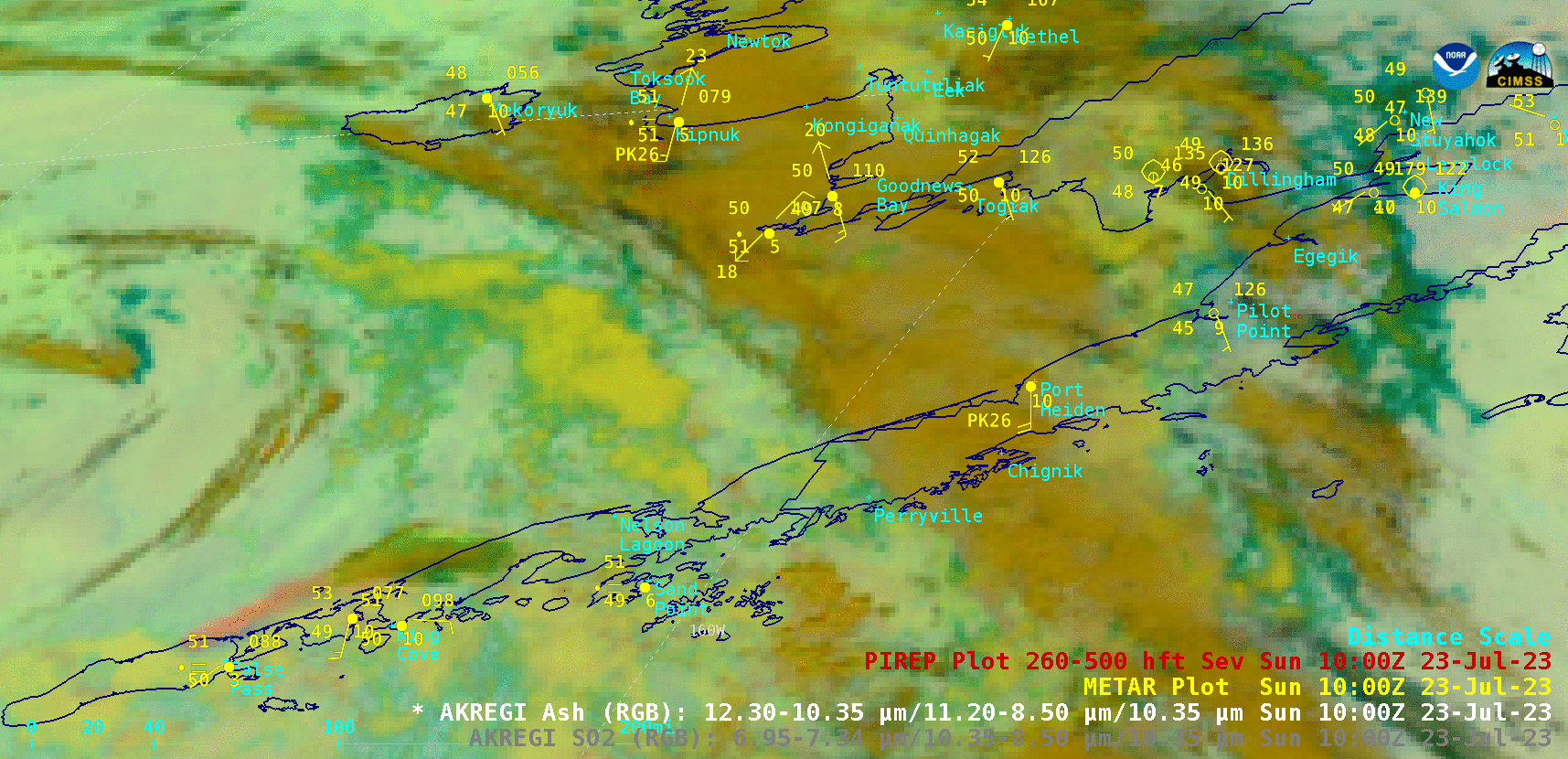
GOES-18 Ash RGB and SO2 RGB images at 1000 UTC [click to enlarge]
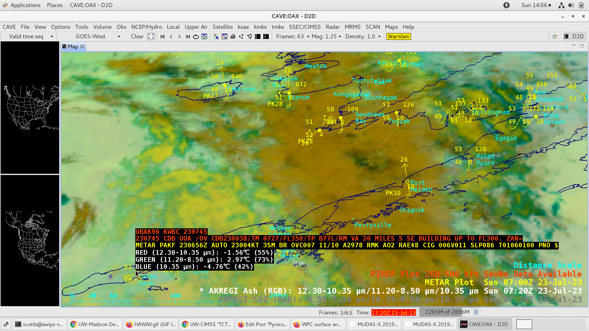
GOES-18 Ash RGB image at 0720 UTC, with cursor sampling of a Pilot Report issued at 0727 UTC [click to enlarge]
===== 24 July Update =====

GOES-18 SO2 RGB images, 0700 UTC on 23 July to 1700 UTC on 24 July [click to play animated GIF | MP4]