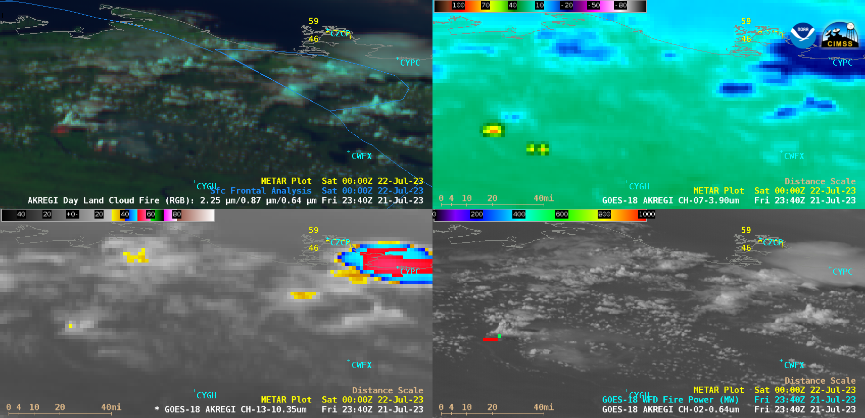
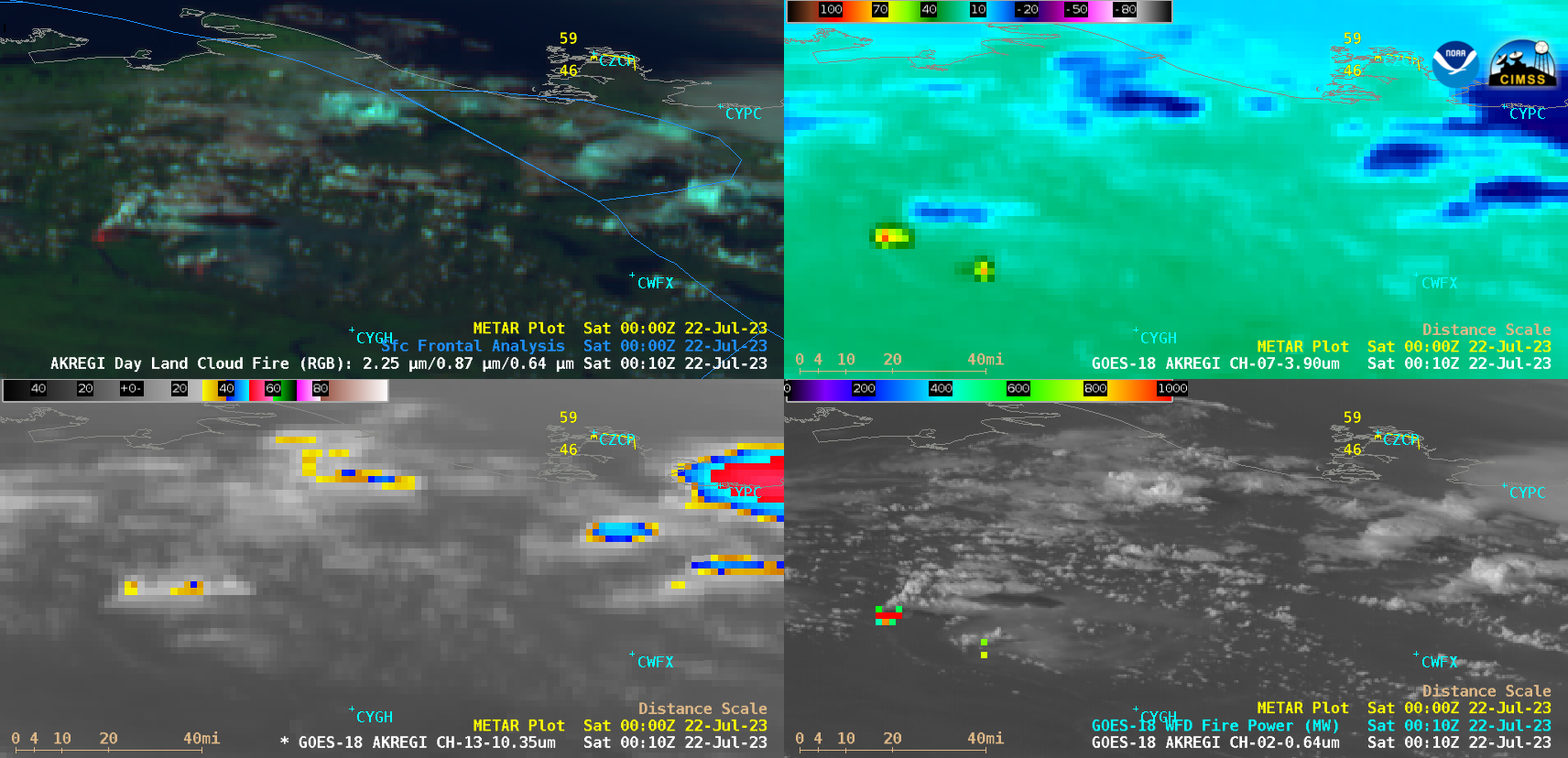
Pyrocumulonimbus clouds in the Northwest Territories
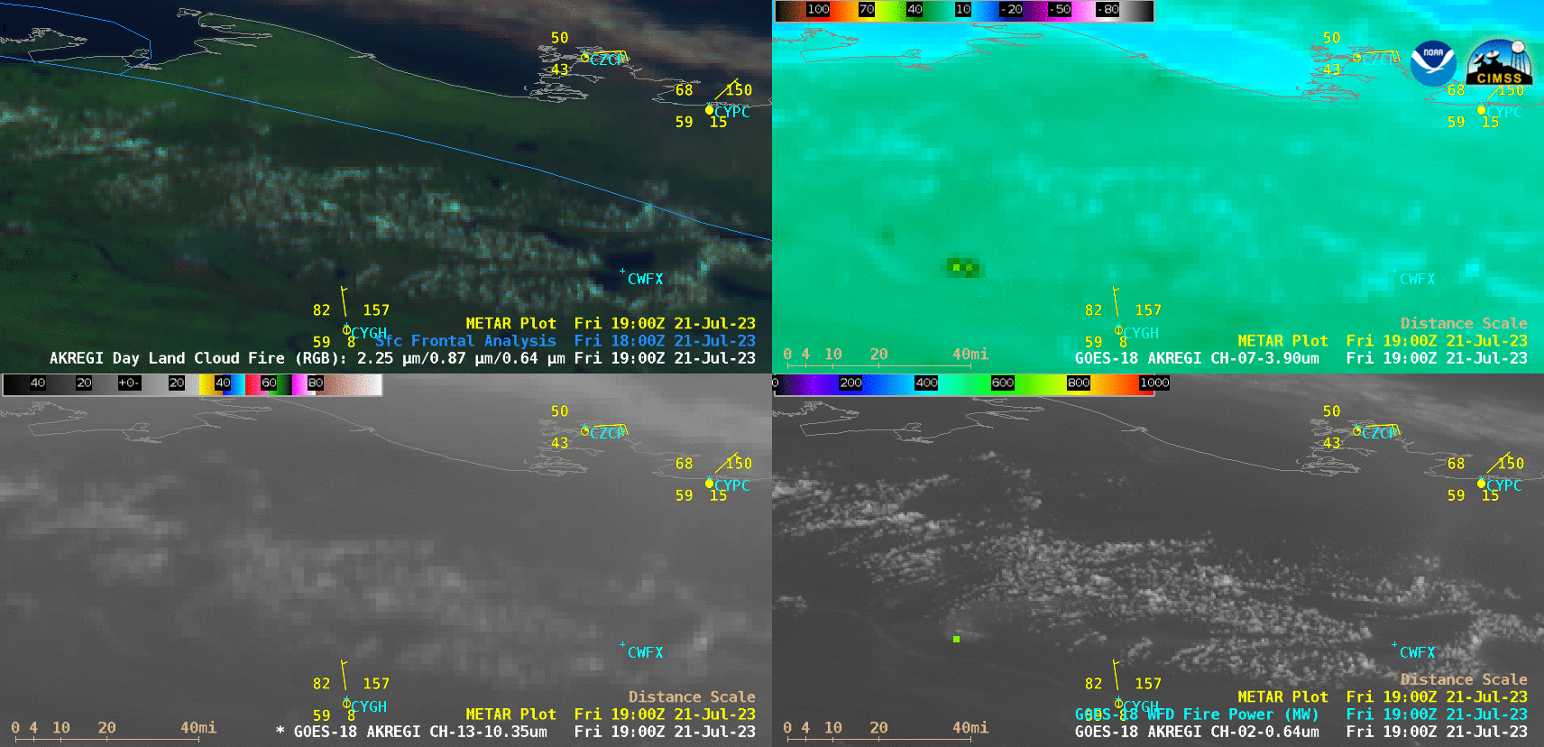
GOES-18 Day Land Cloud Fire RGB (top left), Shortwave Infrared (3.9 µm, top right), “Red” Visible (0.64 µm) + Fire Temperature derived product (bottom left) and “Red” Visible (0.64 µm) + Fire Power derived product (bottom right) [click to play animated GIF | MP4]
At 2300 UTC, the 3.9 µm infrared brightness temperature reached 90.85C, with a Fire Power value of 3623 MW (below). Located at a latitude of 67.35N, this wildfire was only about 40 miles south of the Arctic coast.
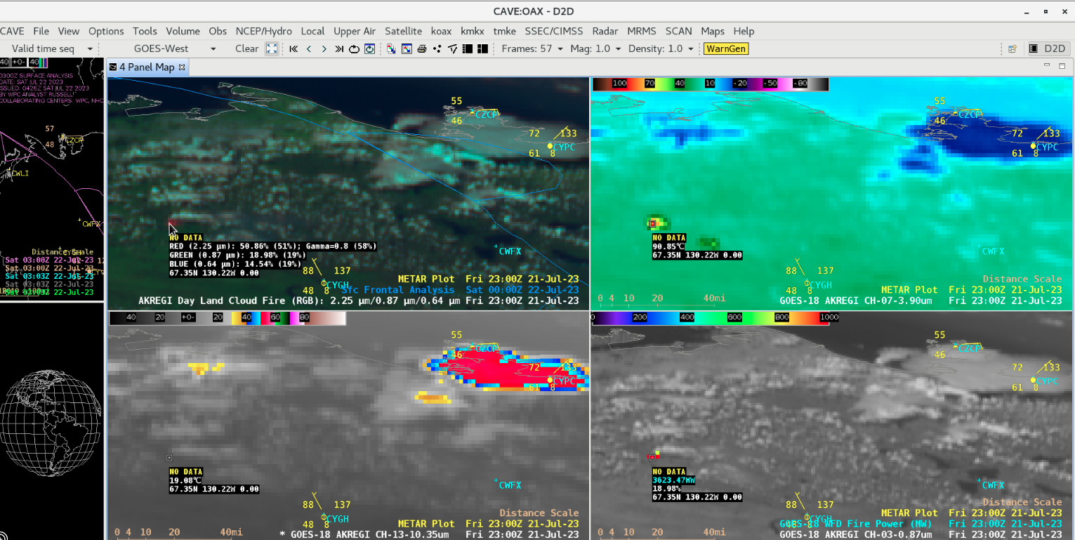
Cursor sampling of GOES-18 imagery at 2300 UTC [click to enlarge]