Super Typhoon Mawar
Himawari-9 Infrared Imagery, above, shows Mawar as it develops and eye and strenghtens to Super Typhoon status. The animation above shows a well-developed symmetric storm with good outflow from all quadrants. The eye is seemingly in steady state from about 0300-0900 UTC, after which time its size shrinks. The 0600 UTC update from the Joint Typhoon Warning Center reported a central pressure near 923 mb. Based on the analysis of heat content in the ocean (from the SSEC Tropical Weather Website), below, Mawar is close to its maximum strength.
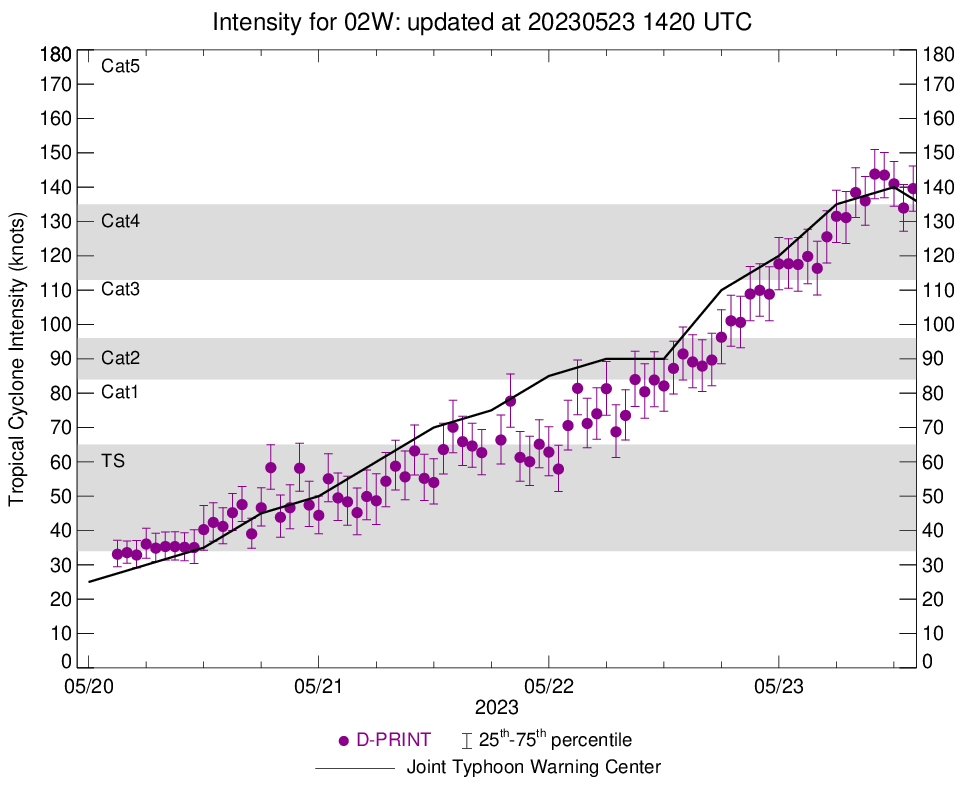
The DPRINT product (formerly called Open-AIIR), a Machine-Learning tool that estimates winds based on satellite presentation, available at the SSEC Tropical Weather Website, suggests a peak in intensity occurred around 1000 or 1100 UTC on 23 May. However, Mawar remains a Super Typhoon. Microwave observations of the eyewall structure (here), can be used to monitor the possibility of an Eyewall Replacement Cycle (ERC), which cycle will be responsible for short-time period variations in typhoon strength from now through landfall on/near Guam. Such cycles are challenging to predict in advance.
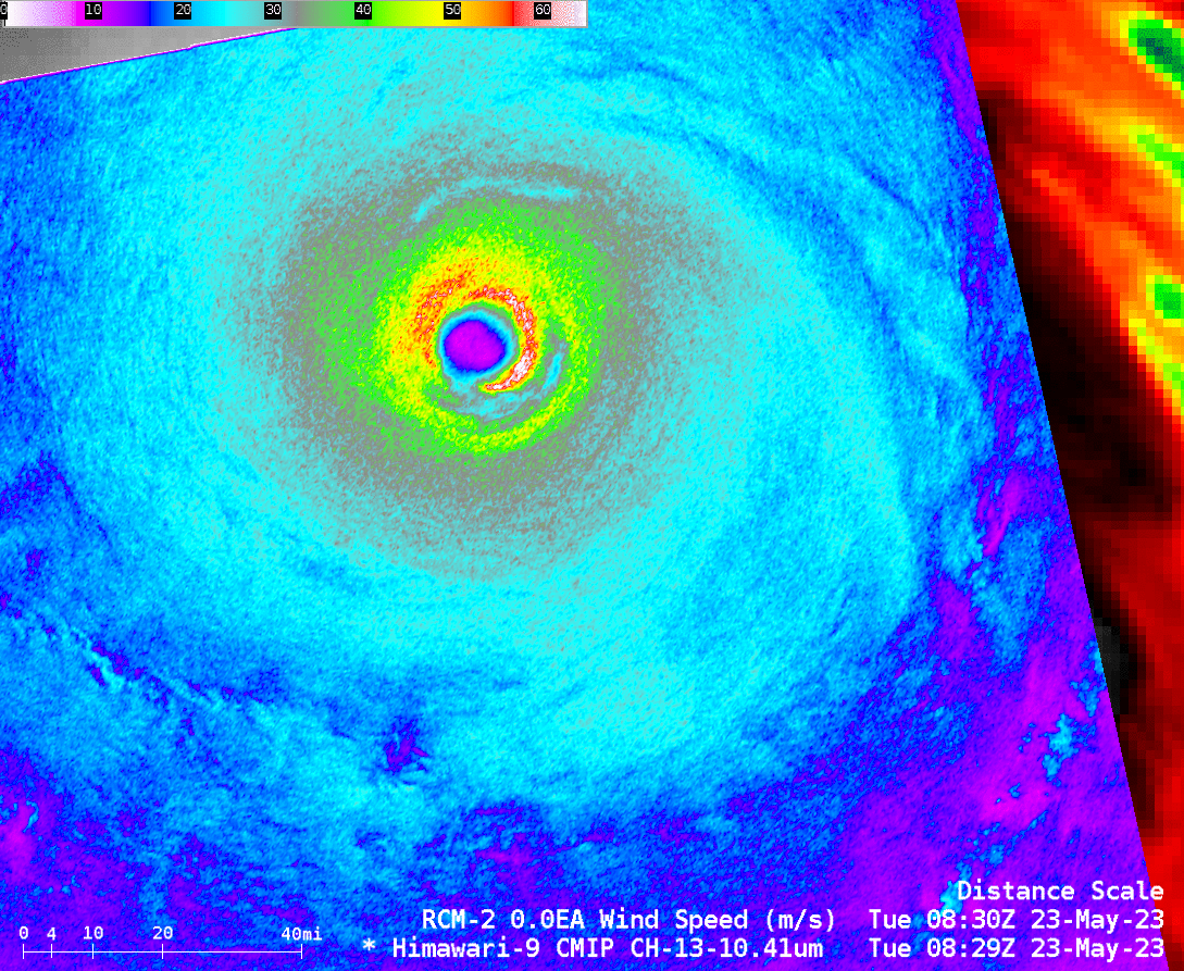
The RCM-2 satellite made another overpass over Mawar, this time at 0830 UTC on 23 May (previous SAR Observations are discussed here and here). The image below compares the SAR observations with the Target Himawari Band 13 (Clean Window, 10.4 µm) image. The strongest SAR winds are not completely encircling the eye. All Mawar SAR observations/analyses can be accessed here.
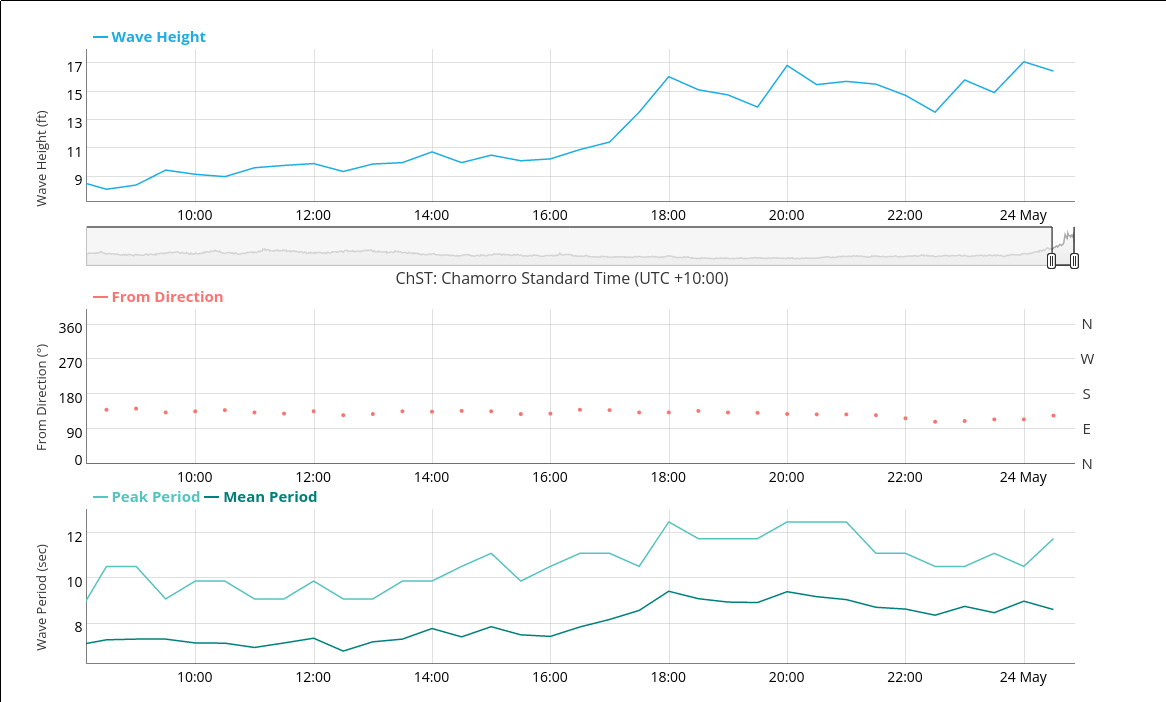
Waves at Ipan, southeast of Guam, shown below, have increased to 16 feet. Significant coastal flooding is expected on Guam with this storm.
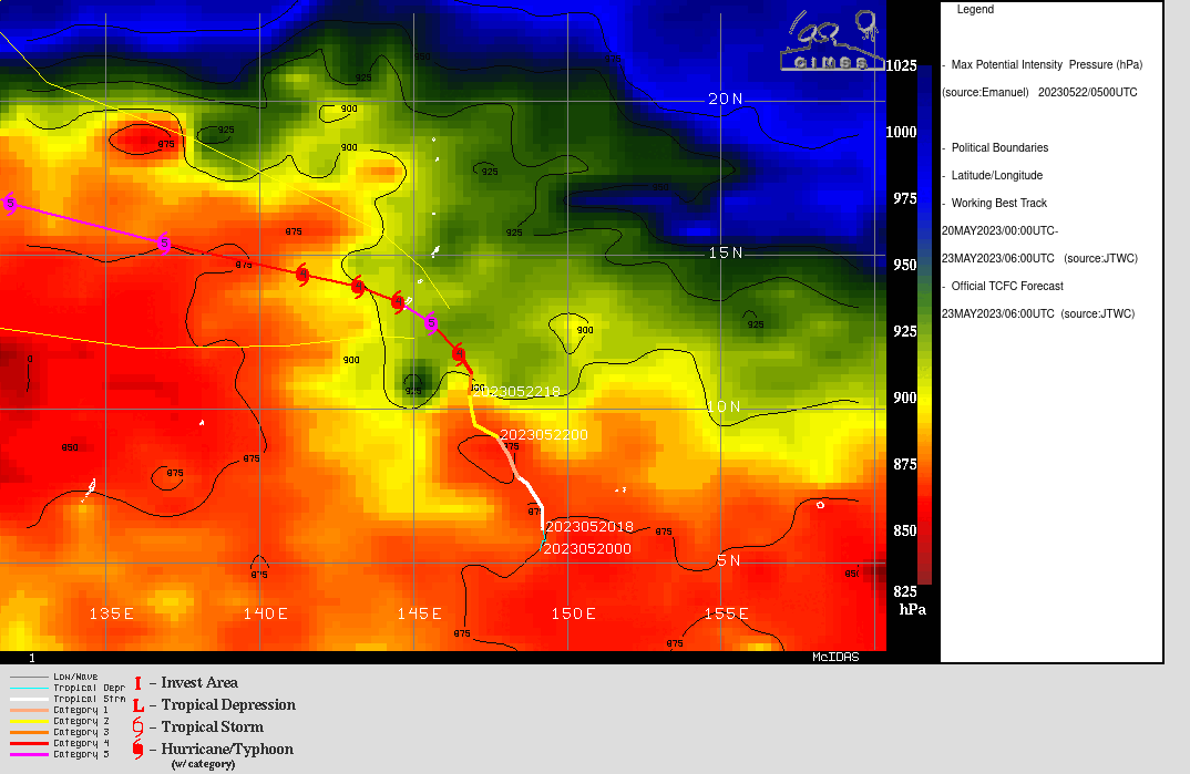
Current forecasts have the path of Mawar bisecting the island of Guam. Refer to the National Weather Service Guam Forecast office website for more information (Local statements from the Guam forecast office are here). Other information is available at the JTWC and Tokyo RSMC.
Update, 1700 UTC on 23 May
The satellite presentation of Mawar has degraded, and the eye is no longer so striking in satellite imagery. The animation below runs from 0634 UTC, when the eye is distinct, through 1657 UTC on 23 May.