Increases in Mawar’s winds diagnosed from SAR data
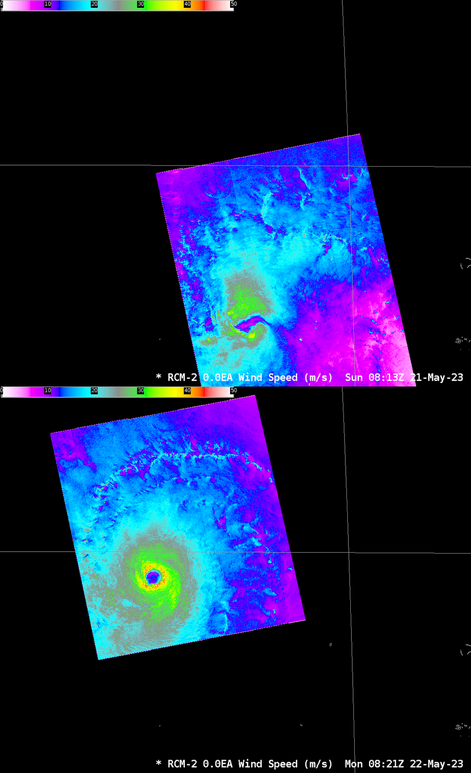
Typhoon Mawar in the western Pacific is moving towards the southern Marianas (the islands of Guam and Rota are both under a Typhoon warning). Radar Constellation Mission Satellite 2 (RCM-2) overflew the storm at 0813 UTC on 21 May, and at 0821 UTC on 22 May, and a toggle of the observations is shown below. The storm is far better organized on 22 May, with a distinct eye and eyewall present in the SAR winds as shown in the toggle below. Peak instantaneous winds increased from around 70 knots on 21 May to 85 knots on 22 May (shown in this toggle using images taken from this website), and the storm has increasing symmetry. Note: the 0600 UTC update from the JTWC discussed peak 1-minute sustained winds of 90 knots.

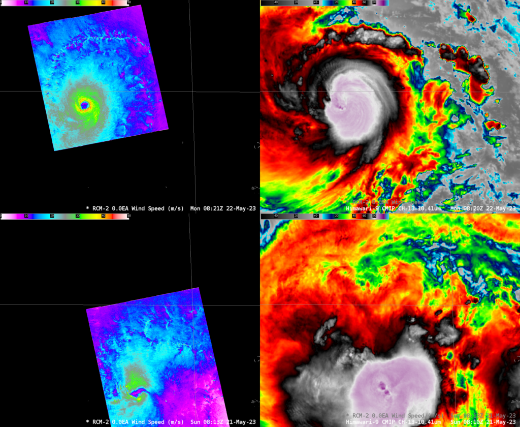
How did the Himawari-9 infrared imagery change within those same 24 hours? The 4-panel below includes the SAR data on the left and Band 13 “Clean Window” infrared imagery (10.4 µm) from Himawari-9 on the right. Very cold cloud tops persist over the center of the storm, but an obvious eye is not yet apparent in the infrared imagery, at least not at the times shown. A prominent outer rainband is apparent in the imagery from 22 May to the north of the eye.

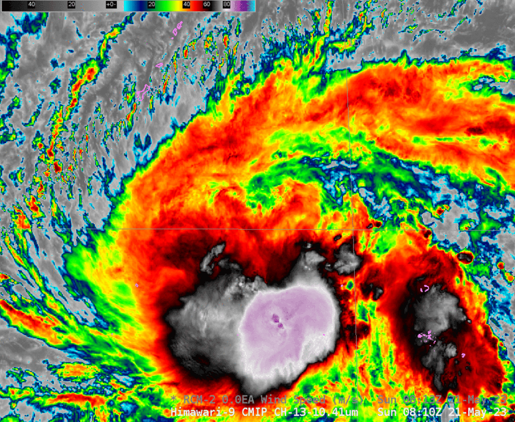
The zoomed-out imagery, below, shows the evolution and movement of the storm between 0810 UTC 21 May and 0820 UTC 22 May, the approximate times of the SAR overpasses. As of 0600 UTC, Mawar was located 280 miles south-southeast of Guam, moving north-northwestward at 6 knots, with a central sea-level pressure of 969 mb.

More information on this dangerous storm is available at the website of the Guam National Weather Service (link), at the Joint Typhoon Weather Center (link), at the Tokyo RSMC (link) and at the SSEC Tropical Weather website (link).
Added: The Himawari-9 Target Sector has been over Mawar for several days now, providing imagery every 2.5 minutes. An mp4 animation showing the evolution of the storm on 21-22 May is below. The development of an eye appears to occur at the end of the animation.

