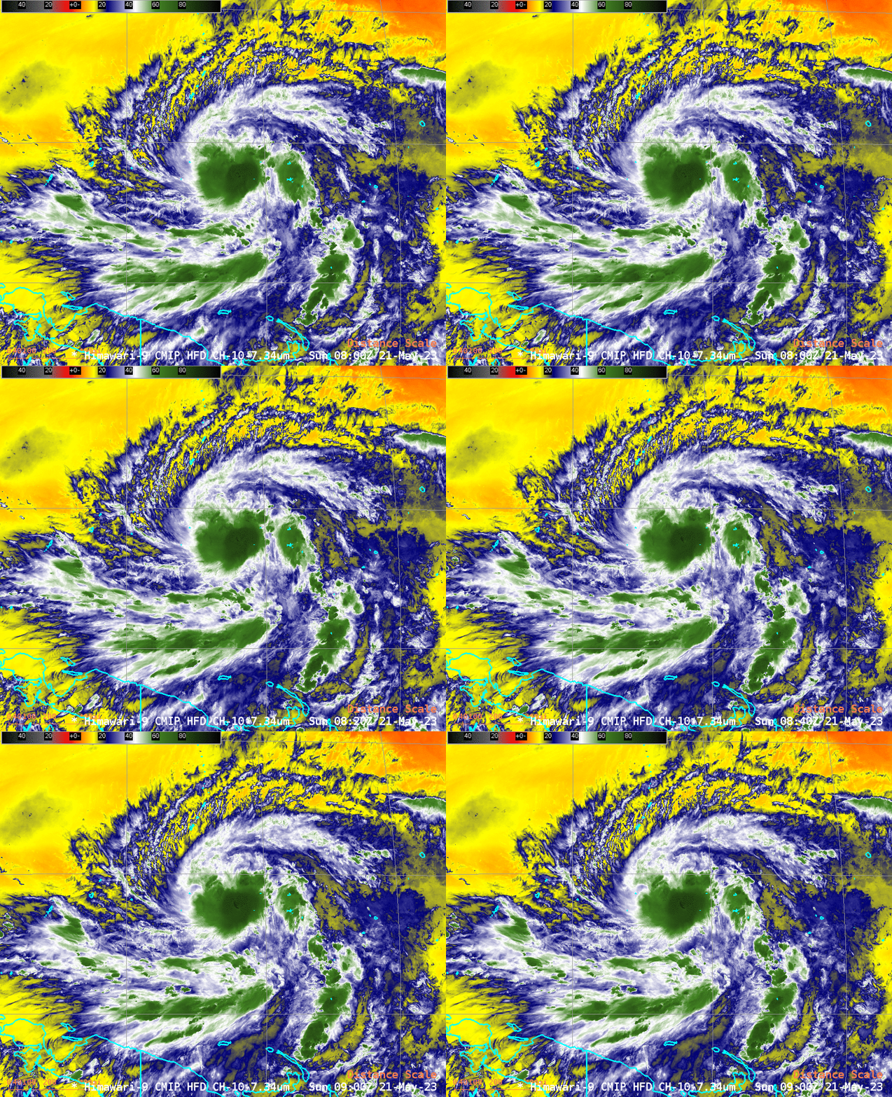
SAR Winds over Tropical Storm Mawar to the southeast of Guam

Himawari-9 Band 10 (Low-level water vapor, 7.3 µm) infrared imagery, above, shows Tropical Storm Mawar to the southeast of Guam. At 0600 UTC, Mawar’s center was about 400 miles south-southeast of the island of Guam. The short water vapor animation above shows an expanding cirrus shield with outflow in all directions. Mawar is expected to become a typhoon later today, and all interests in the southern Marianas islands (Guam and the CNMI are under a Typhoon Watch) should be monitoring the progress of this storm as it approaches.
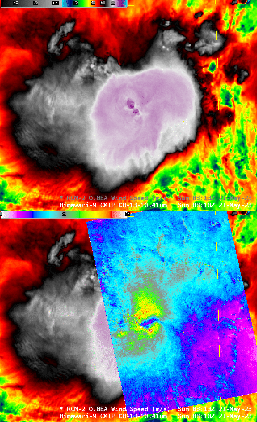
Canada’s RCM-2 (RADARSAT Constellation Mission-2) Satellite, carrying Synthetic Aperture Radar (SAR), overflew the system at 0813 UTC on 21 May. The toggle below compares Clean Window infrared imagery (Band 13, 10.4 µm) from Himawari-9 and the SAR wind analysis at nearly the same time. SAR instantaneous winds are close to 70 knots (see this figure, from here). The SAR imagery does not show a closed-off eye. Himawari-9 shows very cold cloud tops to the west of the SAR-diagnosed surface center, with Band 13 Brightness temperatures close to -95oC. The parallax shift in the Himawari-9 imagery for very cold cloud tops near 148oE Longitude (Himawari-9 is over the Equator at 140.7oE) will not be excessive; however, those coldest cloud tops are in reality a bit farther to the east.

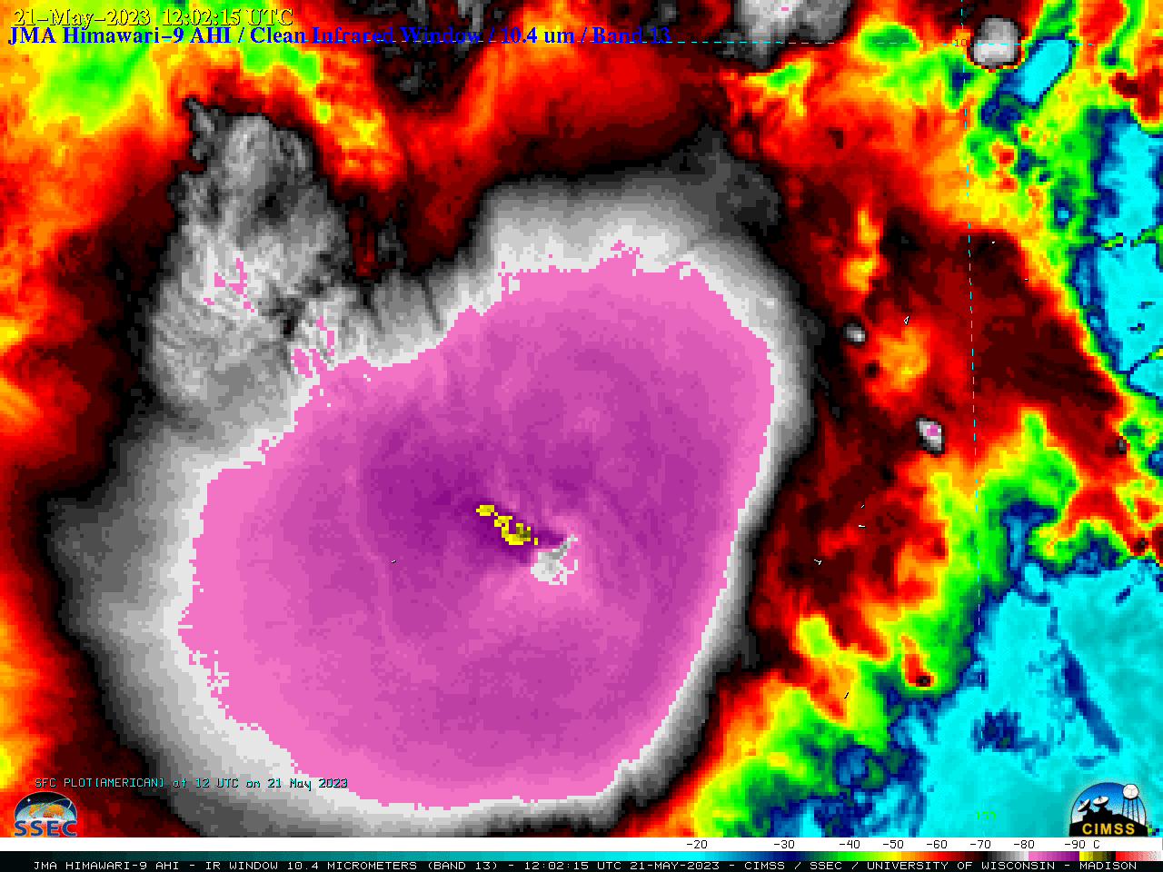
UPDATE: Mawar intensified to a Category 1 Typhoon at 1200 UTC (JTWC advisory) — 2.5-minute rapid scan JMA Himawari-9 “Clean” Infrared Window (10.4 µm) images (below) showed the cold overshooting tops that continued to exhibit infrared brightness temperatures in the -90 to -95ºC range.

JMA Himawari-9 “Clean” Infrared Window (10.4 µm) images (courtesy Scott Bachmeier, CIMSS) [click to play animated GIF | MP4]
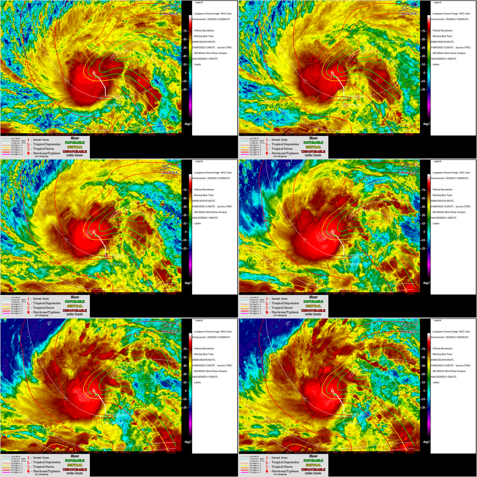
Himawari-9 Infrared Window (11.2 µm) images with an overlay of deep-layer wind shear at 1200 UTC from the CIMSS Tropical Cyclones site (below) indicated that Mawar was moving through an environment of low shear — which, in addition to the storm traversing warm water (Sea Surface Temperature + Ocean Heat Content) favored a continuing trend of intensification.

Himawari-9 Infrared Window (11.2 µm) images, with an overlay of deep-layer wind shear at 1200 UTC [click to enlarge]
Interests in Guam and the CNMI (the southern Marianas Islands) should closely monitor the progress of Mawar. Refer to the Joint Typhoon Warning Center (Link), the National Weather Service in Guam (Link) and the Tokyo RSMC (Link) for more information.

