LightningCast Probabilities over the tropical Pacific Ocean
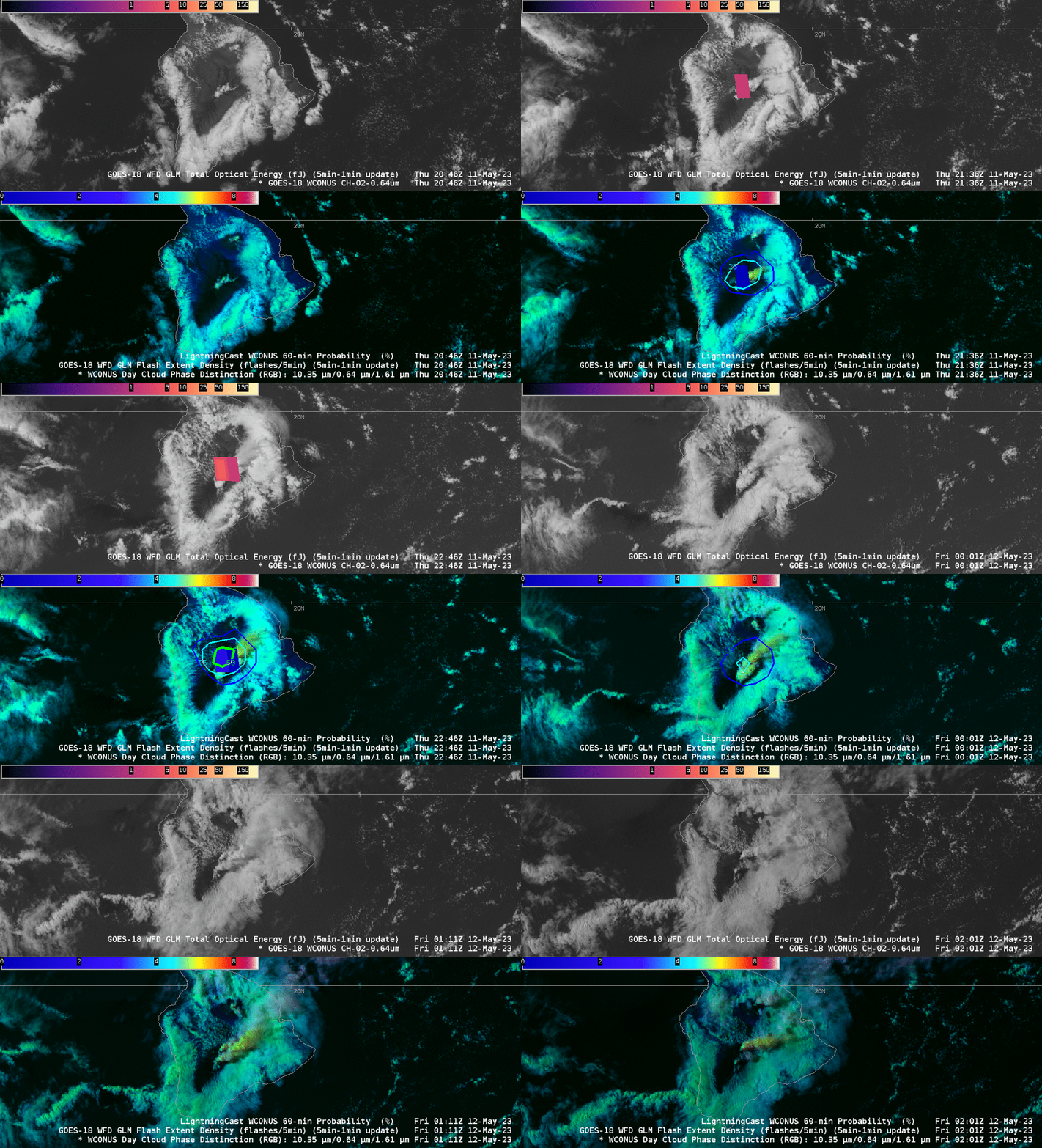
The animations above show thundershower development over the Big Island of Hawai’i on 11 May 2023. LightningCast Probabilities correctly diagnosed the increasing lightning threat, with elevated probabilities (50%) occurring before the first observed Geostationary Lightning Mapper (GLM) flash at 2136 UTC. LightningCast gave situational awareness on this day. (The images above were created using the TOWR-S AWIPS Cloud Instance: Thanks!)
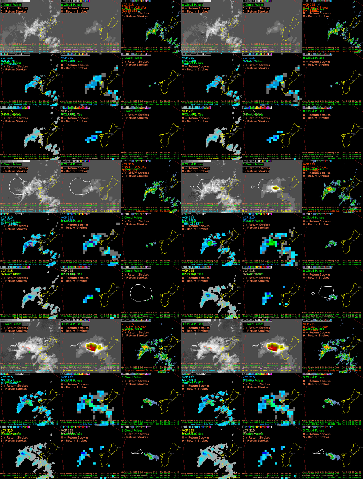
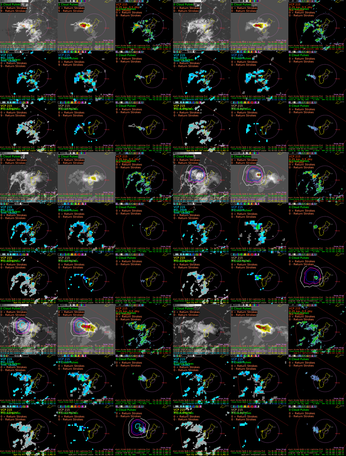
The NWS Forecast Office in Guam sits under the footprint of Himawari-9, a satellite that does not carry a Geostationary Lightning Mapper (GLM). LightningCast Probability was trained to predict GLM flash events based on a combination of ABI Bands (2, 5, 13 and 15 at 0.64 µm, 1.61 µm, 10.3 µm and 12.3 µm, respectively; a training video describing LightningCast is available here). The corresponding bands on AHI are 3, 5, 13 and 15 (at 0.64 µm, 1.61 µm, 10.4 µm and 12.3 µm, respectively); the 1.61 µm band on AHI has 2-km resolution rather than 1-km as on ABI. Ground-based lightning is used to detect lightning at Guam because Himawari-9 does not carry an optical lightning detector such as ABI’s GLM. (Indeed, the only satellite detection of lightning that occurs at Guam is from the LIS (Lightning Imaging Sensor) on the International Space Station. It was not overflying Guam during the times shown above). Ground-based lightning detection networks may not detect in-cloud or cloud-to-cloud lightning strokes that are detected by GLM. Thus the lightning detected in the animations below is possibly less than what a GLM instrument would have detected. The animations below do show lead time for situational awareness of lightning given the 10-minute scanning cadence of Himawari-9 full-disk imagery.
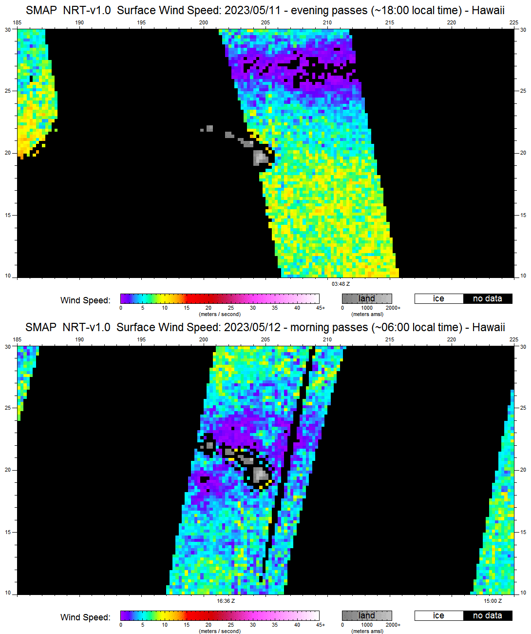
What do the two scenes from Hawaii and Guam have in common? On both days, the trade winds were not strong. That can be inferred by the ring of clouds — a sea breeze front — that encircles the big island. In addition, SMAP data (from this site) show weak winds on 11-12 May. (ASCAT winds at this time were on either side of Hawai’i, but not really over it!)
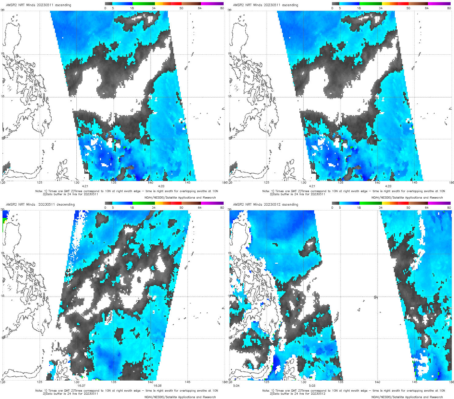
Similarly, AMSR-2 wind speeds near/west of Guam show weak winds. There are differences in lightning morphology in tropical airmasses (vs. continental airmasses) as noted in this paper; however, that paper does not consider the effect of horizontal wind speed, if any.
LightningCast probability fields are available at this website. A menu at that site allows the user to view probabilities in a variety of sectors, including PACUS (that includes Hawaii), Guam and American Samoa.

