Strong winds causing heavy freezing spray off the Alaska coast

GOES-18 “Red” Visible (0.64 µm) images, with and without plots of Derived Motion Winds [click to play animated GIF | MP4]
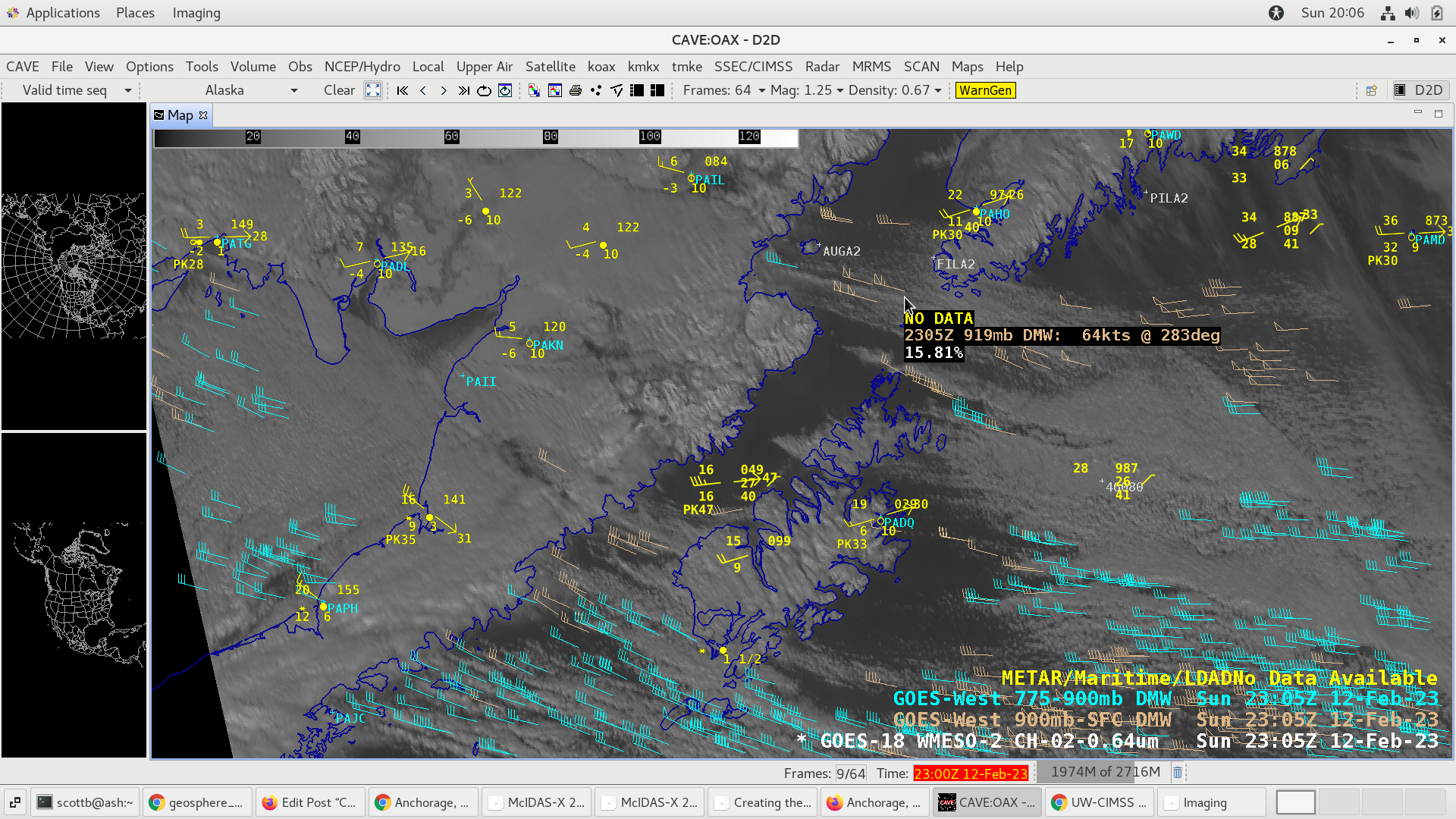
GOES-18 “Red” Visible (0.64 µm) image at 2305 UTC, with plots of Derived Motion Winds (DWM) and a cursor readout showing a 64-knot DMW wind speed [click to enlarge]
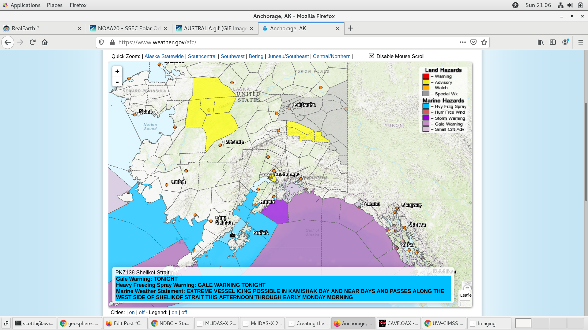
Heavy Freezing Spray Warning issued for the Shelikof Strait [click to enlarge]
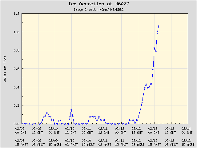
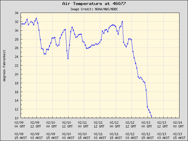
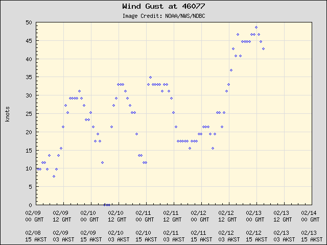
Plot of Buoy 46077 Ice Accretion Rates
RCM/Radarsat-2 SAR winds at 1630 UTC on 12 February (source) are shown below — a NW-to-SE oriented swath of strong offshore winds (40-50 knots, darker shades of red) was seen extending from the far southern end of Cook Inlet (where the aforementioned 64-knot GOES-18 DMW speed was located) into the northwestern Gulf of Alaska. Another pocket of similarly-strong wind speeds was evident farther to the north, in the vicinity of Homer, Homer Spit and the mouth of Kachemak Bay.
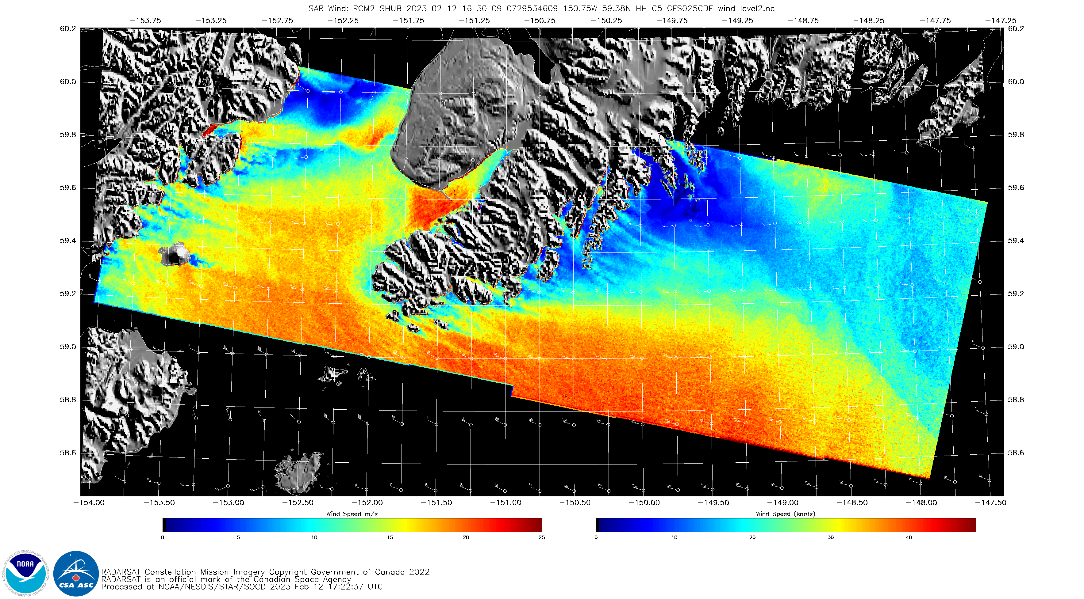
RCM/Radarsat-2 SAR winds at 1630 UTC on 12 February [click to enlarge]