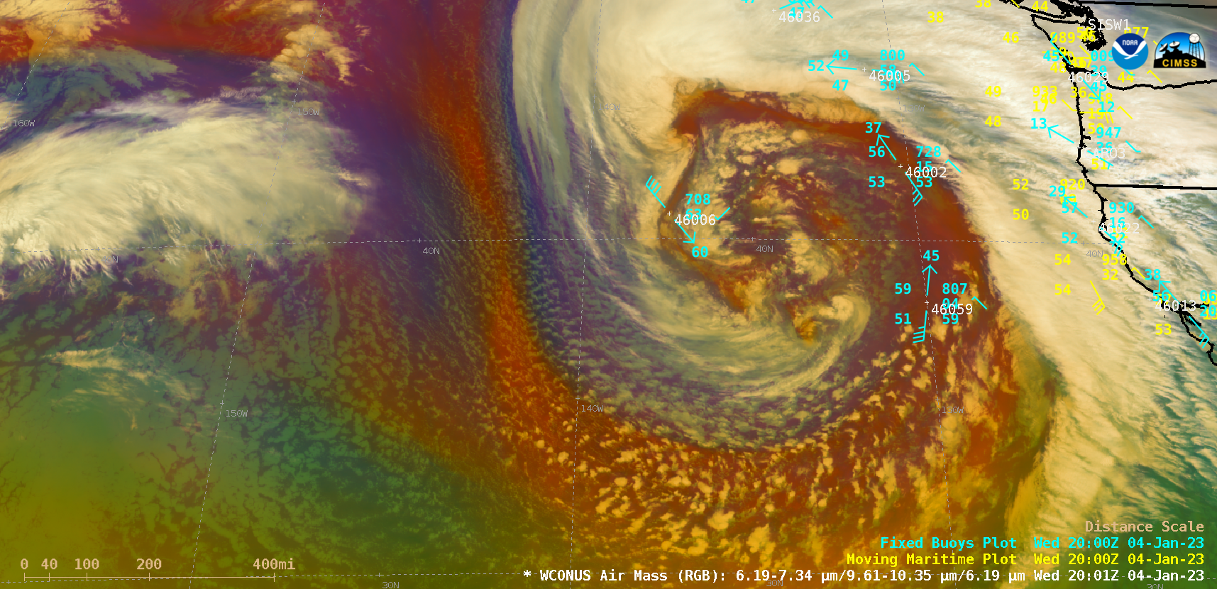
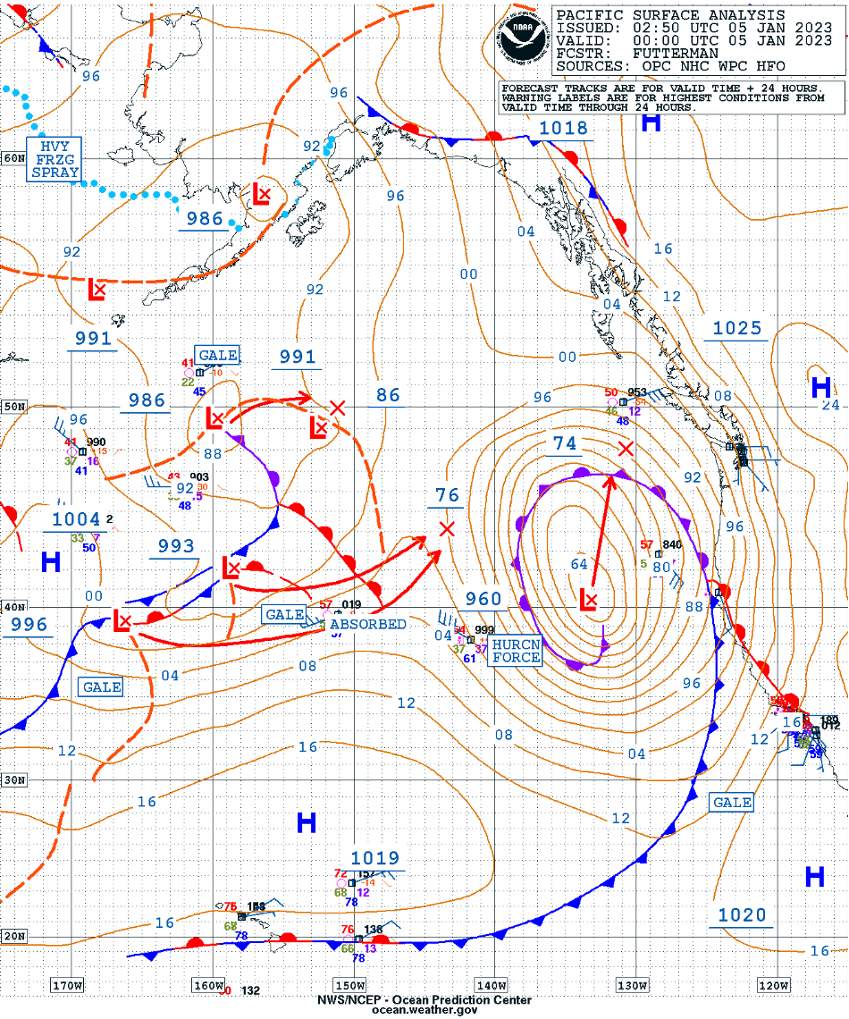
Rapidly intensifying Hurricane Force low off the US West Coast
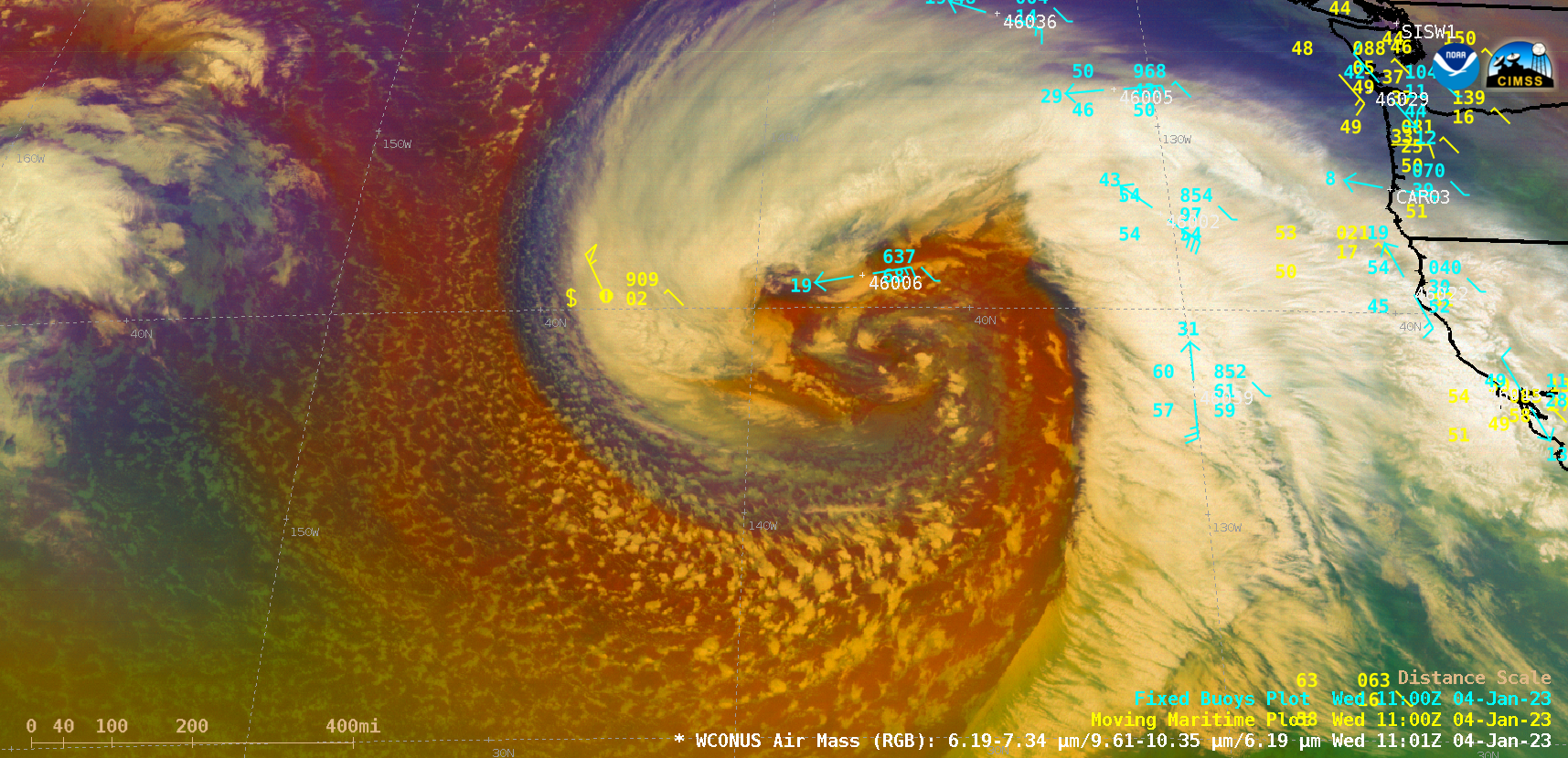
GOES-17 and — beginning at 1801 UTC on 04 January, GOES-18 — Air Mass RGB images, with Moving Maritime (ship) reports plotted in yellow and Fixed Buoy reports plotted in cyan [click to play MP4 animation | animated GIF]
With abundant illumination from the Moon (which was in the Waxing Gibbous phase, at 95% of Full), a Suomi-NPP VIIRS Day/Night Band (0.7 µm) image at 1004 UTC (2:44 AM PST) on 04 January provided an excellent “visible image at night” of the storm. Note the POLAR RESOLUTION report of 55 knot winds with blowing spray (near the western edge of the storm’s cloud shield).
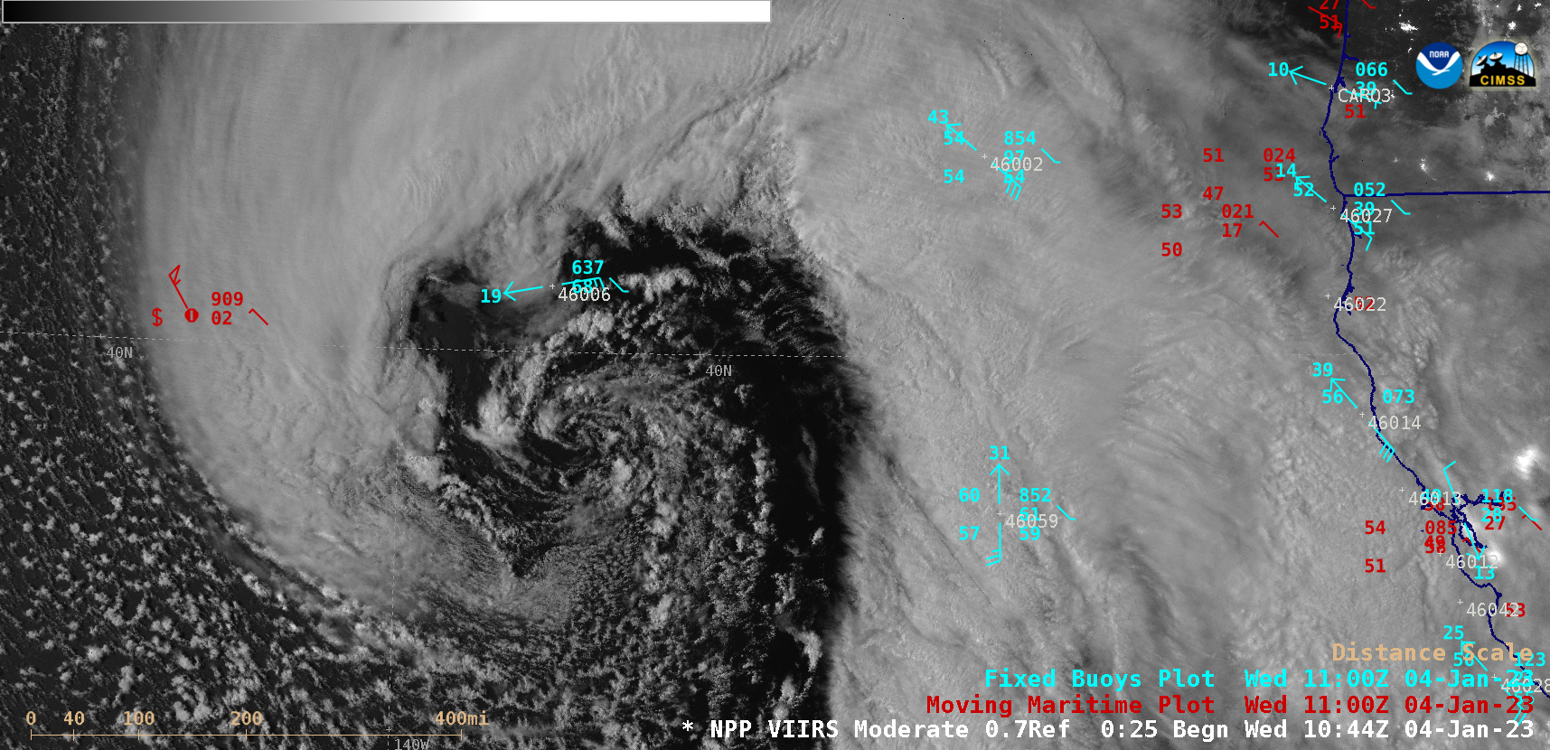
Suomi-NPP VIIRS Day/Night Band (0.7 µm) image, with Moving Maritime (ship) reports plotted in red and Fixed Buoy reports plotted in cyan [click to enlarge]
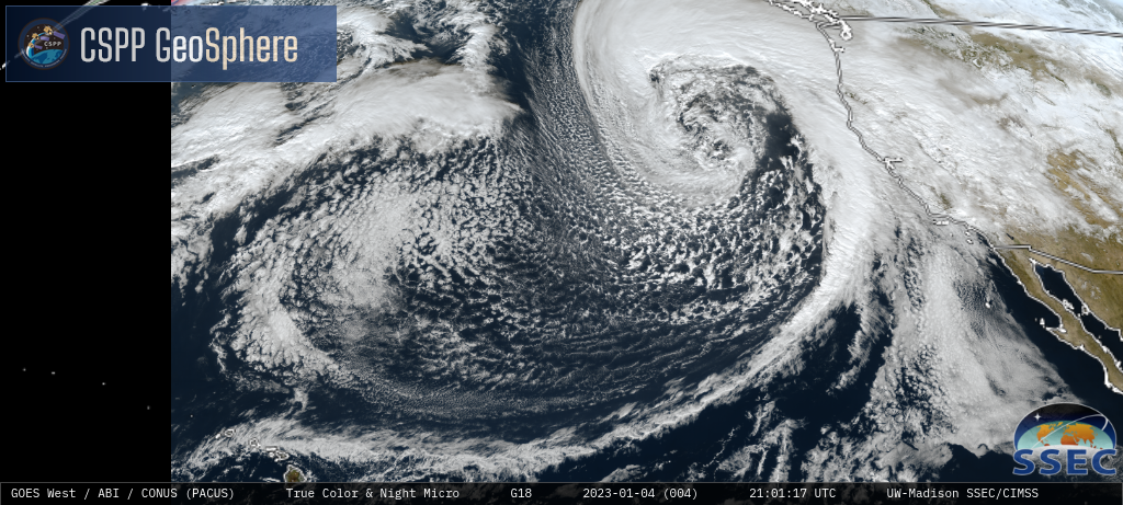
GOES-17/GOES-18 True Color RGB and Nighttime Microphysics RGB images [click to play MP4 animation]