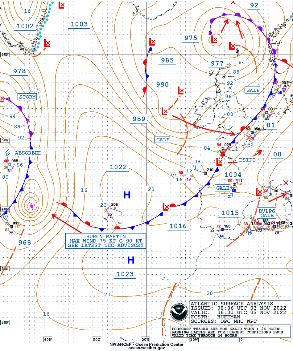
Extratropical transition of Hurricane Martin
GOES-16 Mid-Level Water Vapor (6.9 µm) and Air Mass RGB images [click to play animated GIF | MP4]
DMSP-17 SSMIS Microwave (85 GHz) imagery at 1005 UTC (below) — from the CIMSS Tropical Cyclones site — indicated that a closed eyewall was not present with Martin at that time.
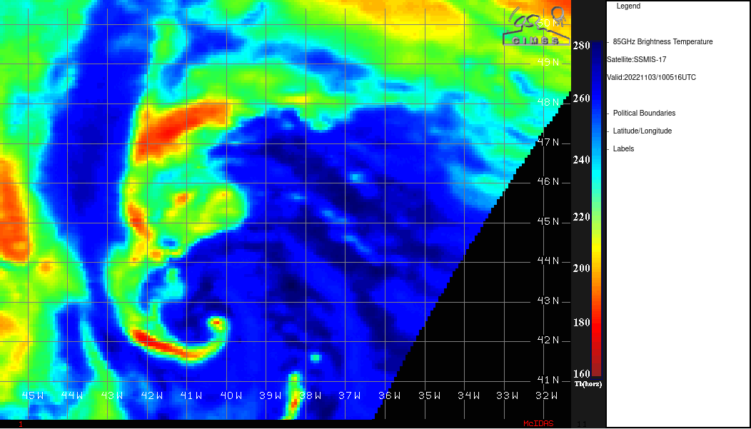
DMSP-17 SSMIS Microwave (85 GHz) image at 1005 UTC [click to enlarge]
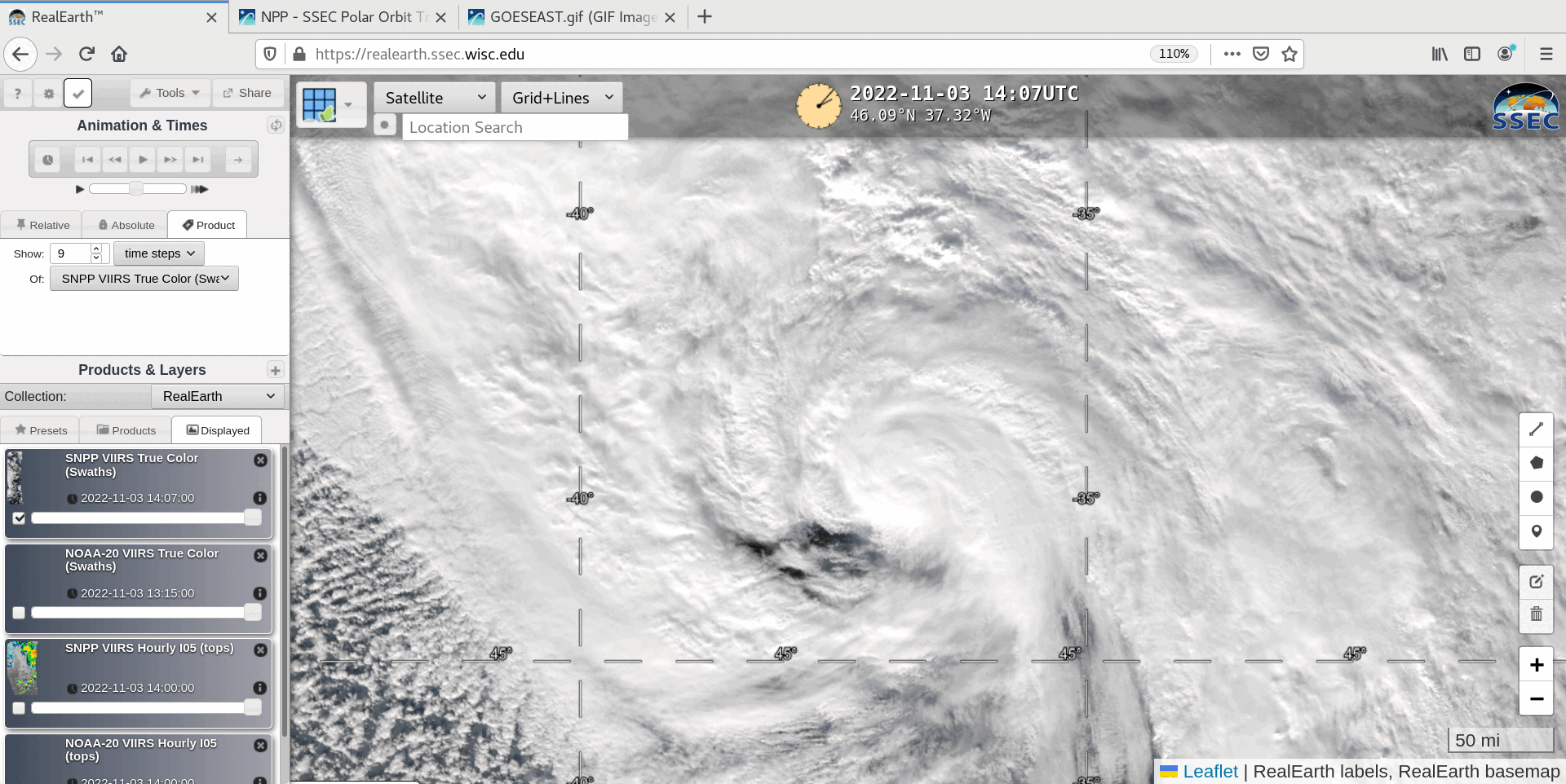
VIIRS True Color RGB and Infrared Window (11.45 µm) images from Suomi-NPP (at 1447 UTC) and NOAA-20 (at 1537 UTC) [clic to enlarge]
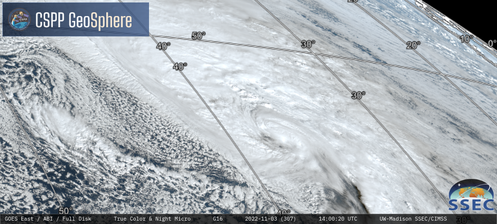
GOES-16 Nighttime Microphysics RGB and daytime True Color RGB images [click to play MP4 animation]