ProbSevere LightningCast Probabilities for Guam
At the request of the National Weather Service forecast office in Guam (where the National Weather Service’s day begins), CIMSS is computing a small region of LightningCast Probabilities that uses Himawari-8 data. The Guam forecast office issues a lightning ‘advisory’ if lightning is possible or occurring within 20 mi of the Guam Airport, and a lightning ‘warning’ if lightning is possible/occurring within 5 mi of the airport. LightningCast probabilities will help in this task. Forecasters will be evaluating its performance in the coming weeks.
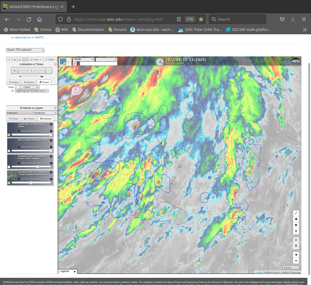
LightningCast imagery is available in a RealEarth instance here (at that website, there is a small drop-down menu titled ‘Select Sector’; Choose Guam). An example animation is shown above. (Guam is located at the outer fringes of Typhoon Nanmadol in the image) In contrast to the scenes under GOES-East’s and GOES-West’s view, GLM data are not available. In the forecast office, ground-based lightning sources are available. This animation (from John Cintineo, CIMSS) shows LightningCast probabilities with Earth Networks Total Lightning. Animations online, as shown above, show only Himawari-8 data and LightningCast probability contours.
As with GOES-R LightningCast computations, Himawari-8 uses Visible (0.64 µm), near-infrared (1.61 µm) and infrared (10.41 µm and 12.3 µm) observations. Resolution differences at 1.61 µm (1 km for GOES-R and 2 km for Himawari-8) and slight differences in infrared spectral responses, especially for band 13 (centered near 10.33 µm for GOES-R and 10.41 µm for Himawari-8) may have an as-yet unknown impact on LightningCast probabilities.