Cedar Creek Fire in Oregon
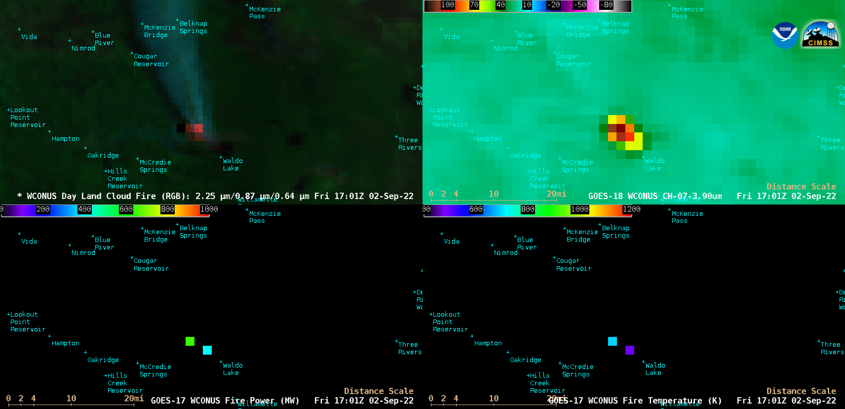
GOES-18 Day Land Cloud Fire RGB (top left), GOES-18 Shortwave Infrared (3.9 µm, top right), GOES-17 Fire Power (bottom left) and GOES-17 Fire Temperature (bottom right) [click to play animated GIF | MP4]
GOES-18 True Color RGB images created using CSPP GeoSphere (below) showed the large smoke plume produced by this wildfire, which spread north-northeastward across Washington State during the day.
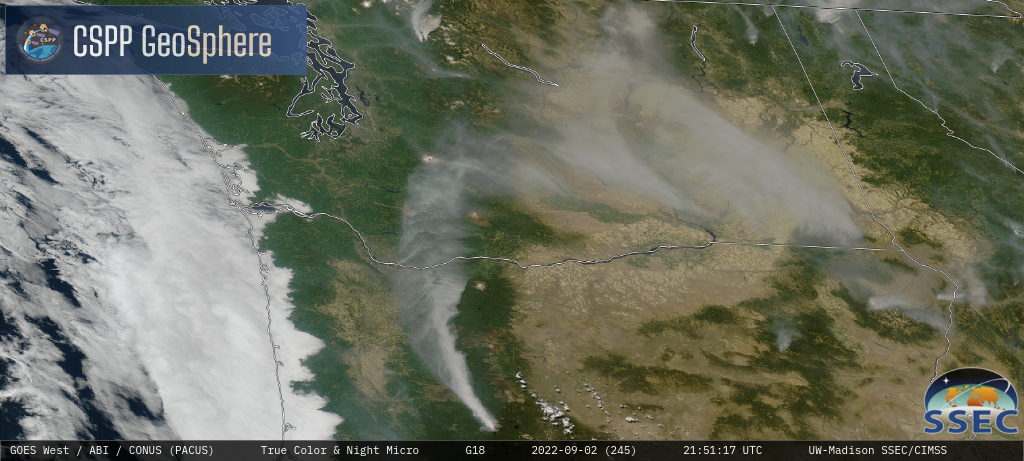
GOES-18 True Color RGB images [click to play MP4 animation]