Marshall Fire near Boulder, Colorado
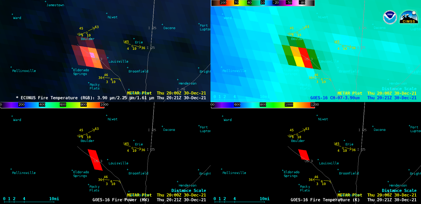
GOES-16 Fire Temperature RGB (top left), Shortwave Infrared (3.9 µm, top right), Fire Power (bottom left) and Fire Temperature (bottom right), [click to play animated GIF | MP4]
GOES-16 Fire Temperature RGB, Shortwave Infrared (3.9 µm) Fire Power and Fire Temperature derived products (above) showed rapid expansion of the Marshall Fire’s thermal signature in Boulder County, Colorado on 30 December 2021. The earliest unambiguous fire signature appeared on the 1841 UTC image (11:41 am MST); the maximum 3.9 µm infrared brightness temperature was 110.96ºC (at 2021 UTC), the peak Fire Power was 1848.94 MW (at 2031 UTC) and the peak Fire Temperature was 1632.94 K (at 2031 UTC). The fire burned over 6000 acres in less than 24 hours, and destroyed or damaged over 1000 homes and businesses (making it the most destructive wildfire on record for the state of Colorado).
A comparison of Shortwave Infrared images from GOES-17 (GOES-West) and GOES-16 (GOES-East) is shown below. As was the case above, the earliest unambiguous fire thermal signature appeared on the 1841 UTC images from both satellites. Beginning at 2100 UTC, a GOES-17 Mesoscale Domain Sector was positioned over the region to monitor the ongoing fire, which provided images at 1-minute intervals.
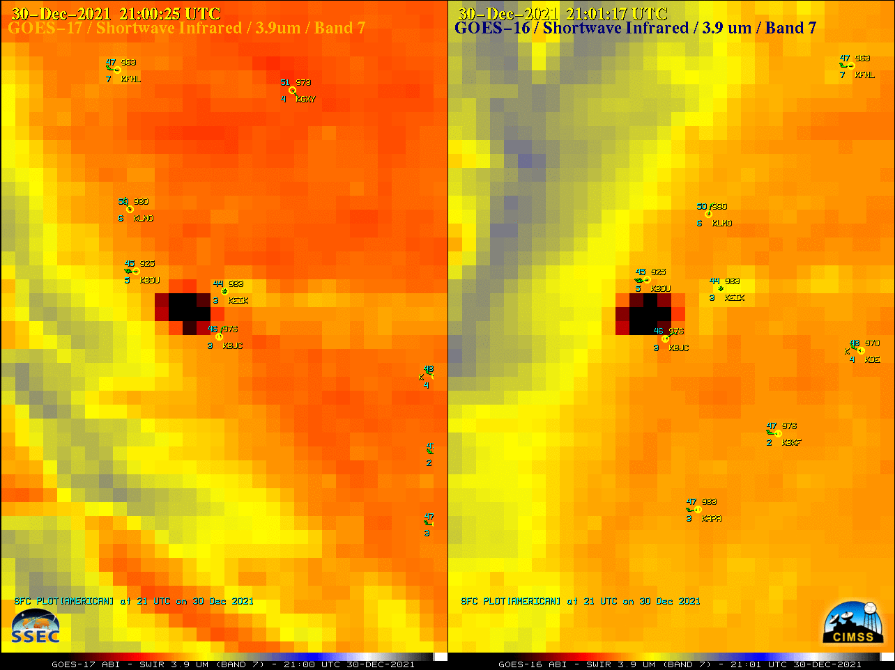
Shortwave Infrared (3.9 µm) images from GOES-17 (left) and GOES-16 (right) [click to play animated GIF | MP4]
GOES-17 and GOES-16 Low-level (7.3 µm), Mid-level (6.9 µm) and Upper-level (6.2 µm) Water Vapor images (below) revealed the rapid development of a band of pronounced warming/drying — indicative of strong mountain wave subsidence — over the Front Range (centered near the Boulder KBOU area), along with additional mountain waves extending to the east. The band of strong mountain wave subsidence helped to transfer the momentum of strong westerly winds aloft (Boulder rawinsondes) downward to the surface; the rapid spread of the fire was driven by very strong surface winds, gusting to speeds over 100 mph.
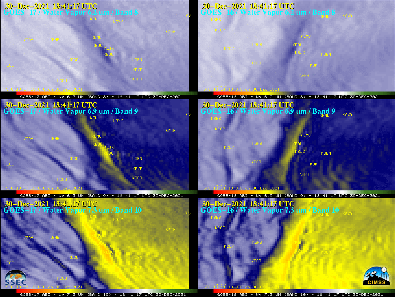
GOES-17 (left) and GOES-16 (right) Upper-level (6.2 µm, top), Mid-level (6.9 µm, center) and Low-level (7.3 µm, bottom) Water Vapor images [click to play animation | MP4]
GOES-16 True Color RGB images created using Geo2Grid (below) highlighted the smoke plume, which drifted as far eastward as Nebraska and Kansas by sunset. Note the development of Kelvin-Helmholtz waves (particularly along the northern edge) as lee-side mountain waves distorted the smoke plume. Smoke briefly reduced the surface visibility to 1.5 miles at Denver International Airport — and farther to the east, the visibility dropped to 7 miles at Fort Morgan. Several other narrow plumes of blowing dust could be seen moving eastward across the eastern Colorado plains (which was experiencing severe to extreme drought).
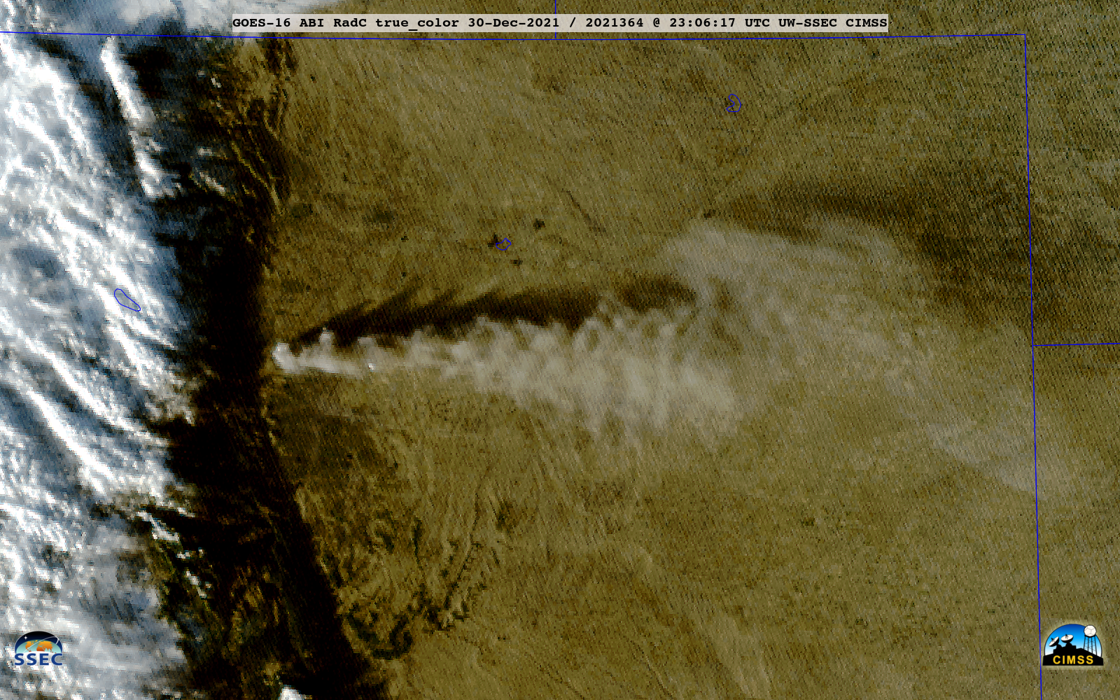
GOES-16 True Color RGB images [click to play animated GIF | MP4]
1-minute GOES-17 True Color RGB images are shown below.
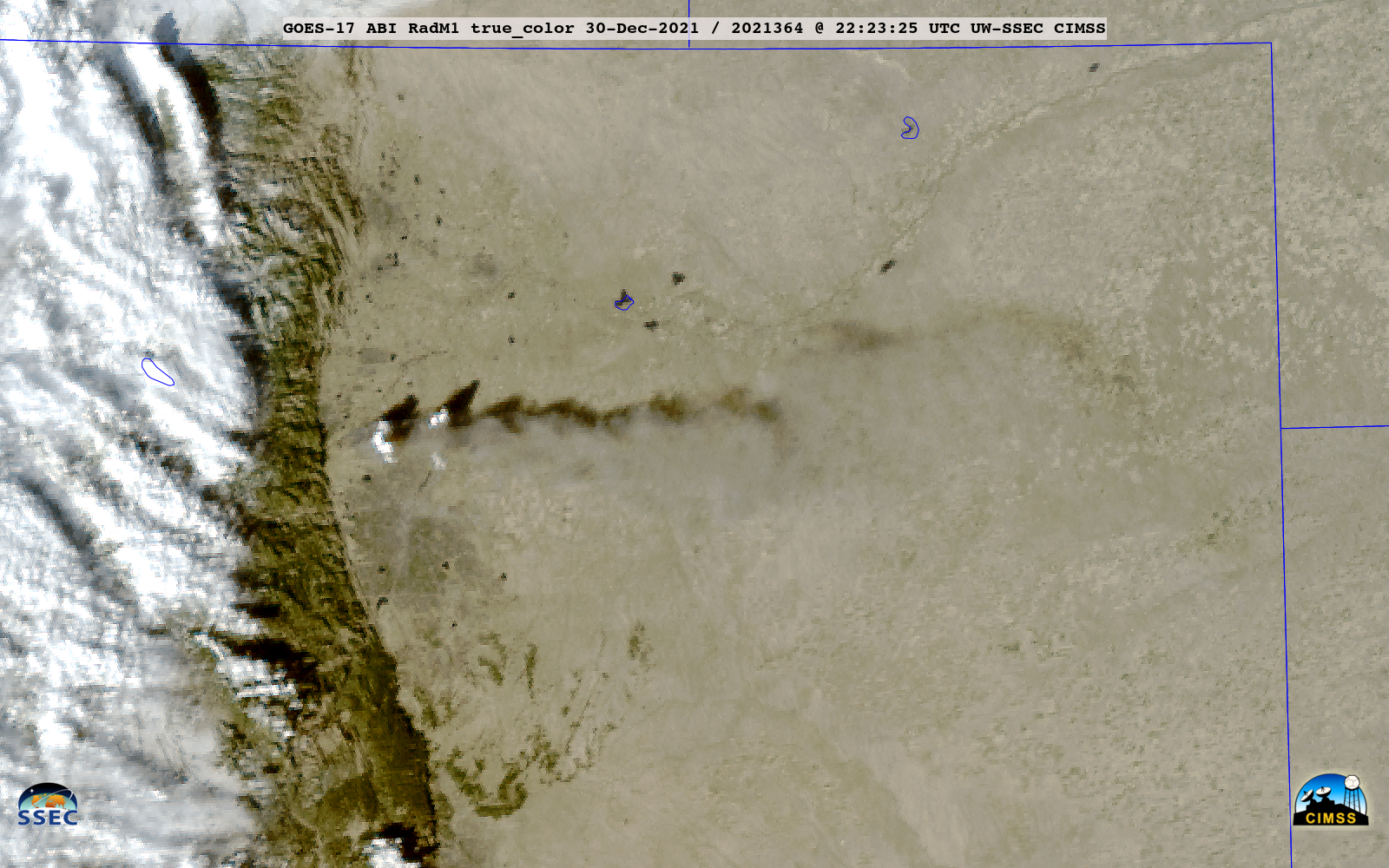
GOES-17 True Color RGB images [click to play animated GIF | MP4]
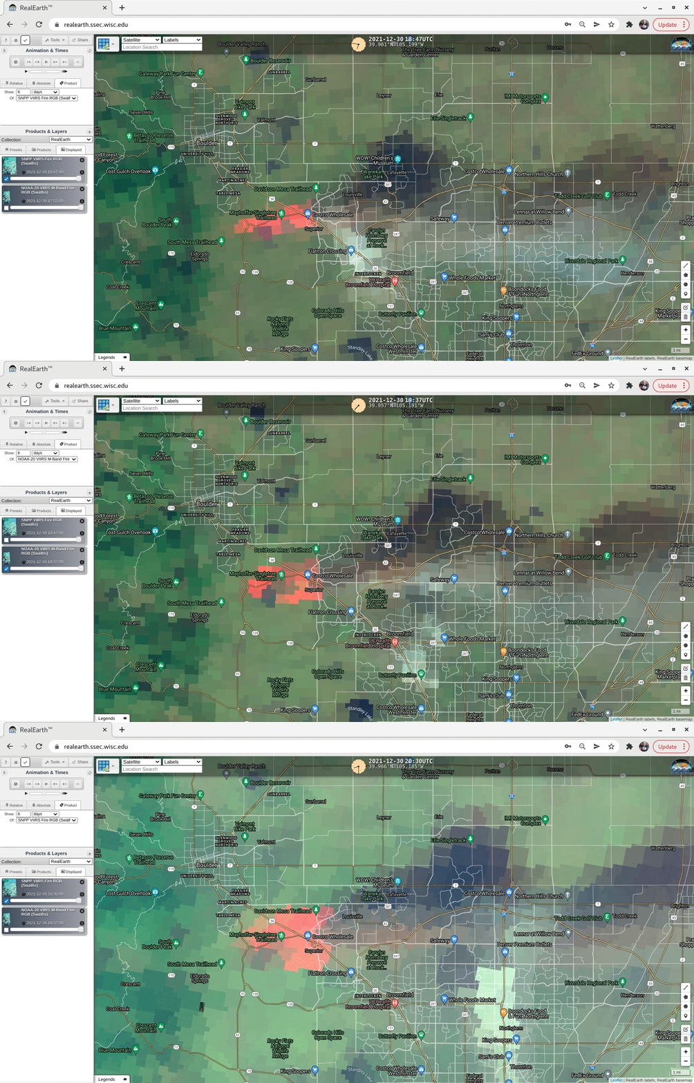
VIIRS Fire RGB images from Suomi-NPP and NOAA-20 as viewed using RealEarth (below) showed the coverage of the Marshall Fire (cluster of red pixels) at 3 time periods.
===== 31 December Update =====
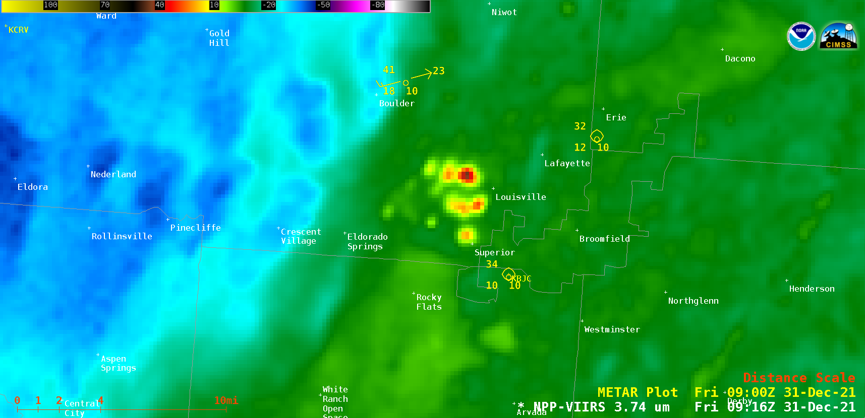
During the subsequent nighttime hours, a VIIRS Shortwave Infrared (3.74 µm) from Suomi-NPP (above) displayed thermal anomalies associated with active fire pockets that continued to burn at 0925 UTC or 2:25 am MST.


