Super Typhoon Rai

Himawari-8 Infrared Window (10.3 µm) images [click to play animated GIF | MP4]
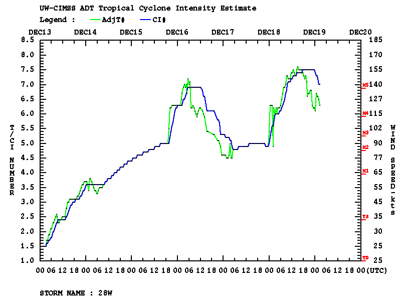
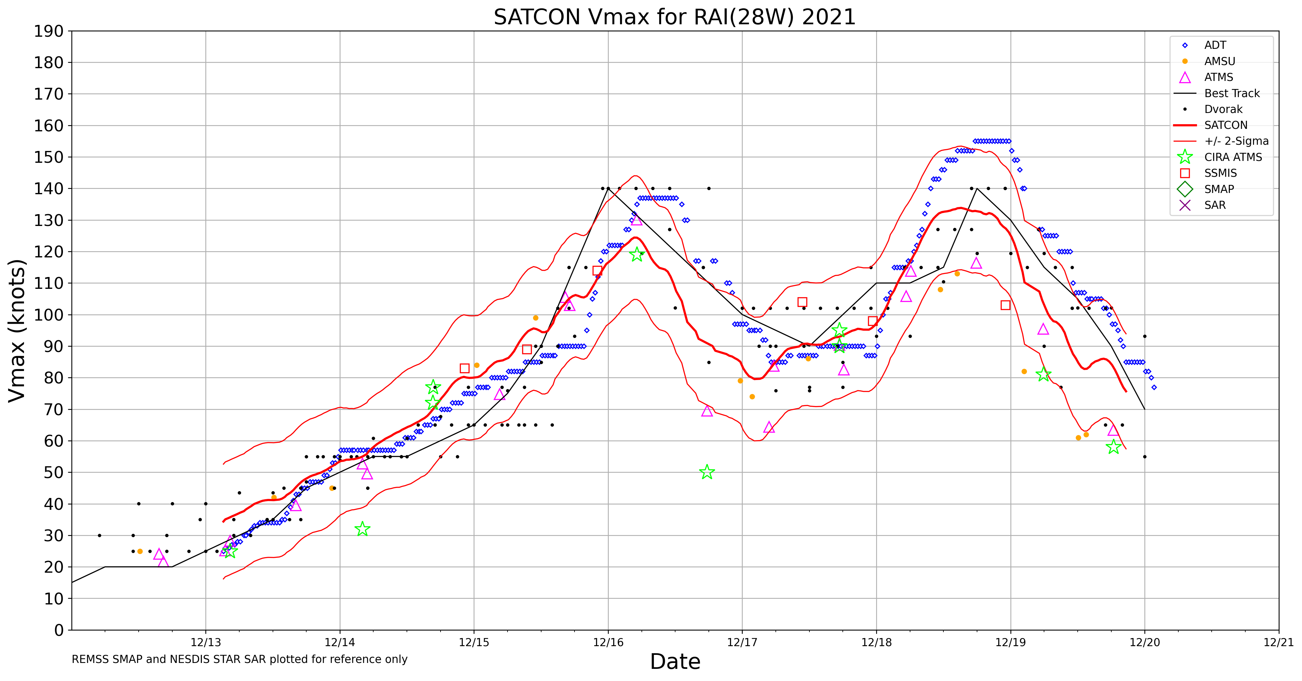
For the second time during its life cycle, Typhoon Rai reached Category 5 intensity (ADT | SATCON) east of Vietnam during the 18-19 December 2021 period. JMA Himawari-8 Infrared Window (10.3 µm) images (above) showed cloud-top infrared brightness temperatures of -90C and colder at times around the eye.
VIIRS Infrared Window (11.45 µm) images from NOAA-20 and Suomi-NPP as viewed using RealEarth (below) provided a more detailed view of Rai around the time that it reached Category 5 intensity.
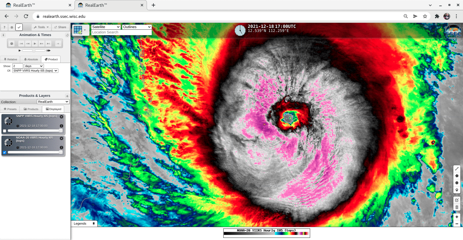
VIIRS Infrared Window (11.45 µm) images from NOAA-20 and Suomi-NPP [click to enlarge]
3 days earlier, Rai first reached reached Category 5 intensity at 0000 UTC on 16 December, shortly before making landfall in the Philippines; 2.5-minute Himawari-8 Infrared images (below) revealed a small-diameter “pinhole” eye. As Rai moved across the Philippines, it was responsible for hundreds of fatalities in addition to widespread flooding and power outages.

Himawari-8 Infrared Window (10.3 µm) images [click to play animated GIF | MP4]