Kona low produces record rainfall and flooding in Hawai`i

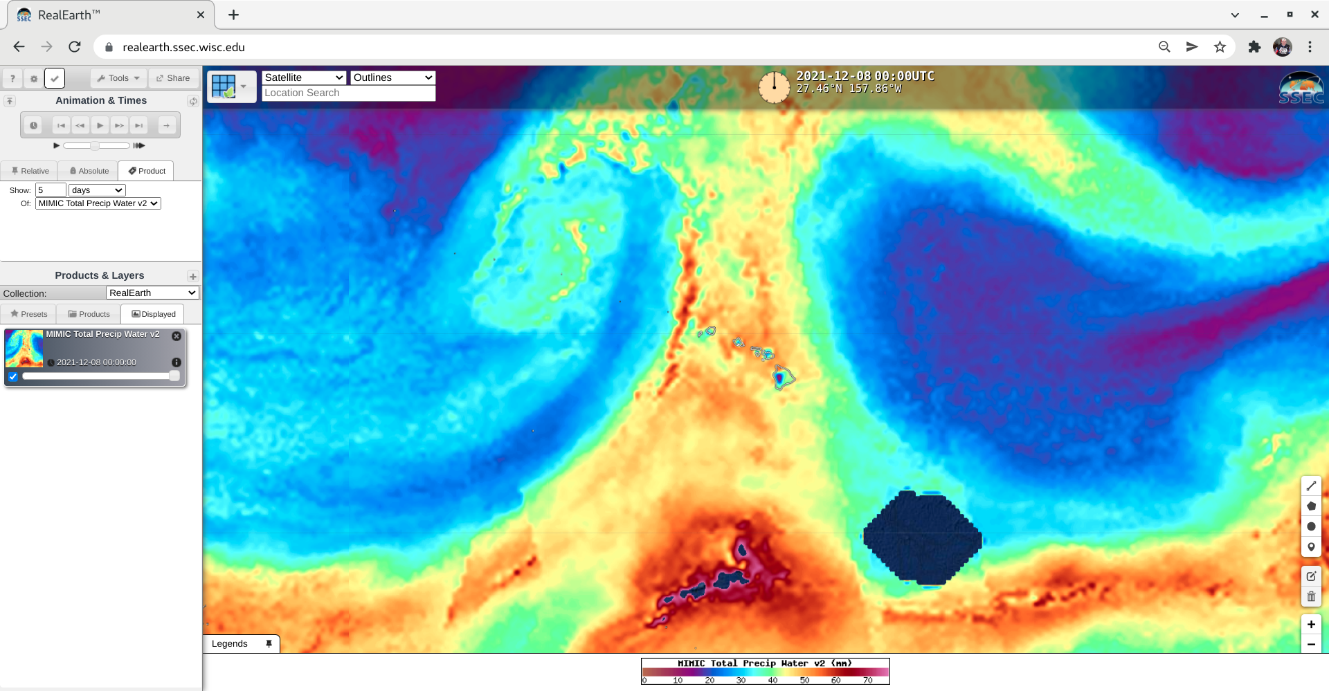
MIMIC Total Precipitable Water product [click to play animation | MP4]
As an anomalously-deep Kona low moved northwest of and then west of Hawai`i during the 04-07 December 2021 period, it began to tap moisture from the Pacific ITCZ and channel it northward across the islands — setting the stage for a prolonged heavy rainfall event (which produced the wettest December day on record at Honolulu). Hourly MIMIC TPW images viewed using RealEarth (above) showed the convergence of 2 northward-moving streams of ITCZ moisture, that then flowed across various portions of Hawai’i (located at the center of the images) from 00 UTC on 04 December to 00 UTC on 08 December.
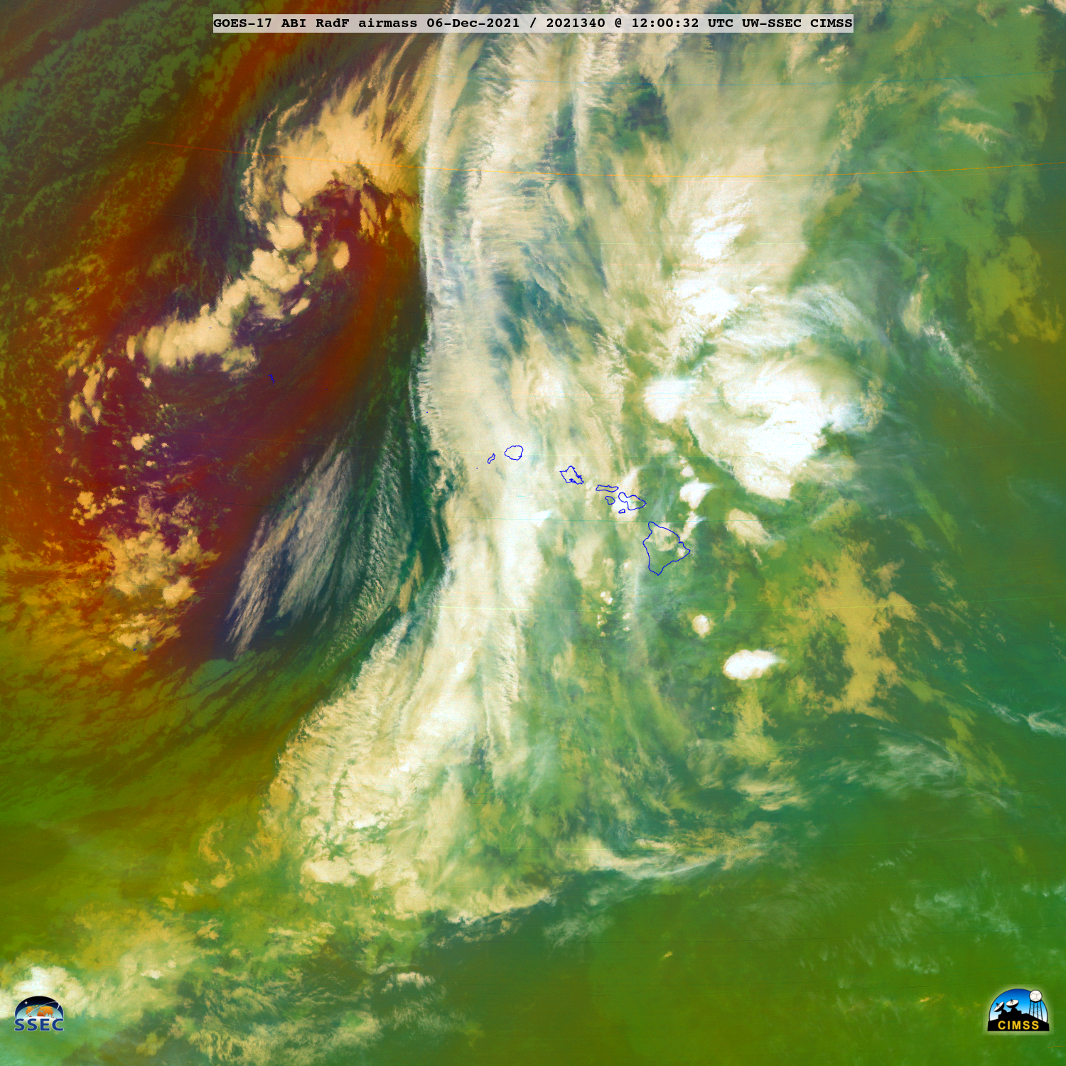
Air Mass RGB images created using Geo2Grid (below) highlighted the southwestward migration of the Kona low (darker shades of red) as well as the northward motion of deep convection within the stream of ITCZ moisture.

GOES-17 Air Mass RGB images [click to play animated GIF | MP4]
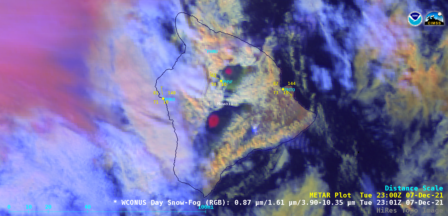
In addition to the heavy rainfall across many of the islands, the high-elevation summits of Mauna Kea and Mauna Loa on the Big Island of Hawai`i also received accumulating snowfall — a signature of this snow cover (darker shades of magenta) was evident in GOES-17 Day Snow-Fog RGB images shown below.

GOES-17 Day Snow-Fog RGB images [click to play animated GIF | MP4]

