Hurricane Ida develops an eye over the Gulf of Mexico, as intensification continues until landfall
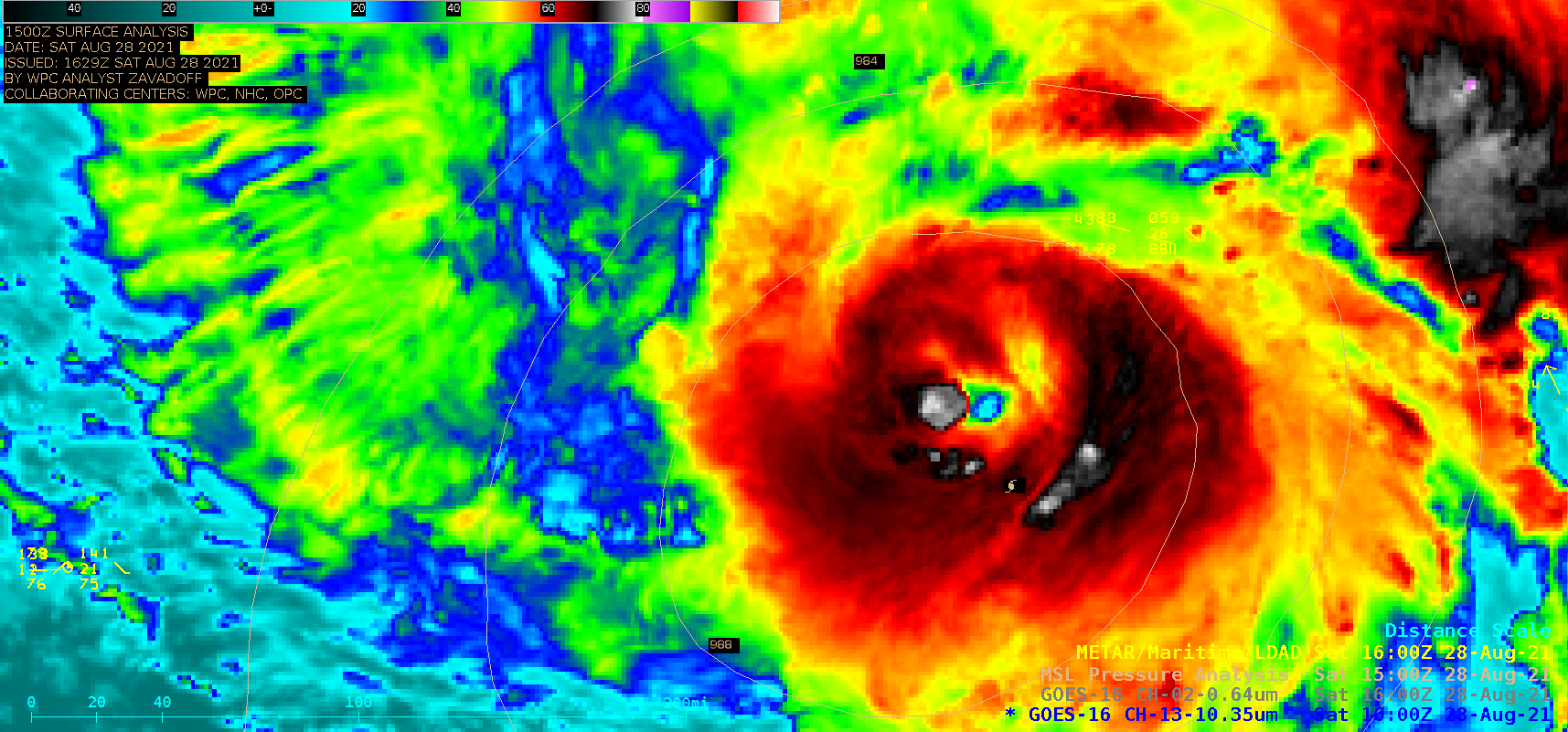
GOES-16 “Clean” Infrared Window (10.35 µm) and “Red” Visible (0.64 µm) images [click to play animation | MP4]
1-–minute Mesoscale Domain Sector GOES-16 (GOES-East) “Red” Visible (0.64 µm) and “Clean” Infrared Window (10.35 µm) images (above) showed that Hurricane Ida gradually developed an eye, as the Category 1 storm intensified to Category 2 by 1800 UTC on 28 August 2021.
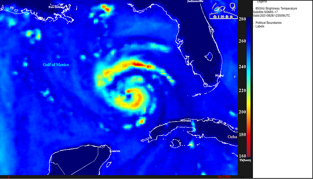
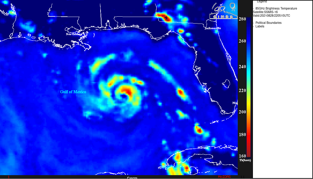
Microwave (85 GHz) images from DMSP-17 (above) and DMSP-16 (below) — from the CIMSS Tropical Cyclones site — provided 2 views of the eye and eyewall structure at 1235 UTC and 2205 UTC, respectively.
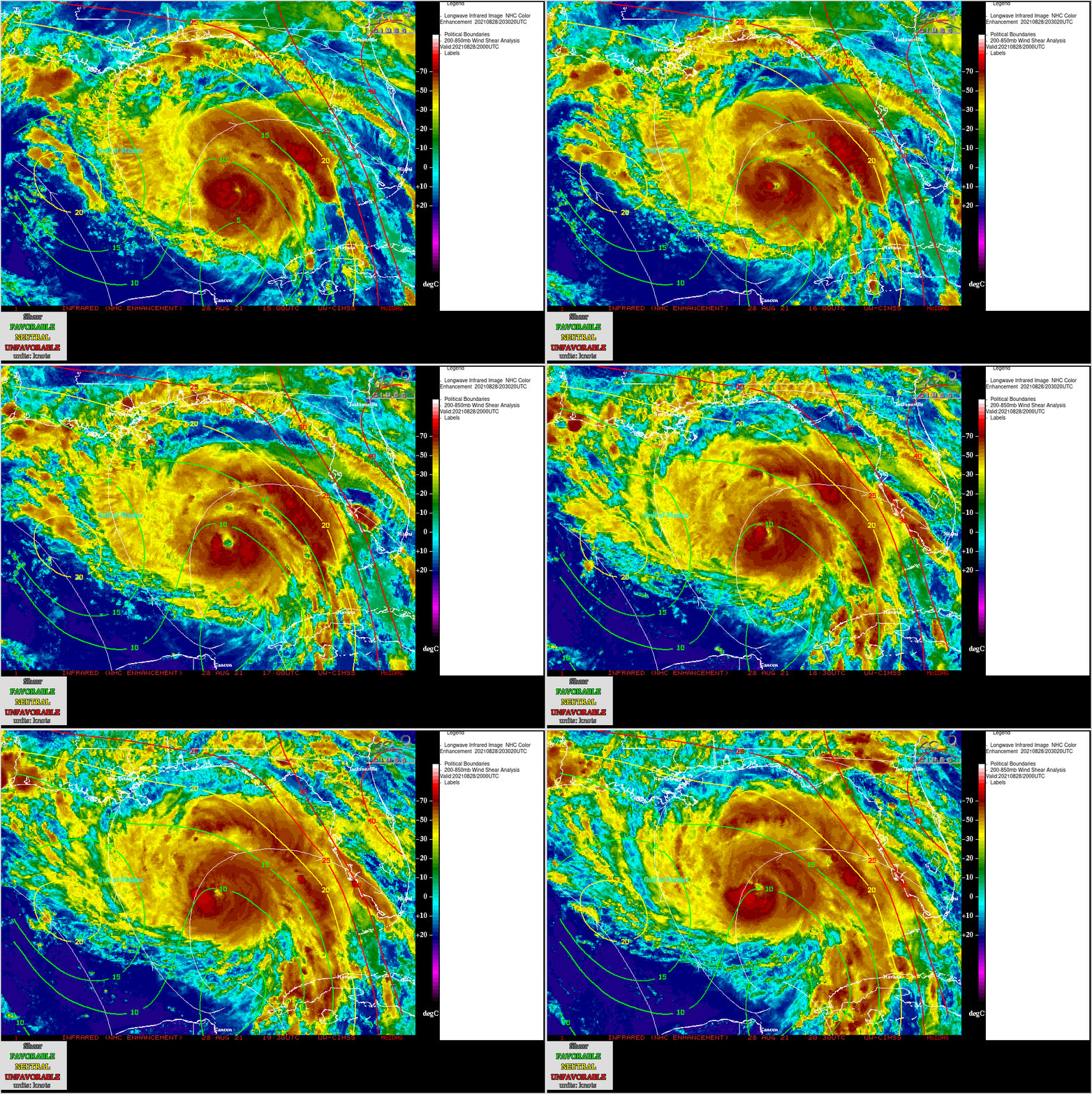
Ida was moving across very warm water (SST | OHC) — and was forecast to pass over an area of very high Ocean Heat Content associated with a warm eddy that was shed from the Gulf of Mexico’s Loop Current. Ida was also moving through an environment of low wind shear (below), which favored further intensification as it continued to approach the Louisiana coast.
===== 29 August Update =====
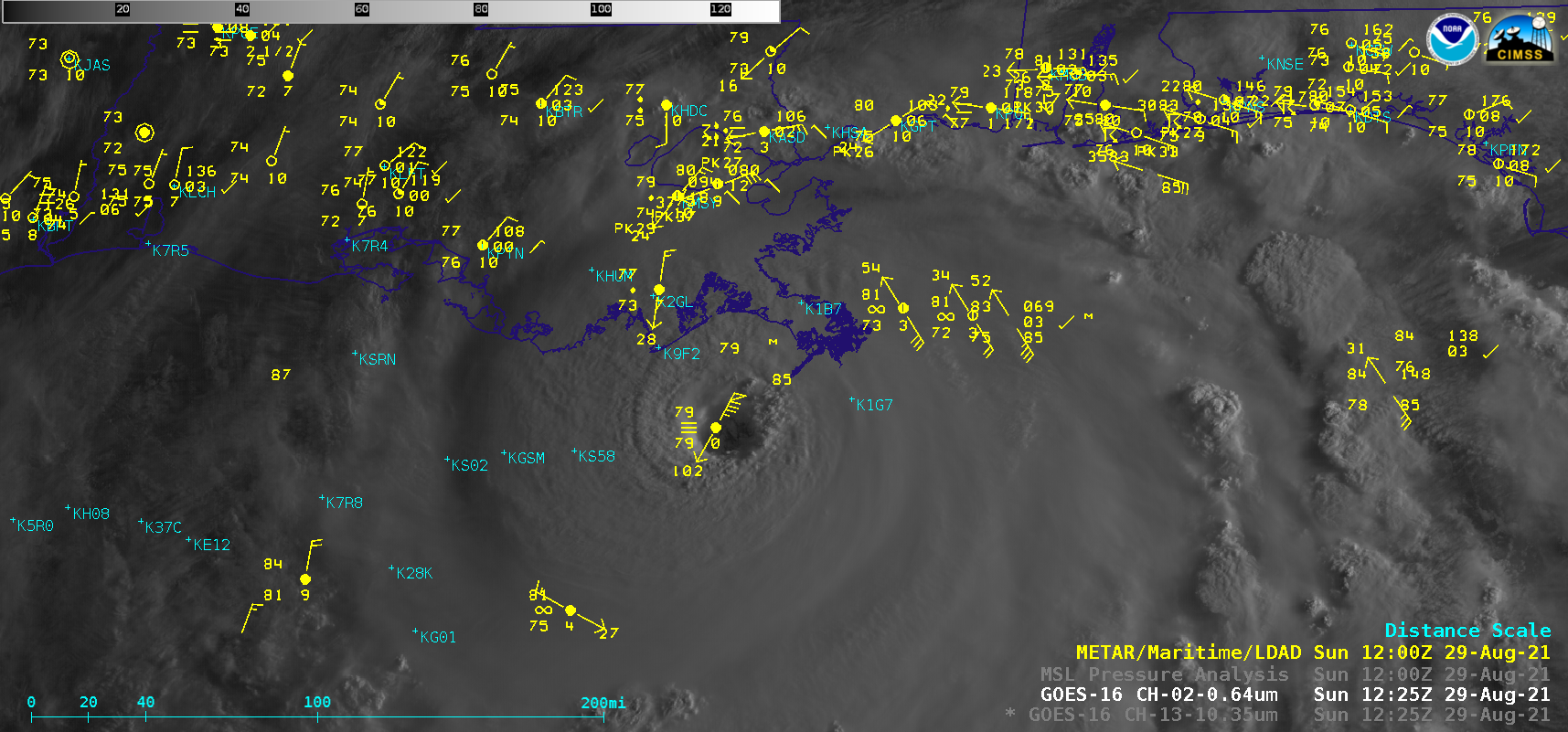
GOES-16 “Clean” Infrared Window (10.35 µm) and “Red” Visible (0.64 µm) images [click to play animation | MP4]
Ida reached Category 4 intensity at 0600 UTC on 29 August; 1-minute GOES-16 Infrared and Visible images (above) depicted a well-defined eye during the hours leading up to the hurricane making landfall along the coast of Louisiana at 1655 UTC.
GMI Microwave imagery at 1510 UTC (below) portrayed a closed eye, with the heaviest precipitation located within the eastern semicircle of Ida.
A closer view of 1-minute GOES-16 Visible images (below) revealed the presence of low-level mesovortices within the eye of Ida — a feature often observed with high-intensity tropical cyclones. The mesovortices persisted as the hurricane moved inland, as Ida was slow to weaken. Just east of the eye, Galliano (KGAO) reported wind gusts as high as 85 knots (plot | text), before observations ceased after 21 UTC (presumably due to power outages). A separate mesonet station at Galliano recorded a wind gust of 122 mph (NWS New Orleans tweet | plot); a ship reported a wind gust of 194 knots (tweet).
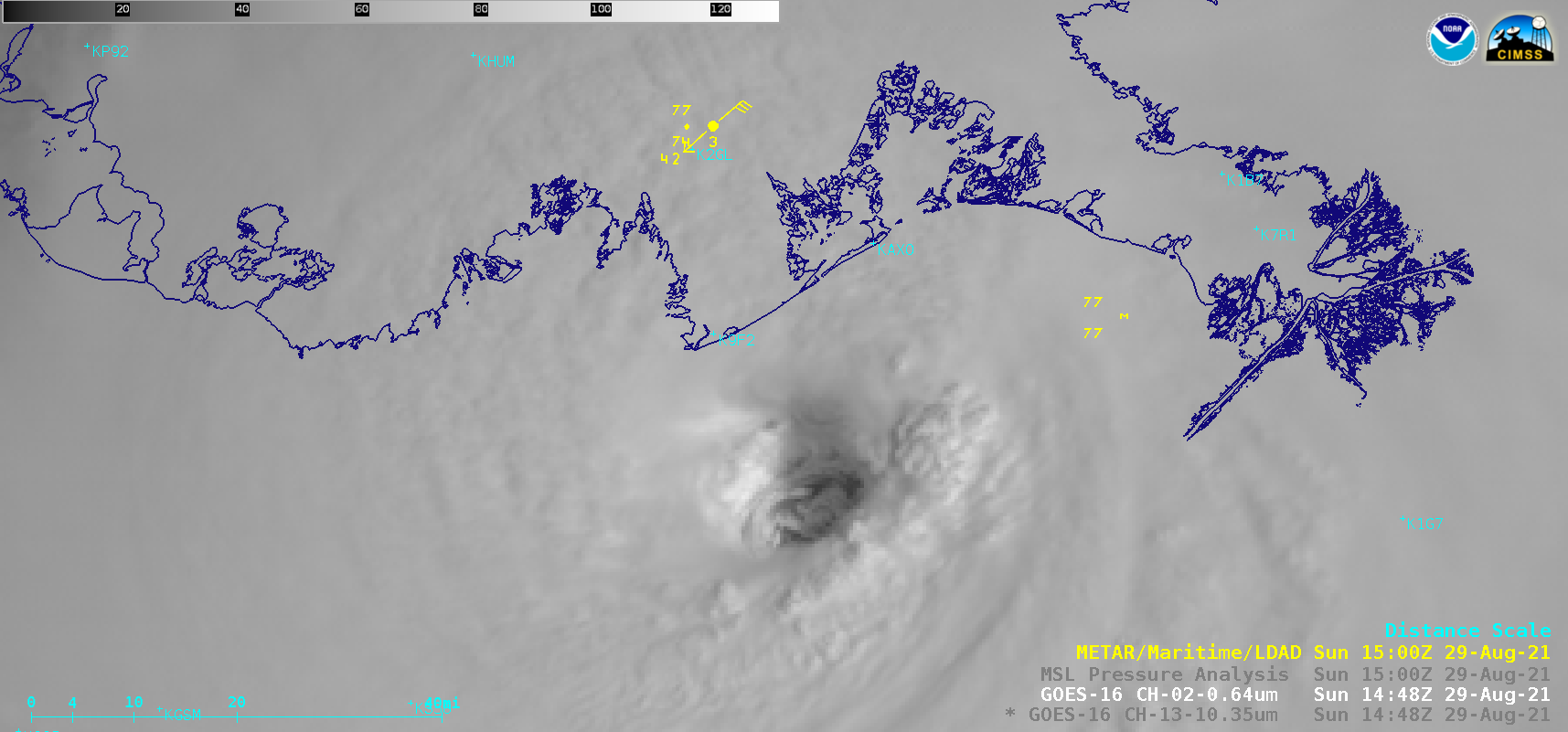
GOES-16 “Red” Visible (0.64 µm) images [click to play animation | MP4]
The MIMIC Total Precipitable Water product (below) showed that Ida was transporting rich tropical moisture northward across the central Gulf of Mexico coast of the US, raising a threat for flooding rainfall.


