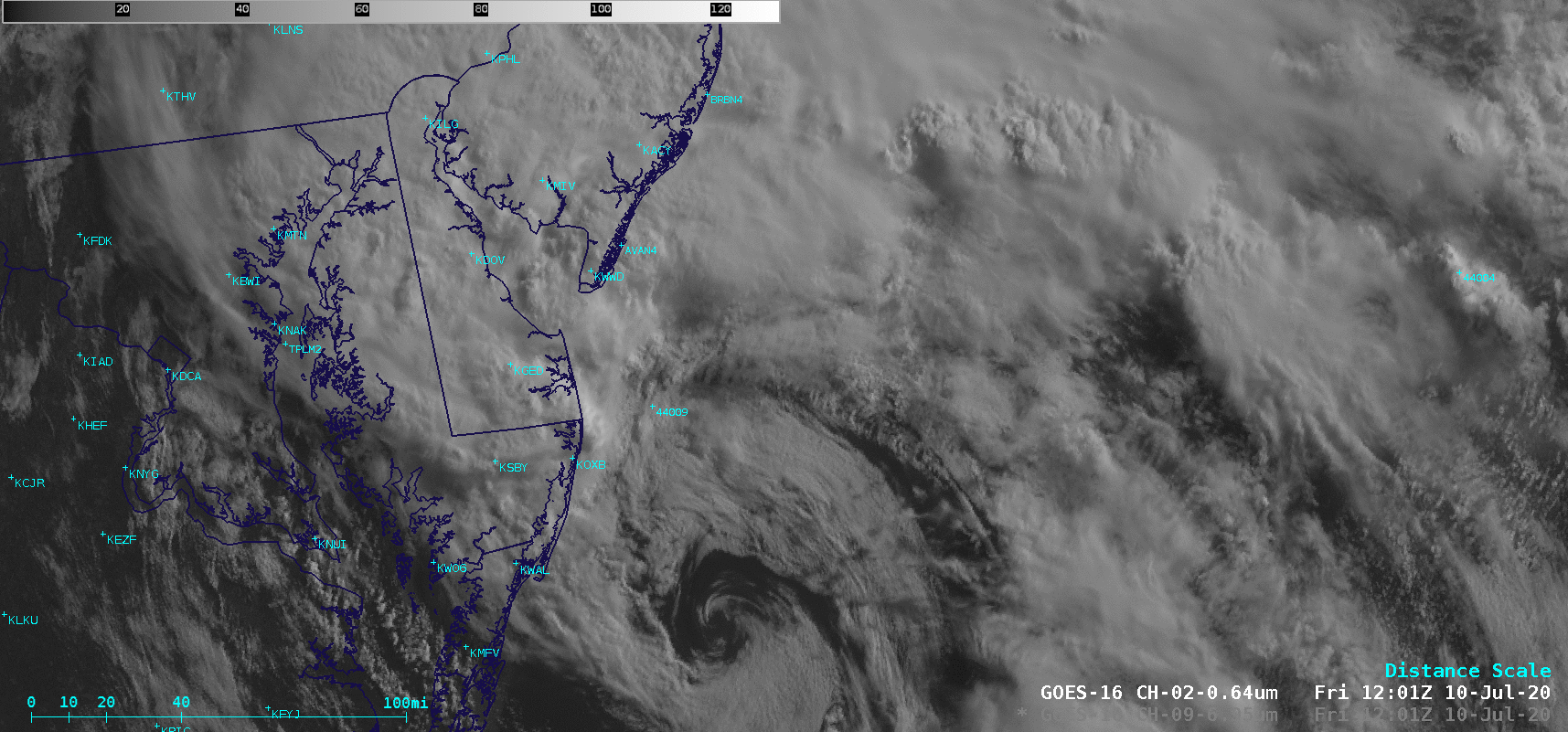
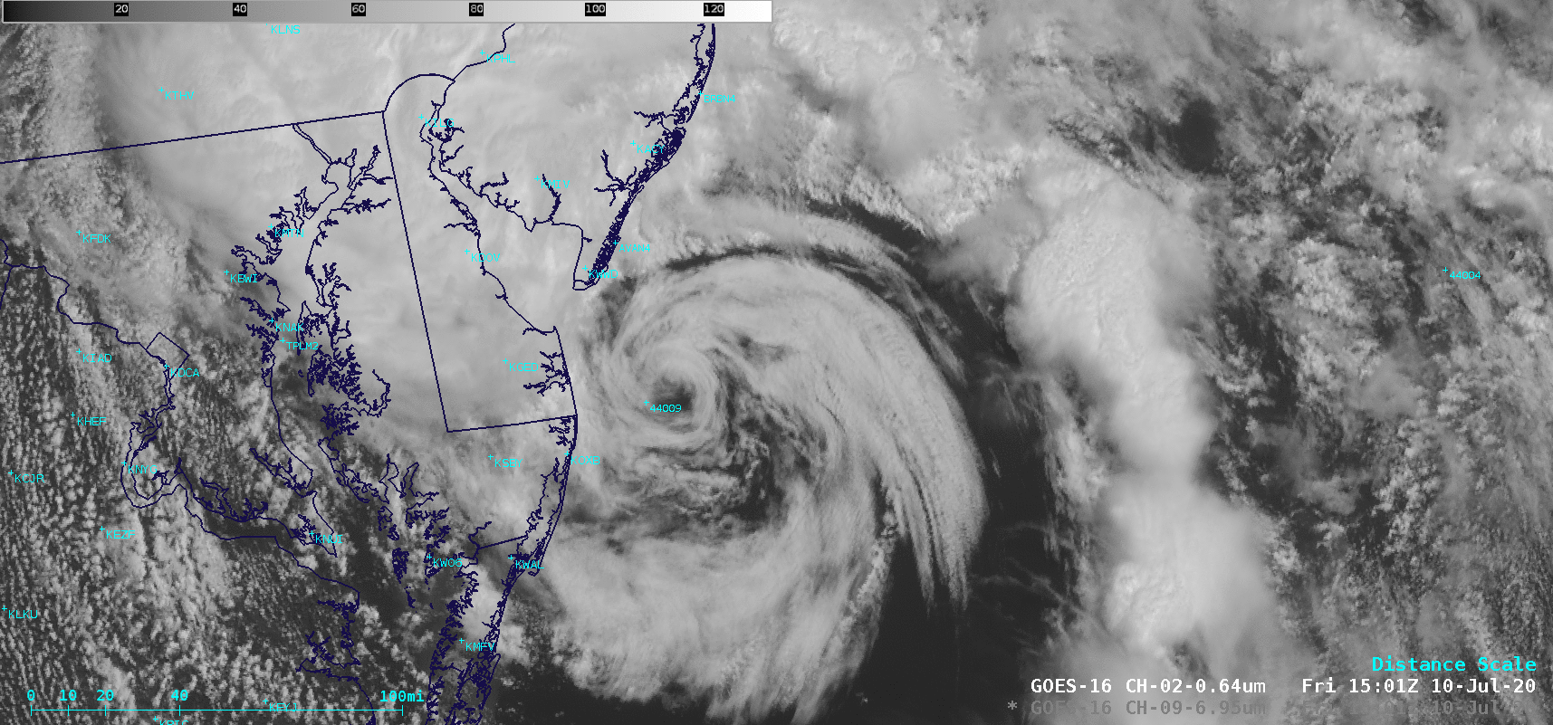
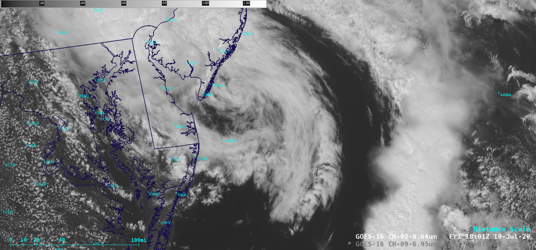
Tropical Storm Fay makes landfall in New Jersey
![GOES-16 “Red” Visible (0.64 µm) and “Clean” Infrared Window (10.35 µm) images [click to play animation | MP4]](https://cimss.ssec.wisc.edu/satellite-blog/images/2020/07/200710_goes16_visible_infrared_TS_Fay_anim.gif)
GOES-16 “Red” Visible (0.64 µm) and “Clean” Infrared Window (10.35 µm) images [click to play animation | MP4]
GOES-16 Visible images with plots of Derived Motion Winds (below) revealed a few wind targets with speeds of 50 knots or higher (red barbs), but those were located well east/northeast of the storm center.
![GOES-16 “Red” Visible (0.64 µm) images, with plots of Derived Motion Winds [click to play animation | MP4]](https://cimss.ssec.wisc.edu/satellite-blog/images/2020/07/200710_goes16_visible_derivedMotionWinds_TS_Fay_anim.gif)
GOES-16 “Red” Visible (0.64 µm) images, with plots of Derived Motion Winds [click to play animation | MP4]
![GOES-16 Mid-level Water Vapor (6.9 µm) and “Red” Visible (0.64 µm) images [click to play animation | MP4]](https://cimss.ssec.wisc.edu/satellite-blog/images/2020/07/200710_goes16_waterVapor_visible_TS_Fay_anim.gif)
GOES-16 Mid-level Water Vapor (6.9 µm) and “Red” Visible (0.64 µm) images [click to play animation | MP4]
![Sea Surface Temperature analysis [click to enlarge]](https://cimss.ssec.wisc.edu/satellite-blog/images/2020/07/200710_sst_Fay.png)
Sea Surface Temperature analysis [click to enlarge]