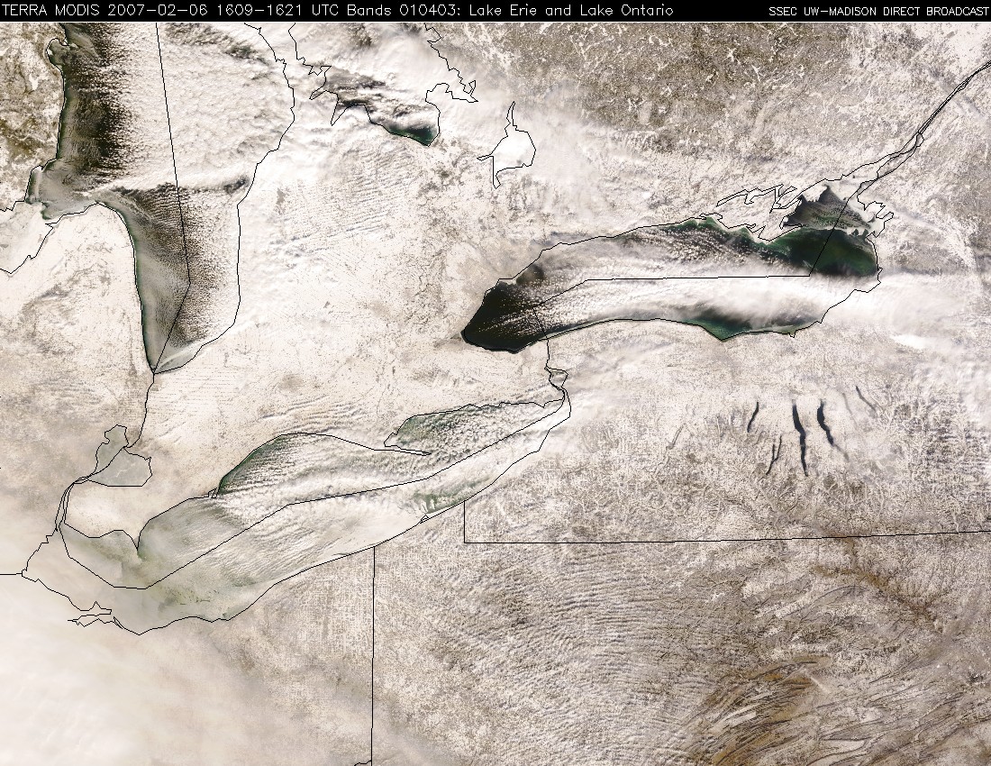
Lake-effect snow in the eastern Great Lakes
The lake-effect snowfall (LES) across the eastern Great Lakes region during the early February 2007 arctic outbreak has been phenomenal: as of 12 February, storm total snowfall amounts downwind of Lake Ontario have been as high as 141 inches in Redfield, New York (accumulations of 27 inches in 12 hours were reported, along with snowfall rates of up to 4-5 inches per hour). A series of daily Terra and Aqua MODIS true color images during the 03-09 February period (Java animation) show the well-defined LES bands over Lake Erie and Lake Ontario; you can also see the areal extent of lake ice increasing during this time over Lake Erie (this lake is the most shallow of the five Great Lakes, so it tends to freeze the earliest).
GOES-12 visible imagery (below; Java animation) shows the movement of an intense LES band across Lake Ontario on 06 February 2007.


