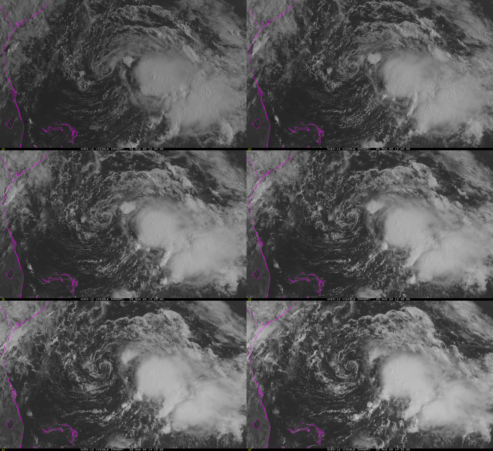
Danny and Wind Shear
Vertical wind shear is the change of wind speed and/or direction with height. For tropical cyclones, wind shear is something that must be overcome if strengthening is to occur. For (minimal) tropical storm Danny, strong wind shear has persisted in keeping convection far from the storm center. When the storm center is exposed, as in the visible loop above from 28 August, the atmospheric changes that occur within the convection cannot serve to strengthen the storm center.
Wind shear can be diagnosed using satellite cloud information. It is plainly evident in the satellite loop — note how the upper level clouds are moving from the southwest — especially over the western half of the satellite loop — whereas the lower level clouds are circulating around the storm center. A diagnosis of shear from the CIMSS Tropical Weather Website shows very large shear values (>40) associated with a mid-tropospheric short wave just starting to move off the southeast coast of the United States. Values are somewhat less over Danny, and large again off to the east of Danny. As the short wave approaches Danny, shear values over Danny will increase, and chances for intensification will drop.
Other factors continue to support intensification, however, such as warm sea surface temperatures. The analysis shows ocean water temperatures in the low- to mid-80s in the vicinity of Danny. Two other features are evident in the sea surface temperature plot. The Gulf Stream shows plainly as a ribbon of warm water extending eastward from Cape Hatteras. In addition, there is a striking path of cooler temperatures off to Danny’s north and east; this is a result of the mixing and upwelling associated with the passage of Hurricane Bill last week. The energy that was lost from the warm ocean waters helped to sustain Bill’s strong winds.
Satellite-derived winds can be used to approximate Danny’s future direction. Cloud levels in visible imagery can be determined from the temperature of the cloud. Low-level steering currents (1.5-3 km) over Danny this morning were from the east-southeast whereas upper level steering currents (3-10 km) were more southerly. If Danny is a shallow feature, it might move from the east-southeast towards the southeast coast of the US, following the low-level steering. If Danny is a deeper feature, its motion should be more northerly. The forecast path from the National Hurricane Center shows northward motion, suggesting that Danny is a deep system.


