Satellite signatures of the Notre Dame Cathedral fire in Paris, France
![EUMETSAT Meteosat-11 Shortwave Infrared (3.92 µm) images, with airport identifiers plotted in red [click to play animation | MP4]](https://cimss.ssec.wisc.edu/satellite-blog/wp-content/uploads/sites/5/2019/04/190415_meteosat11_shortwaveInfrared_Notre_Dame_Fire_anim.gif)
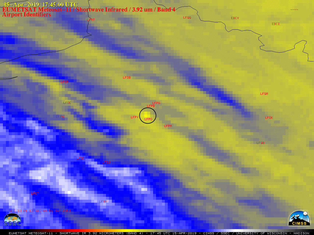
EUMETSAT Meteosat-11 Shortwave Infrared (3.92 µm) images, with airport identifiers plotted in red [click to play animation | MP4]
The fire reportedly began around 1650 UTC; the maximum 3.92 µm brightness temperature sensed by Meteosat-11 was 284.5 K (11.35ºC) on the 1745 UTC image, not long after the fire had spread to the large spire of the cathedral (Meteosat-11 was actually scanning the Paris area at 1756 UTC, since the Meteosat Second Generation satellites scan each Full Disk from south to north). Clouds approaching from the west began to mask the fire signature at 1930 UTC.
Even though high clouds had begun to move overhead, a thermal signature (darker black pixel) could still be seen in 1-km resolution Metop-A and Metop-C Shortwave Infrared (3.75 µm) images at 2009 and 2048 UTC (below, courtesy of William Straka, CIMSS). The maximum 3.75 µm brightness temperature detected by Metop was 291.1 K (18.0ºC).
![Metop-A and Metop-C Shortwave Infrared (3.74 µm) images at 2009 and 2048 UTC [click to enlarge]](https://cimss.ssec.wisc.edu/satellite-blog/wp-content/uploads/sites/5/2019/04/190415_metop_shortwaveInfrared_Notre_Dame_Fire_anim.gif)
Metop-A and Metop-C Shortwave Infrared (3.75 µm) images at 2009 and 2048 UTC [click to enlarge]