Tornado outbreak in Illinois

GOES-16 “Red” Visible (0.64 µm) images, with SPC storm reports plotted in red [click to play animation | MP4]
GOES-16 “Clean” Infrared Window (10.3 µm) images (below) showed that cloud-top infrared brightness temperatures were as cold as -55ºC (darker shades of orange) with the more vigorous thunderstorm overshooting tops.
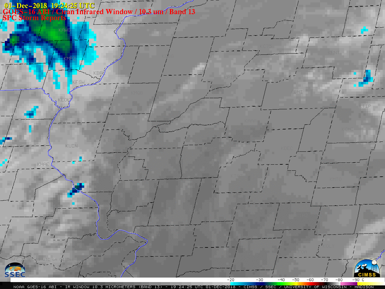
GOES-16 “Clean” Infrared Window (10.3 µm) images, with SPC storm reports plotted in red [click to play animation | MP4]
![Plot of 00 UTC Lincoln, Illinois rawinsonde data [click to enlarge]](https://cimss.ssec.wisc.edu/satellite-blog/wp-content/uploads/sites/5/2018/12/181201_18utc_181202_00utc_kilx_raobs_anim.gif)
Plots of 18 UTC and 00 UTC rawinsonde data from Lincoln, Illinois [click to enlarge]
![Terra/Aqua MODIS and Suomi NPP/NOAA-20 VIIRS Visible and Infrared images [click to enlarge]](https://cimss.ssec.wisc.edu/satellite-blog/wp-content/uploads/sites/5/2018/12/181201_modis_viirs_visible_infraredWindow_IL_anim.gif)
Terra/Aqua MODIS and Suomi NPP/NOAA-20 VIIRS Visible and Infrared images [click to enlarge]
/na2018_12_01_335.gif)
![Comparison of GOES-16 ABI and NOAA-20 VIIRS Infrared Window images at 2007 UTC [click to enlarge]](https://cimss.ssec.wisc.edu/satellite-blog/wp-content/uploads/sites/5/2018/12/181201_2007utc_goes16_abi_vs_noaa20_viirs_infrared_IL.png)
Comparison of GOES-16 ABI and NOAA-20 VIIRS Infrared Window images at 2007 UTC [click to enlarge]