River valley fog in southwestern Wisconsin
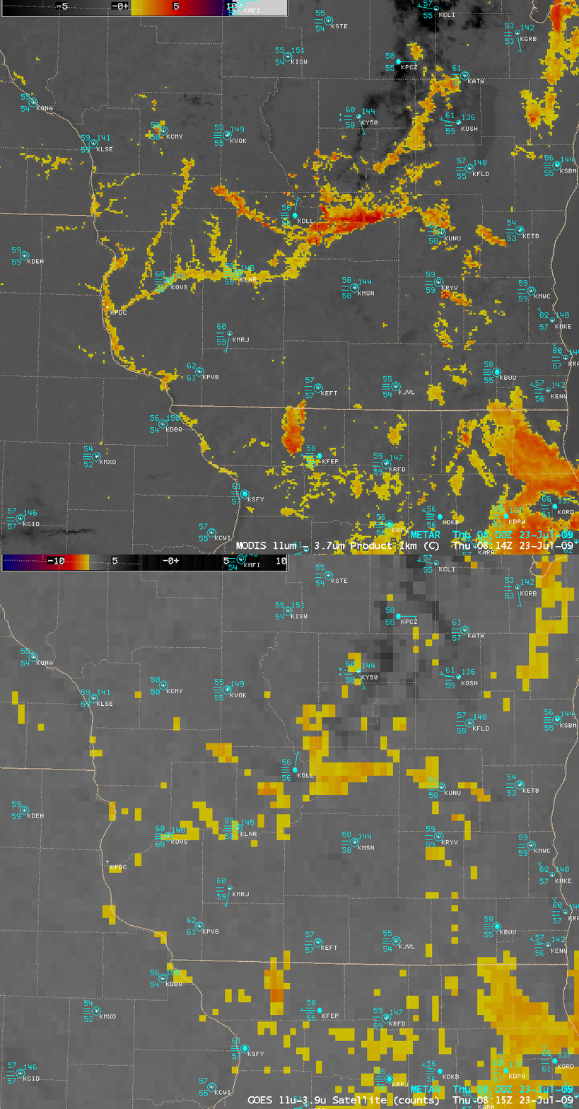
A comparison of the 1-km resolution MODIS fog/stratus product with the corresponding 4-km resolution GOES-12 fog/stratus product (above) shows the importance of improved spatial resolution for the detection of areas of river valley fog (yellow to orange features) that were beginning to form across parts of southwestern Wisconsin and adjacent portions of southeastern Minnesota and northeastern Iowa at 08:15 UTC (3:15 am local time) on 23 July 2009. The features that were enhanced with the darker orange to red colors were patches of deeper stratus clouds.
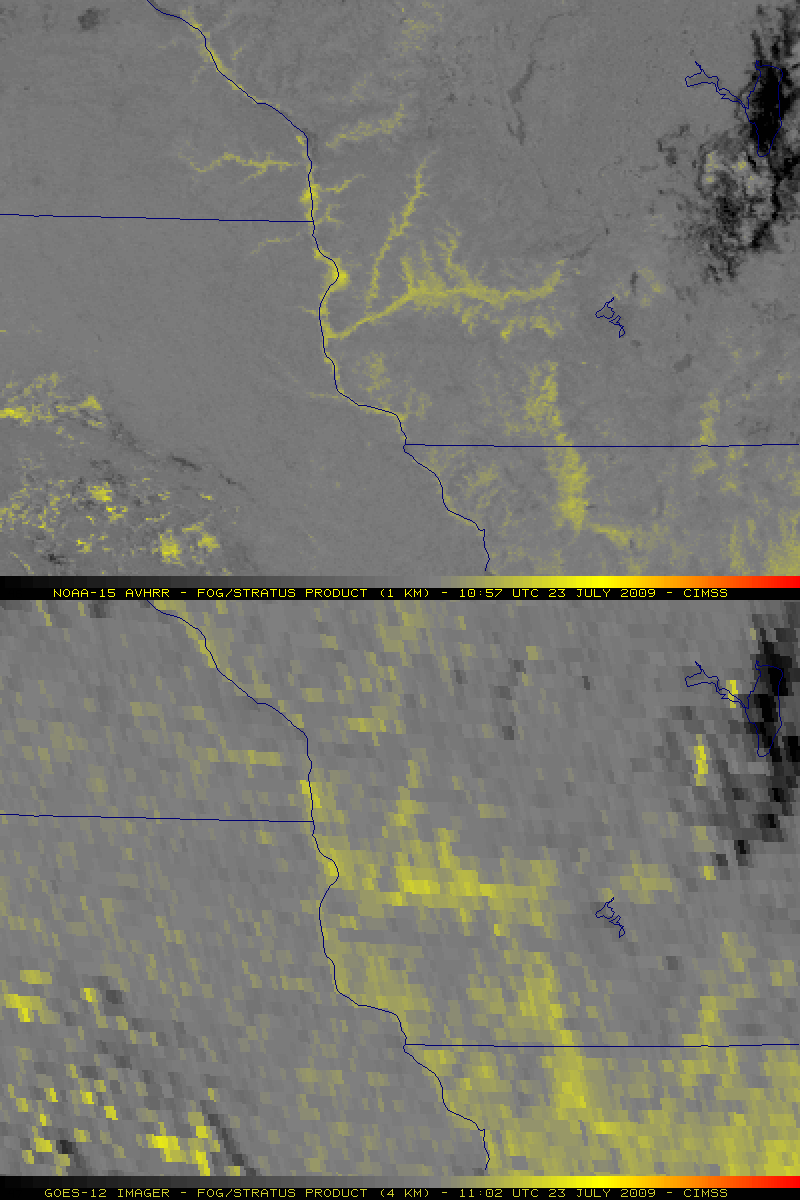
About 2 hours and 45 minutes later, a similar comparison of the 1-km resolution NOAA-15 AVHRR fog/stratus product with the 4-km resolution GOES-12 fog/stratus product (below) indicated that some areas of fog had continued to increase in coverage during that time interval (especially in parts of the east-west oriented Wisconsin River valley and the north-south oriented Mississippi River valley).
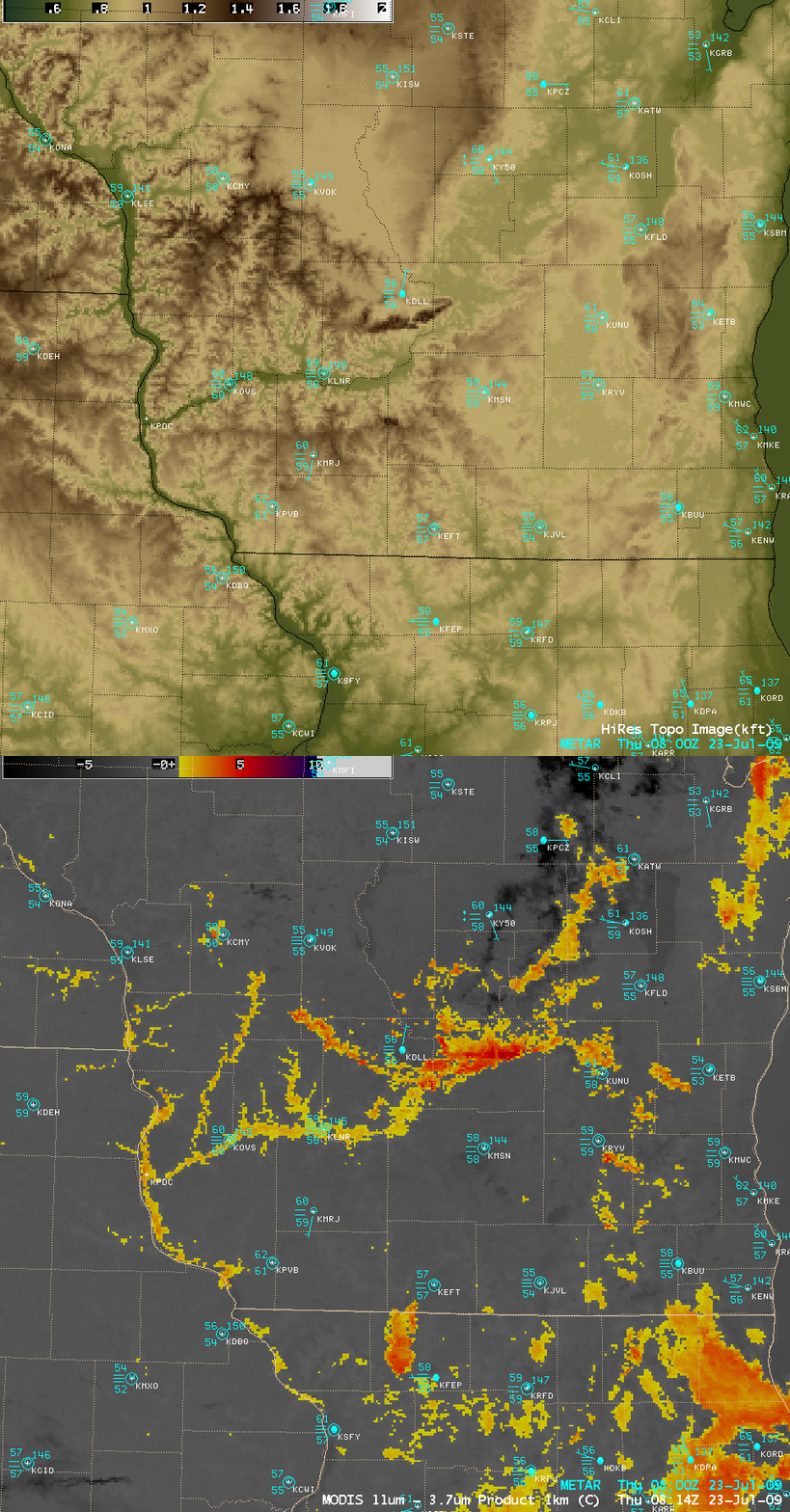
An AWIPS image of the high resolution topography (below) shows which river valleys were experiencing fog formation as seen on the MODIS fog/stratus product image.
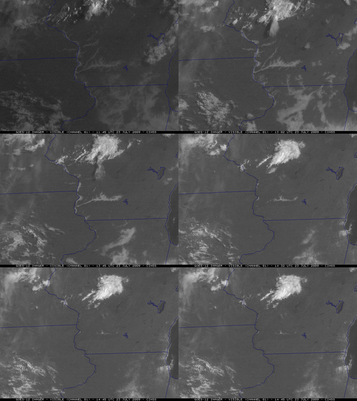
After sunrise, GOES-12 visible images (below) revealed that the areas of fog burned off rather quickly as the high July sun angle promoted rapid surface heating and subsequent boundary layer mixing.
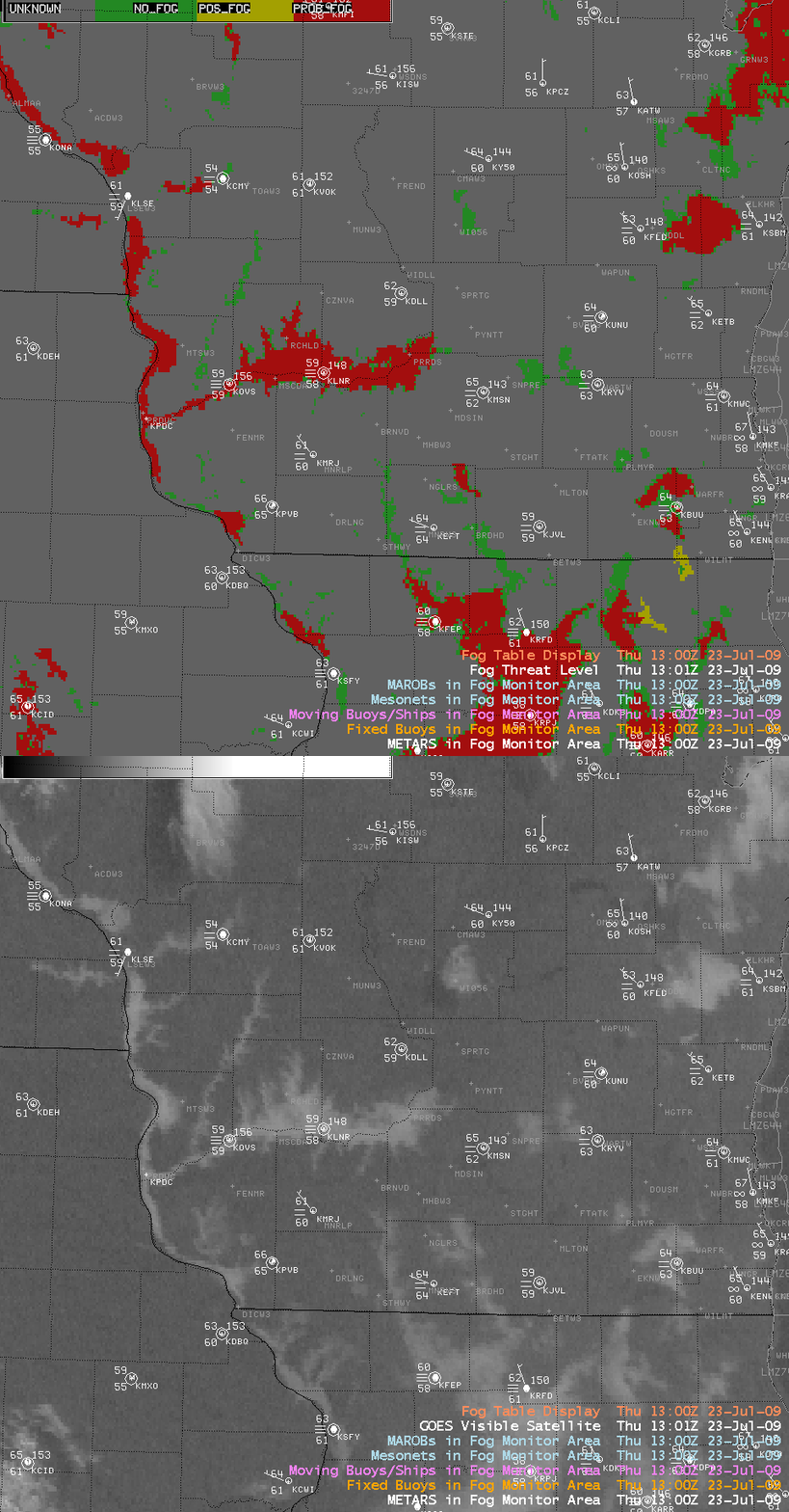
At 13:00 UTC (8 am local time), the GOES-12 visible image indicated that the AWIPS Fog Monitor product (below) was incorrectly identifying the fog in the Kickapoo River valley in southwestern Wisconsin (running northeast through southwest from station KVOK to KOVS) as a green “NO_FOG” feature. This underscores the importance of modifying the default values of the AWIPS Fog Monitor product so that fog features over a certain region (and during a certain season) can be more accurately characterized.


