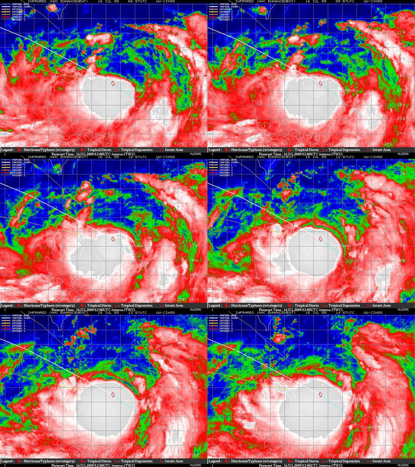
Tropical Storm 07W (Molave): very cold cloud tops
MTSAT-1R InfraRed (IR) images from the CIMSS Tropical Cyclones site (above) showed the rapid development of a cold Central Dense Overcast (CDO) as Tropical Storm 07W (Molave) intensified east of the Philippines in the West Pacific Ocean on 16 July 2009. It is interesting to note that the CDO was centered a considerable distance to the southwest of the low-level circulation of the tropical cyclone.
4-km resolution MTSAT-1R 10.3 µm IR cloud top brightness temperatures (above) were a cold as -92.4º C (purple color enhancement) at 12:30 UTC. 1 hour and 15 minutes later, a 1-km resolution MODIS 11.0 µm IR image (below) indicated that cloud top IR brightness temperatures were still as cold as -92.1º C.


