Volcanic plume over the Great Lakes region?
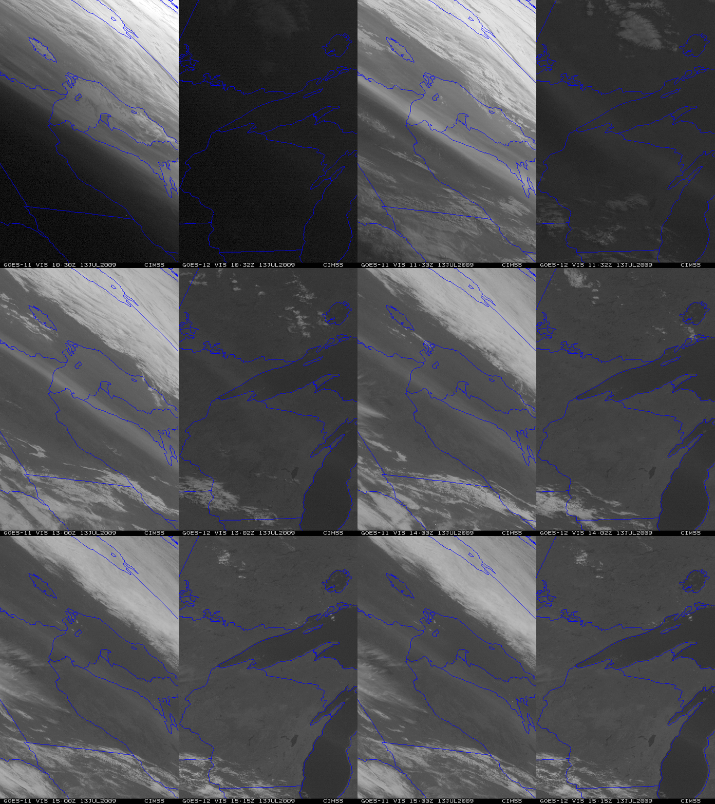
A comparison of GOES-11 and GOES-12 visible channel images (above) revealed an aerosol plume aloft that was oriented northwest-to-southeast over the western Great Lakes region on 13 July 2009. This example shows the value of forward scattering to help in the identification these kinds of aerosol plumes — note how the plume is much brighter on the GOES-11 image than the GOES-12 image, due to the morning sun’s position in relation to GOES-11 (located at 135º West longitude) versus GOES-12 (located at 75º West longitude). Also note how the hazy aerosol plume tended to “disappear” on both the GOES-11 and the GOES-12 visible images as the sun angle increased during the morning hours.
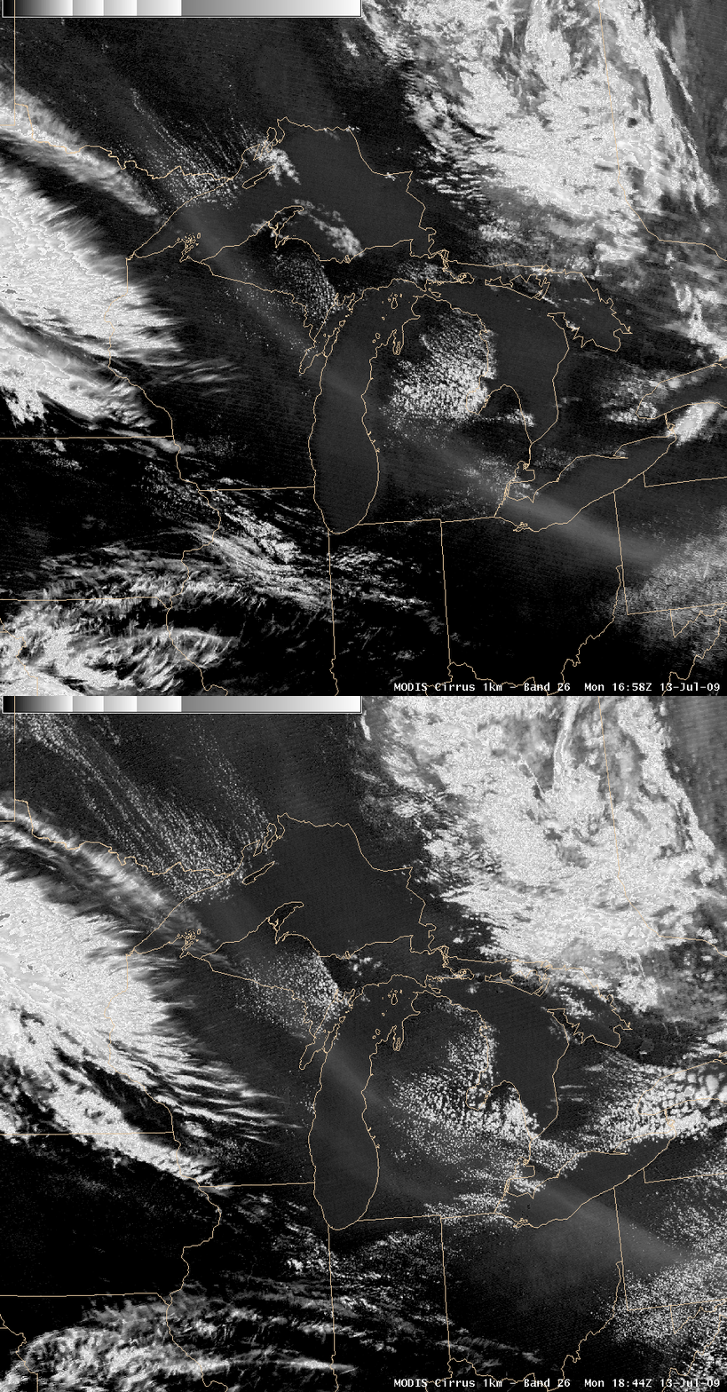
Later in the day, this aerosol plume was easily seen on AWIPS images of the MODIS near-IR 1.3 µm “cirrus detection” channel (below). The so-called “cirrus detection” channel helps to identify features that are effective scatters of light — which includes cirrus ice crystals as well as airborne aerosols (such as dust, haze, volcanic ash, or volcanic sulfates).
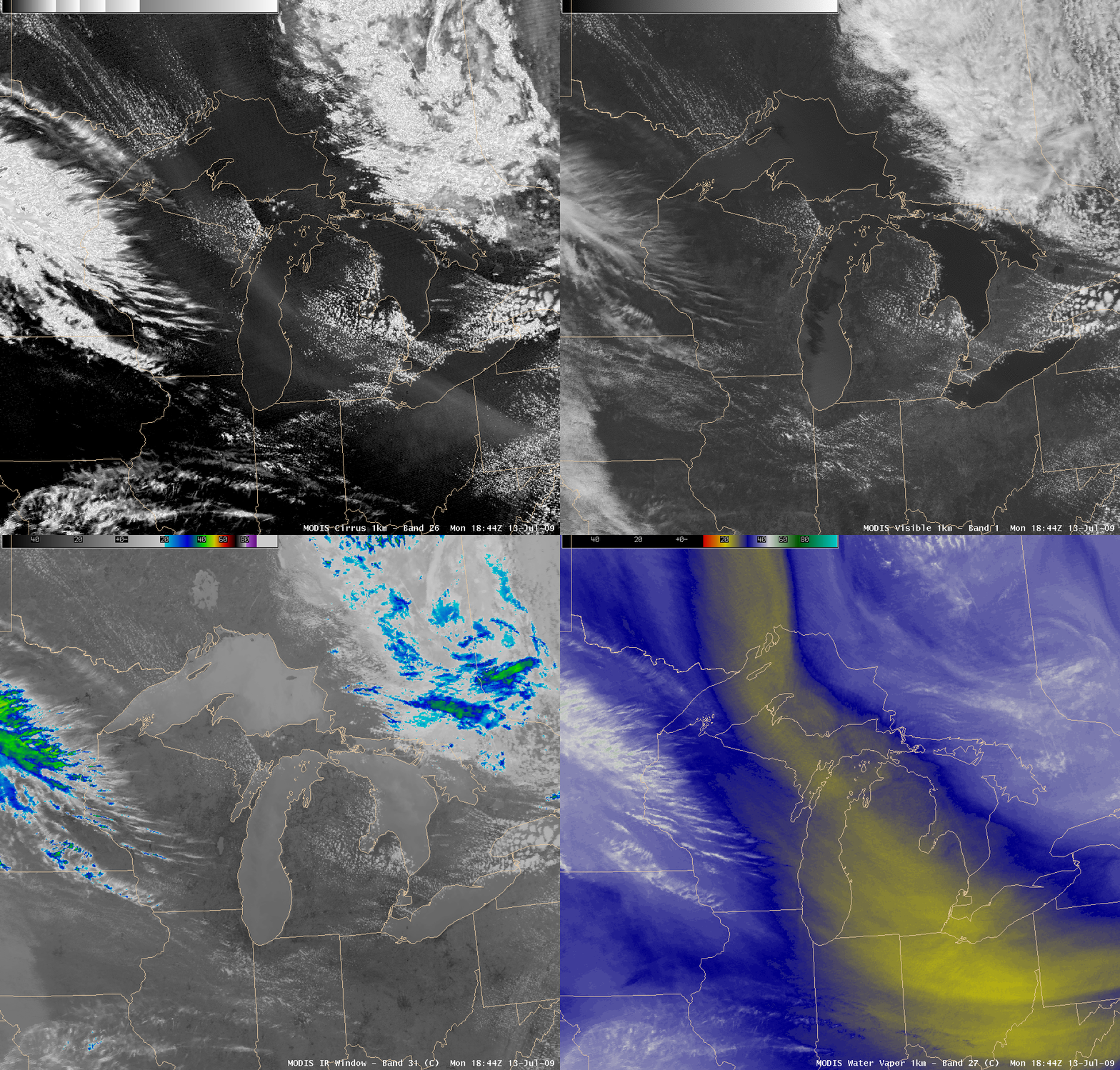
This aerosol plume exhibited no obvious signal on any of the other conventional MODIS channels, such as the visible, IR window, and water vapor channels (below). So was this aerosol feature due to smoke aloft from fires in Canada or Alaska, or was it a high-altitude volcanic sulfate plume (likely from the Sarychev Peak eruptions earlier in the Summer)?
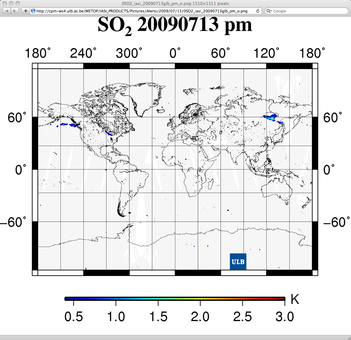
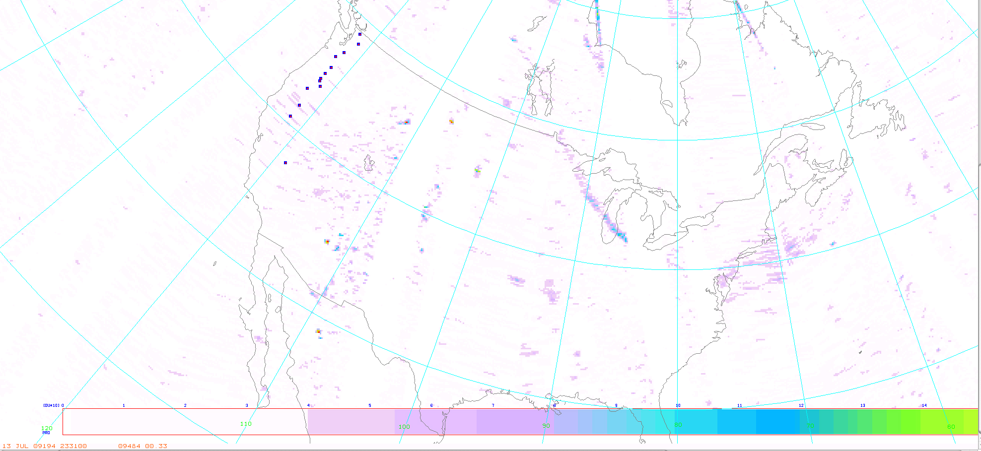
As it turns out, this plume was identified as an “SO2 alert” on the IASI SO2 product (above, courtesy of Université Libre de Bruxelles). This feature also exhibited SO2 concentrations of about 6-12 Dobson Units on the Aura OMI SO2 product (below, courtesy of NOAA/NESDIS).
NOAA ARL HYSPLIT backward trajectories (below) suggest that the aerosol plume had spent some time over the Arctic region during the previous week or so, where we had seen similar evidence of high-altitude aerosol plumes on the GOES-11 visible images in early July.


