Severe convection in South Dakota
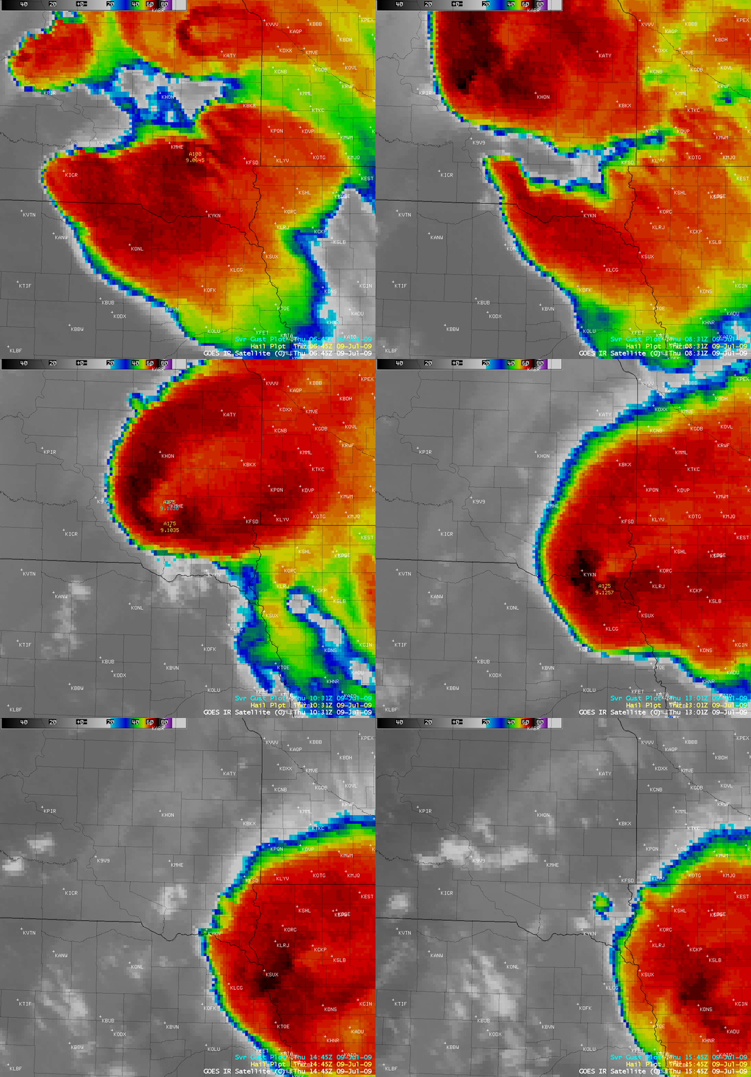
Severe convection developing over eastern South Dakota during the pre-dawn hours on 09 July 2009 exhibited an unusually large and well-defined “enhanced-v” storm top signature on AWIPS images of the GOES-12 10.7 µm IR channel (above) as it produced large hail (up to 2.50 inches in diameter) and damaging winds (gusting as high as 90 mph) across parts of South Dakota and extreme northeastern Nebraska.
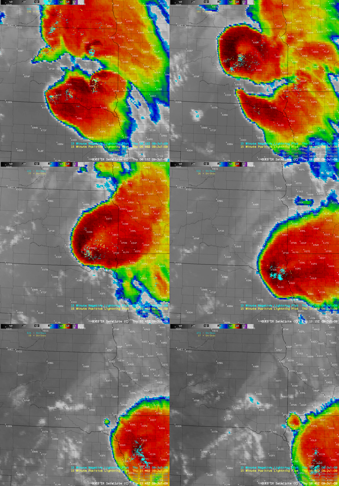
An overlay of negative and positive cloud-to-ground lighting strikes (below) showed that this storm was producing a large amount of lightning in the vicinity of the overshooting top (near the vertex of the enhanced-v signature), but there was also a number of strikes located a fair distance to the northeast, far away from the coldest cloud tops.
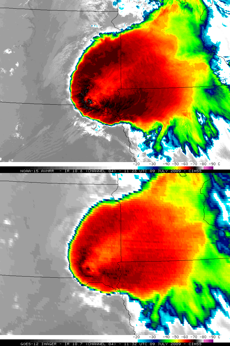
A comparison of the 4-km resolution GOES-12 10.7 µm IR data with 1-km resolution NOAA-15 AVHRR 10.8 µm IR data (below) demonstrated the advantage of improved spatial resolution in detecting the cloud top temperature structure of the enhanced-v signature. The coldest/warmest cloud top temperatures on the NOAA-15 IR image were -80º C / -59º C (deltaT = 21º C), compared to -68º C / -56º C (deltaT = 12º C) on the GOES-12 IR image.
A NOAA-15 AVHRR Red/Green/Blue (RGB) false-color composite image (below) displayed a stunning view of the storm just after sunrise (at 11:33 UTC), about 20 minutes after it produced a wind gust to 90 mph, hail up to 1.00 inch in diameter, and brief heavy rain near Scotland in southeastern South Dakota.
Note that the overshooting top was casting a shadow onto the anvil of the storm below — and this very tall thunderstorm complex was casting an impressive shadow to the west and southwest across South Dakota and Nebraska. Also note the presence of a boundary layer gravity wave train oriented southwest-to-northeast across Nebraska, which was positioned in advance of a cold frontal boundary.
Additional radar and satellite images of this storm can be found on the AccuWeather WeatherMatrix Blog.


