Lake Superior lake breeze
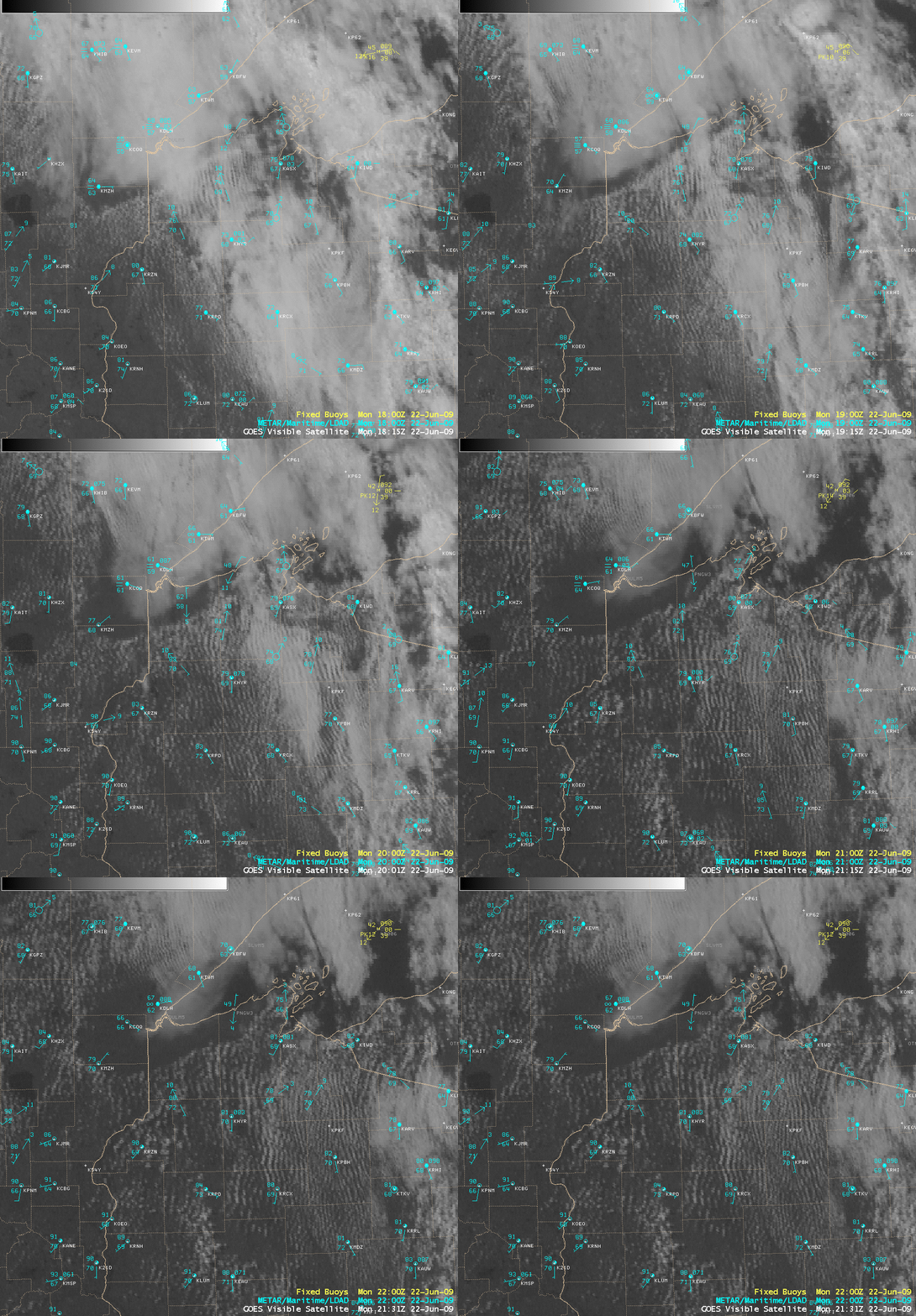
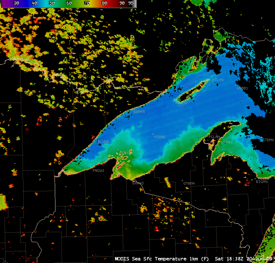
GOES-12 visible images (above) showed that a well-defined lake breeze developed along the western portion of Lake Superior during the afternoon hours on 22 June 2009. The MODIS Sea Surface Temperature (SST) product from 2 days earlier (below) indicated that SST values in the much of the middle of the lake were still in the low 40s F (blue color enhancement) — and Buoy 45006 was actually reporting a SST value of 39 F on 22 June. In northern Wisconsin, note the large surface air temperature gradient that existed between Port Wing (station identifier PNGW3) which remained in the upper 40s F and Ashland (station identifier KASX) which rose into the low 80s F!
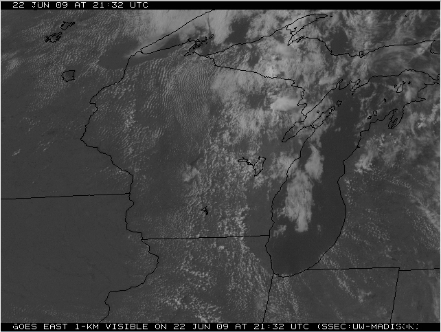
Farther to the south, GOES-12 visible imagery also showed that a Lake Michigan lake breeze was moving inland across southeastern Wisconsin and northeastern Illinois (below).


