Hurricane Matthew moves into the Bahamas
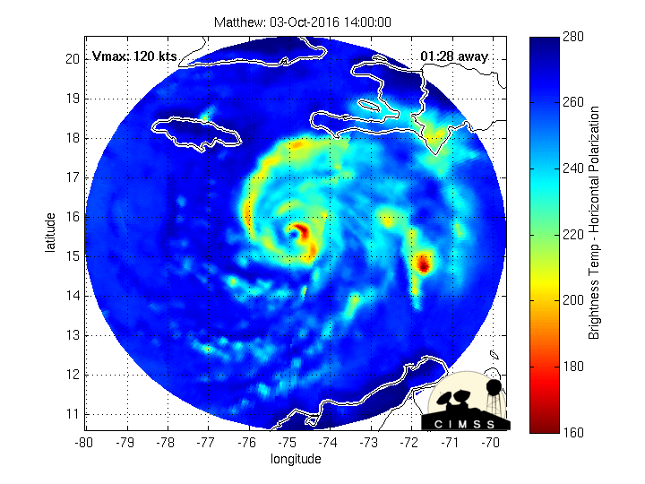
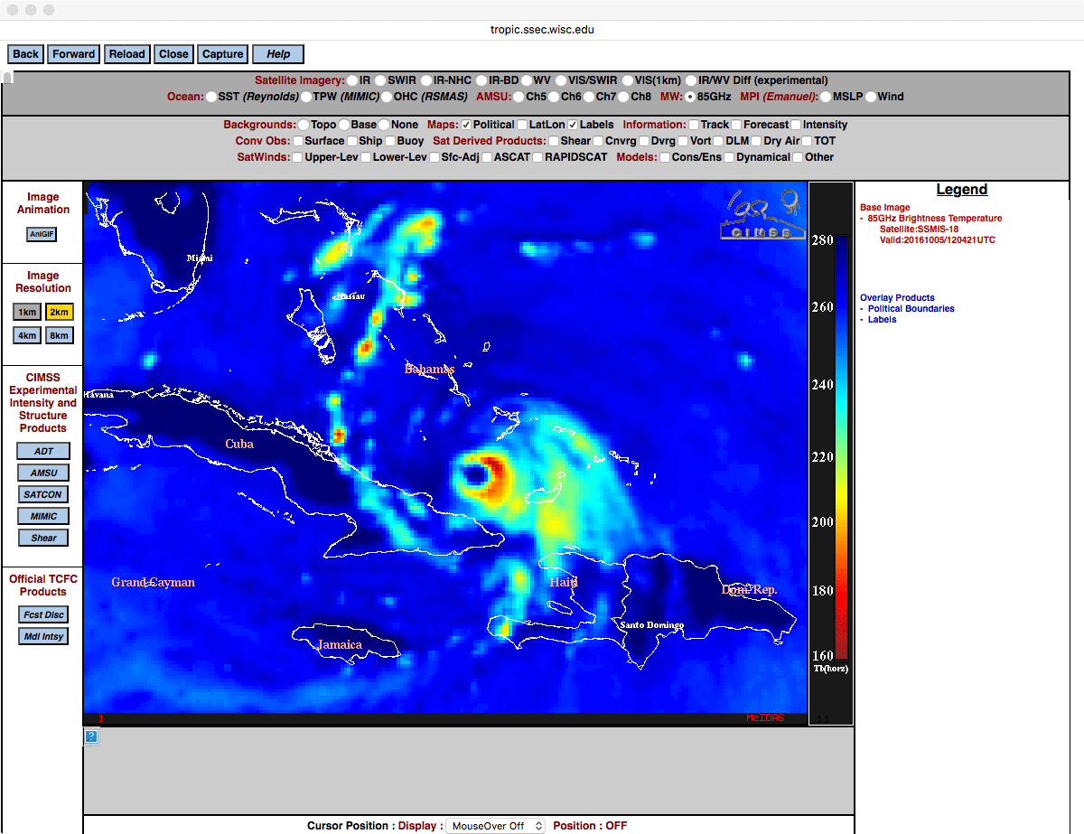
Morphed Microwave Imagery showing the eye of Matthew from 1400 UTC 3 October through 1345 UTC 5 October (Click to enlarge)
The animation of Matthew, above, from morphed microwave imagery (from this site), shows the toll that interaction with the high terrain of Hispaniola and eastern Cuba has had on the storm (causing it to be downgraded from Category 4 to Category 3 intensity). The formerly distinct eye had eroded, although eye re-formation occurs at the end of the animation. Once again, a comparison of microwave vs infrared imagery revealed that the well-defined eye structure was much more apparent using microwave data. Strengthening/Re-organization of Matthew in the near term will be governed by Sea Surface Temperatures (that are warm) and wind shear (shown below, from this site, that is weak).
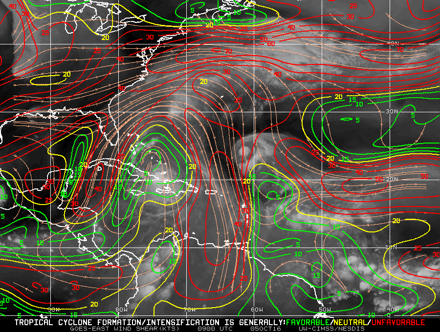
Diagnosed wind shear, 0900 UTC on 5 October 2016 (Click to enlarge)
Total Precipitable Water fields (from this site, using data from here), below, show abundant moisture surrounding Matthew at its present position. There is dry air over the eastern United States landmass, however.
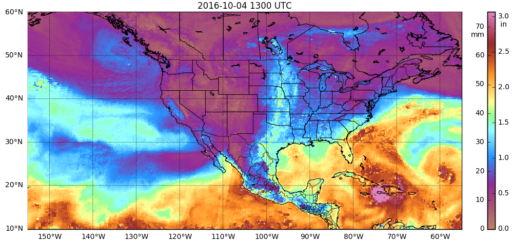
Morphed Total Precipitable water from MIRS, 1300 UTC 4 October – 1200 UTC 5 October (Click to enlarge)
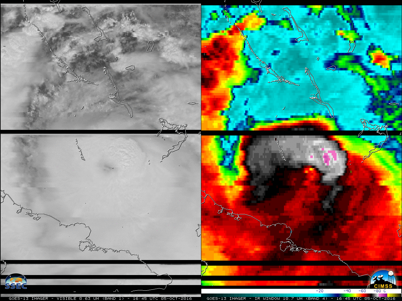
During the morning and afternoon hours, the satellite presentation of Matthew began to slowly improve on GOES-13 Visible (0.63 µm) and Infrared Window (10.7 µm) imagery, below (MP4 | animated GIF), with well-defined convective bursts seen later in the day. Note: the noise seen on the 1645 UTC images was due to solar RFI.
![GOES-13 0.63 µm Visible (left) and 10.7 µm Infrared Window (right) images [Click to play animation]](https://cimss.ssec.wisc.edu/satellite-blog/wp-content/uploads/sites/5/2016/10/161005_goes13_visible_infrared_Matthew_anim.gif)
GOES-13 0.63 µm Visible (left) and 10.7 µm Infrared Window (right) images [Click to play animation]