Dolphin acquires an eye
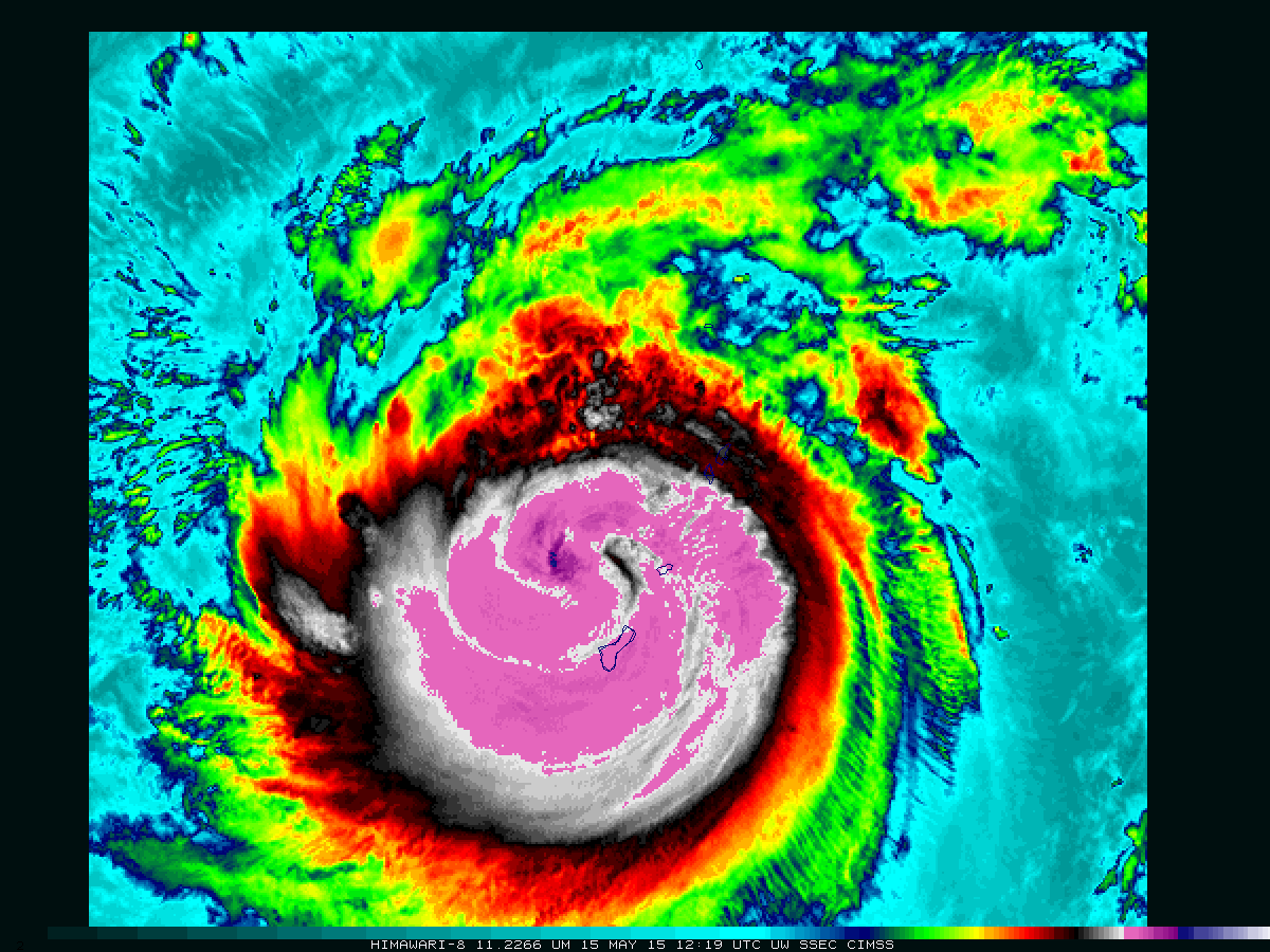
Himawari-8 11.22 µm infrared channel images (click to play animation)
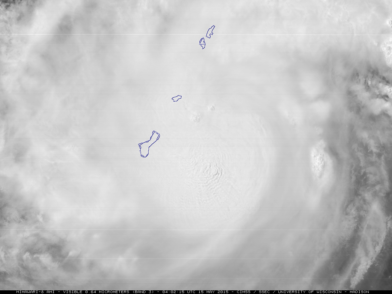
Himawari-8 infrared imagery (above, at 2.5-minute time steps and available here as an mp4) shows the development of an eye in Typhoon Dolphin shortly after 1400 UTC when the storm was northwest of Guam. With the subsequent arrival of daylight, mesovortices were clearly seen within the eye on 2.5-minute interval rapid scan visible images (animated gif | mp4 movie file).
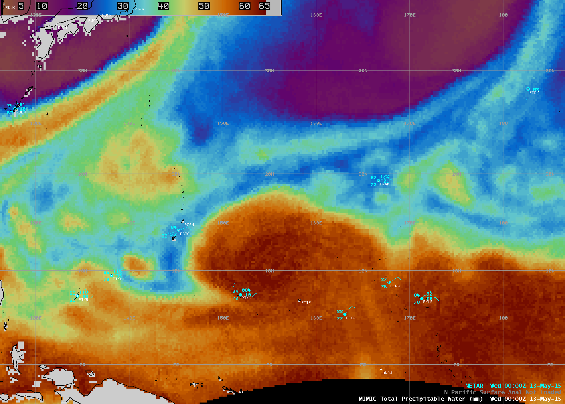
About 2 hours prior to eye formation, a Metop satellite overpass allowed the ASCAT instrument to provide surface scatterometer winds of Typhoon Dolphin, overlaid on a MIMIC Total Precipitable Water (TPW) image (below; TPW animation). The maximum TPW values were in the 60-65 mm or 2.4-2.6 inch range, and the highest ASCAT wind value was 68 knots in the eastern eyewall region of the storm.

MIMIC TPW product, with an overlay of Metop ASCAT surface scatterometer winds
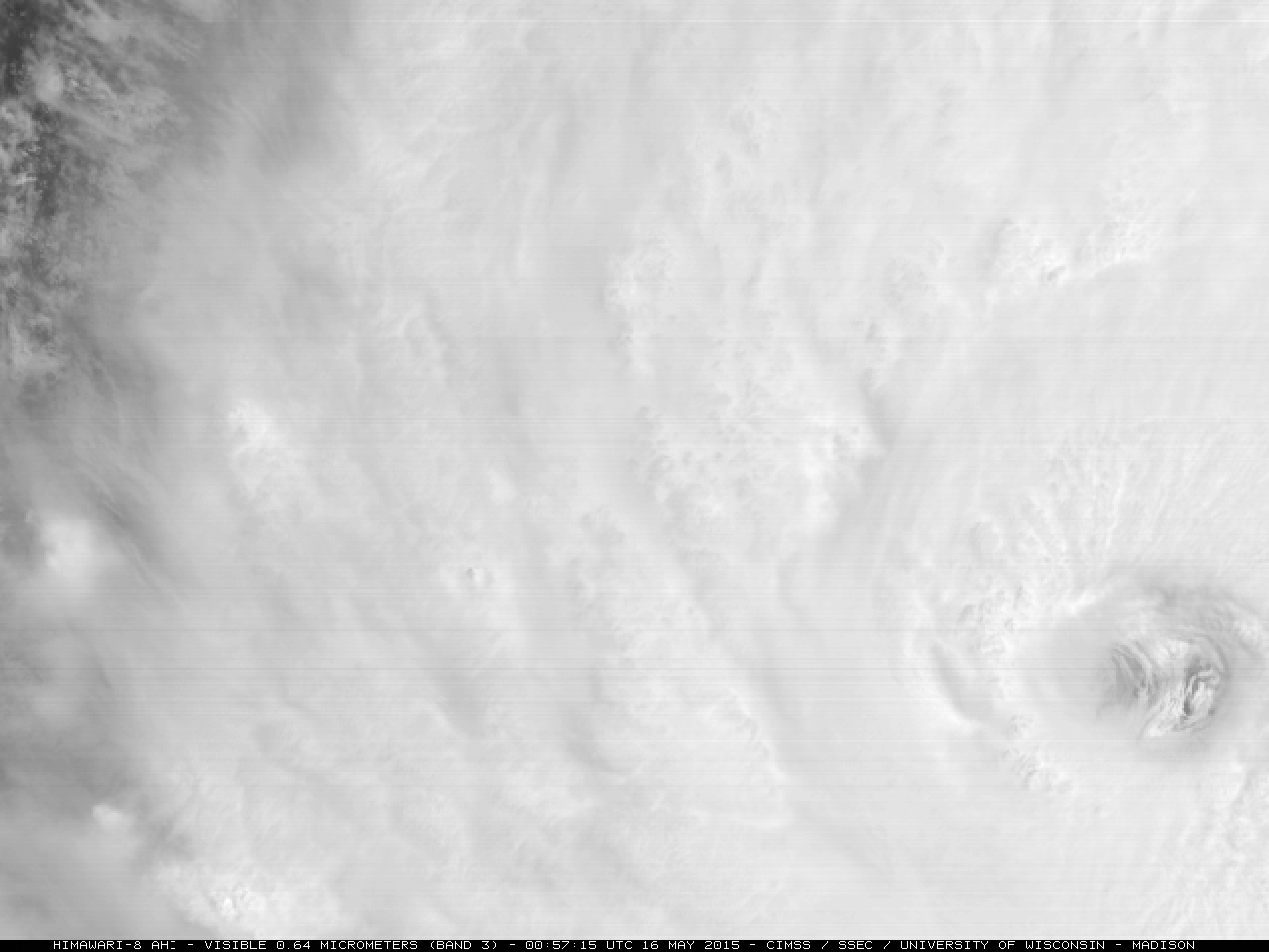
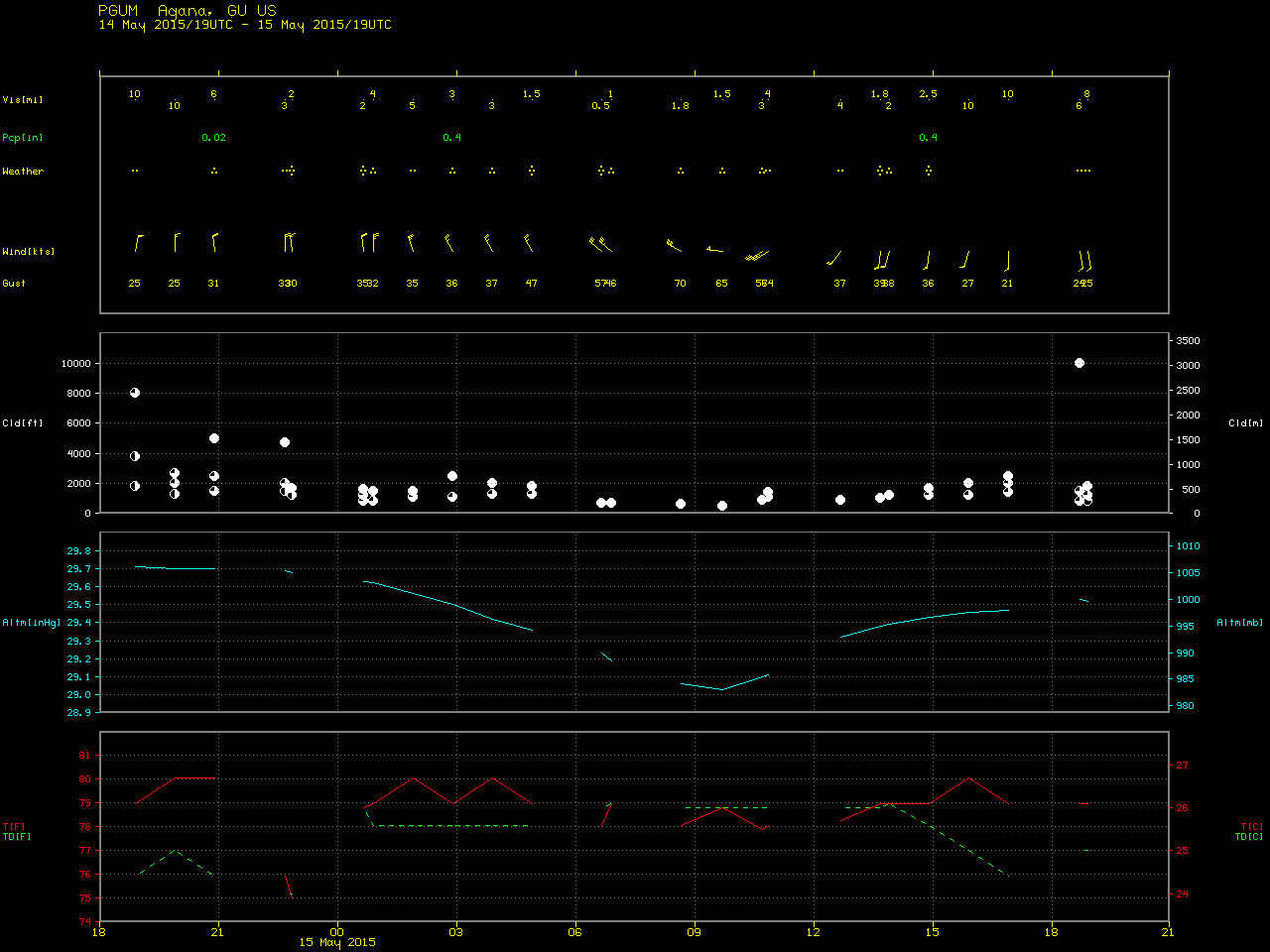
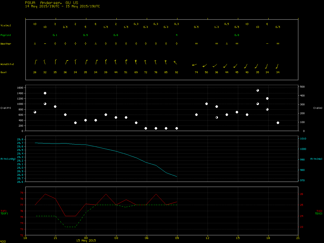
During the preceding daylight hours as Category 2 intensity Typhoon Dolphin was approaching Guam, rapid-scan (2.5-minute interval) 0.5-km resolution Himawari-8 0.64 µm visible channel images (below; click image to play animation; also available as an mp4 movie file) revealed a number of large convective bursts — but no eye was yet apparent. As the center of Dolphin passed between the islands of Guam and Rota, the peak wind gust was 70 knots at Agana, Guam (PGUM) and 92 knots at Anderson Air Force Base, Guam (PGUA).
Himawari-8 0.64 µm visible channel images (click to play animation)