Strong early-season storm in the North Pacific
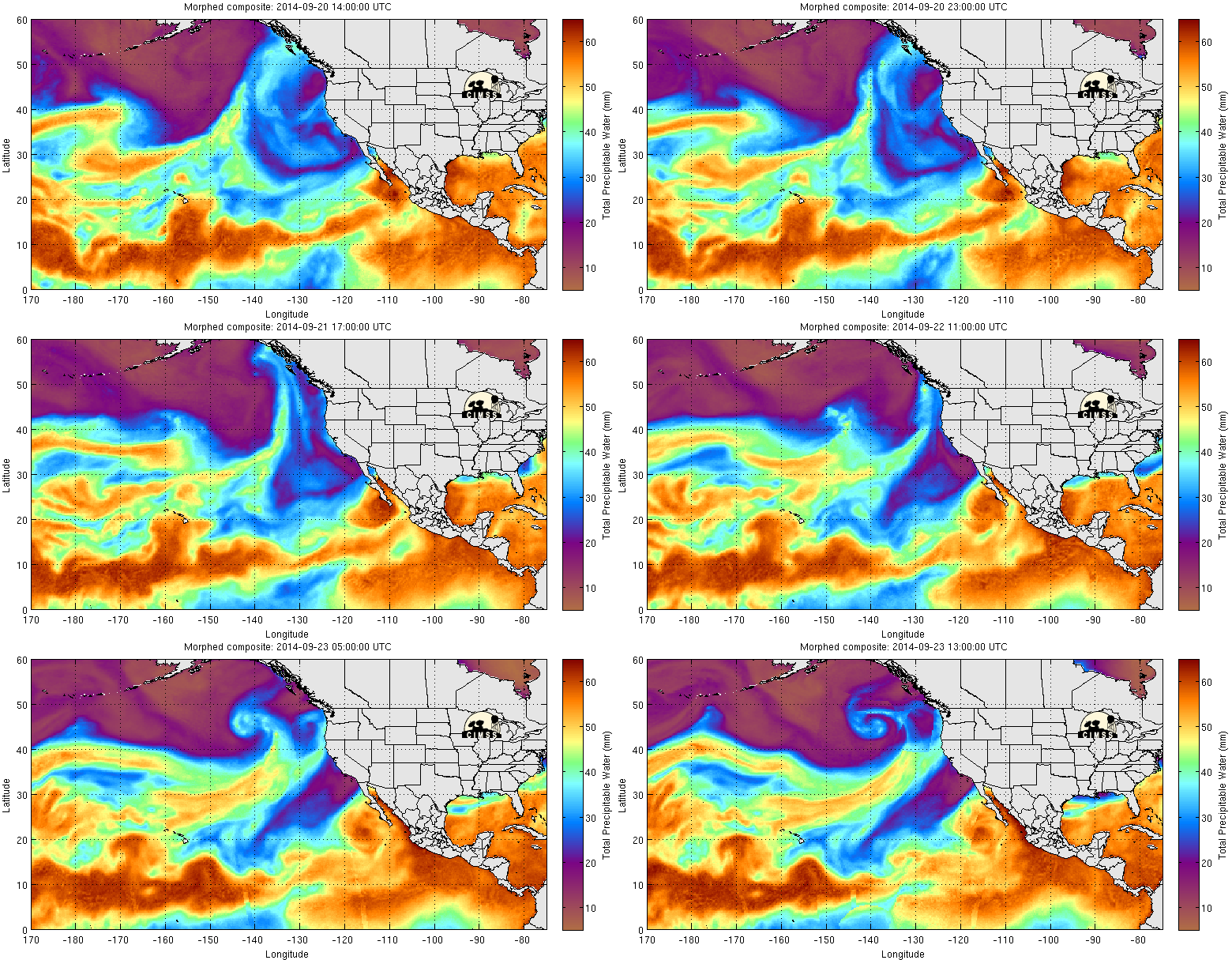
The GOES-15 6.5 µm water vapor channel imagery above showed the development and evolution of a strong mid-latitude cyclone in the eastern North Pacific Basin during the 21-23 September 2014 time period; of particular interest was the development of strong subsidence behind the storm (depicted by brighter shades of yellow), and also a second jet starting to approach the storm from the west (as evidenced by increasing cold cloud tops in the base of the trough at the end of the animation). A closer view of the storm using AWIPS II imagery is available here. The strong storm had access to abundant sub-tropical moisture, as depicted in the MIMIC Total Precipitable Water animation below.
The ASCAT Scatterometer that flies on METOP gives routine observations of surface winds over the ocean. A large area of storm-force winds (in red) was depicted in the image below (from 0630 UTC on 23 September), overlain on the GOES-15 Water Vapor imagery.
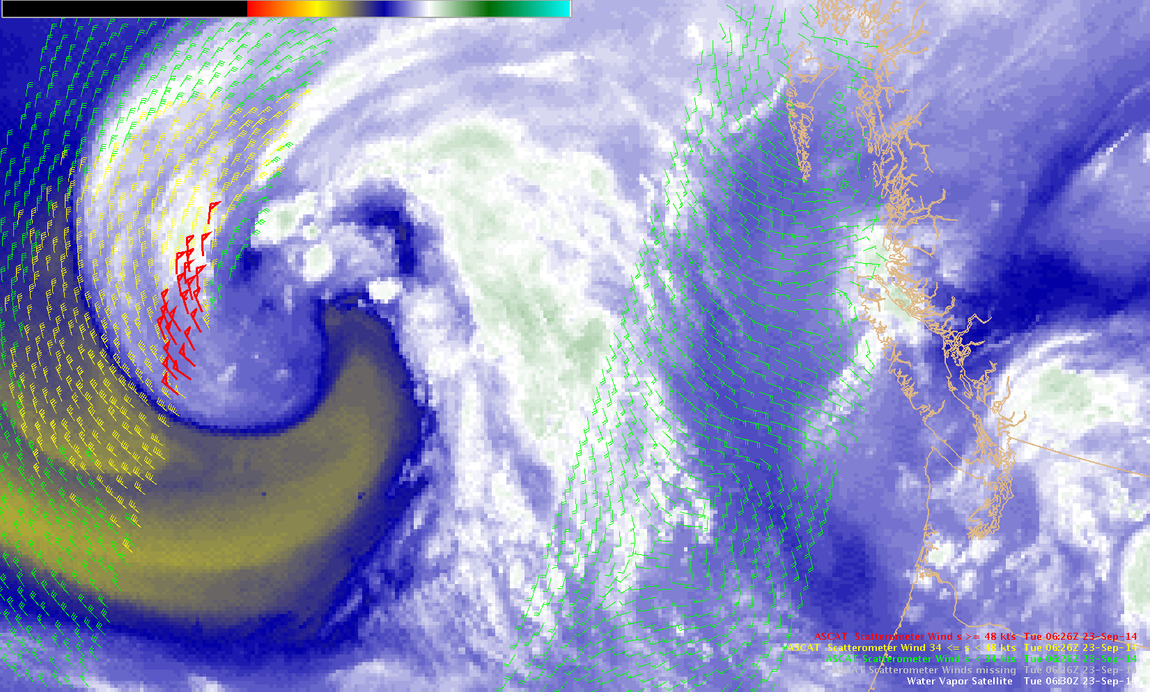
GOES-15 6.5 µm water vapor channel image and ASCAT winds, 0630 UTC on 23 September (click to enlarge)
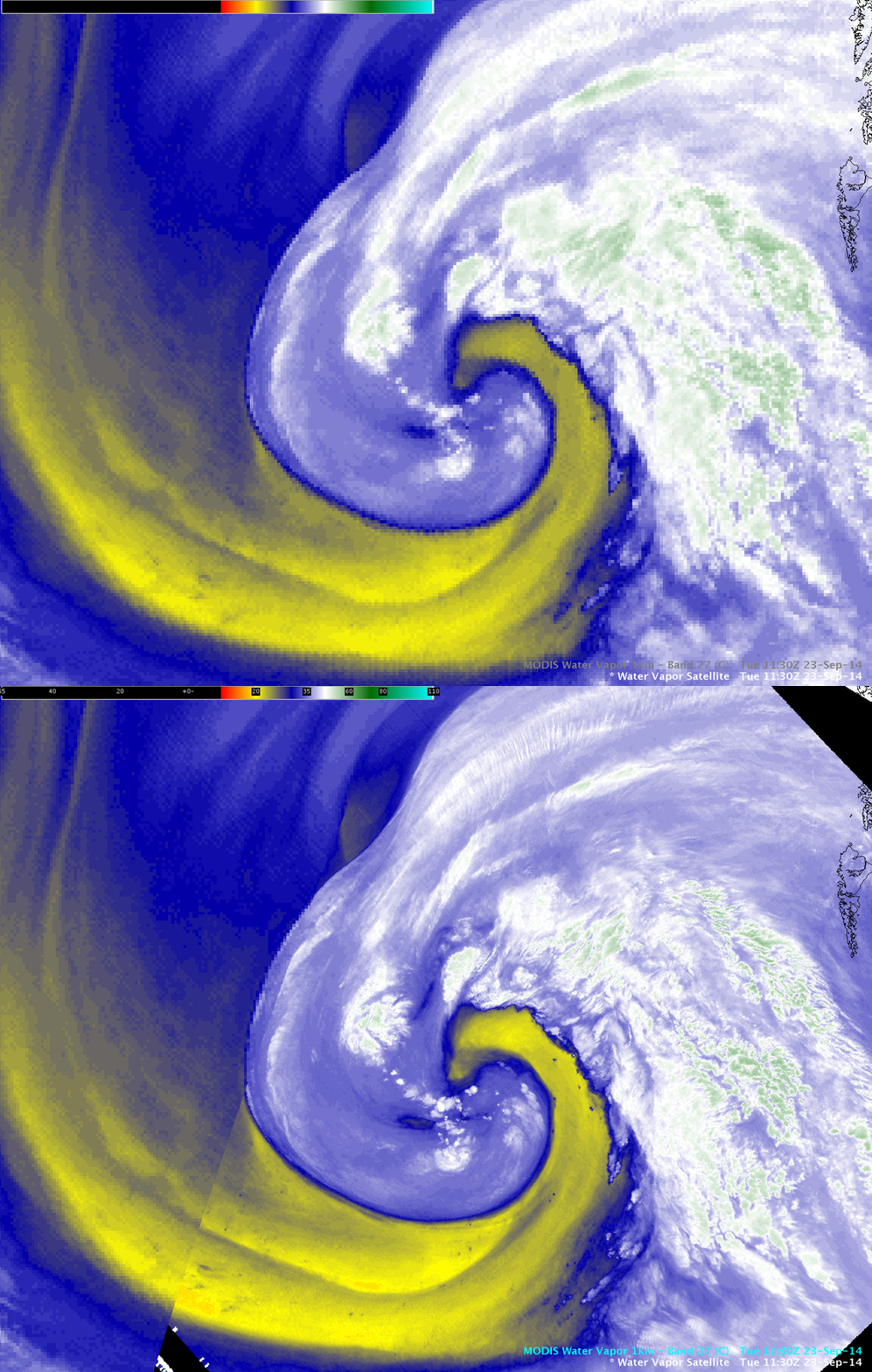
A comparison of 4-km resolution GOES-15 6.5 µm and 1-km resolution Aqua MODIS 6.7 µm water vapor channel images at 11:30 UTC, below, demonstrated the benefit of higher spatial resolution for providing a more accurate display of the water vapor gradients and various small-scale features (such as transverse banding associated with cold clouds to the north of the storm), along with the polar-orbiter image elimination of geostationary parallax error for more more precise feature location.
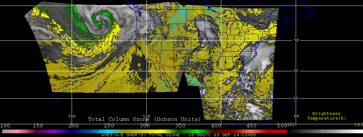
The GOES sounder Total Column Ozone product, below, showed an increase in ozone values (350-380 Dobson Units, darker green to lighter green color enhancement) as the tropopause was lowered in the vicinity of the deepening mid-latitude cyclone.
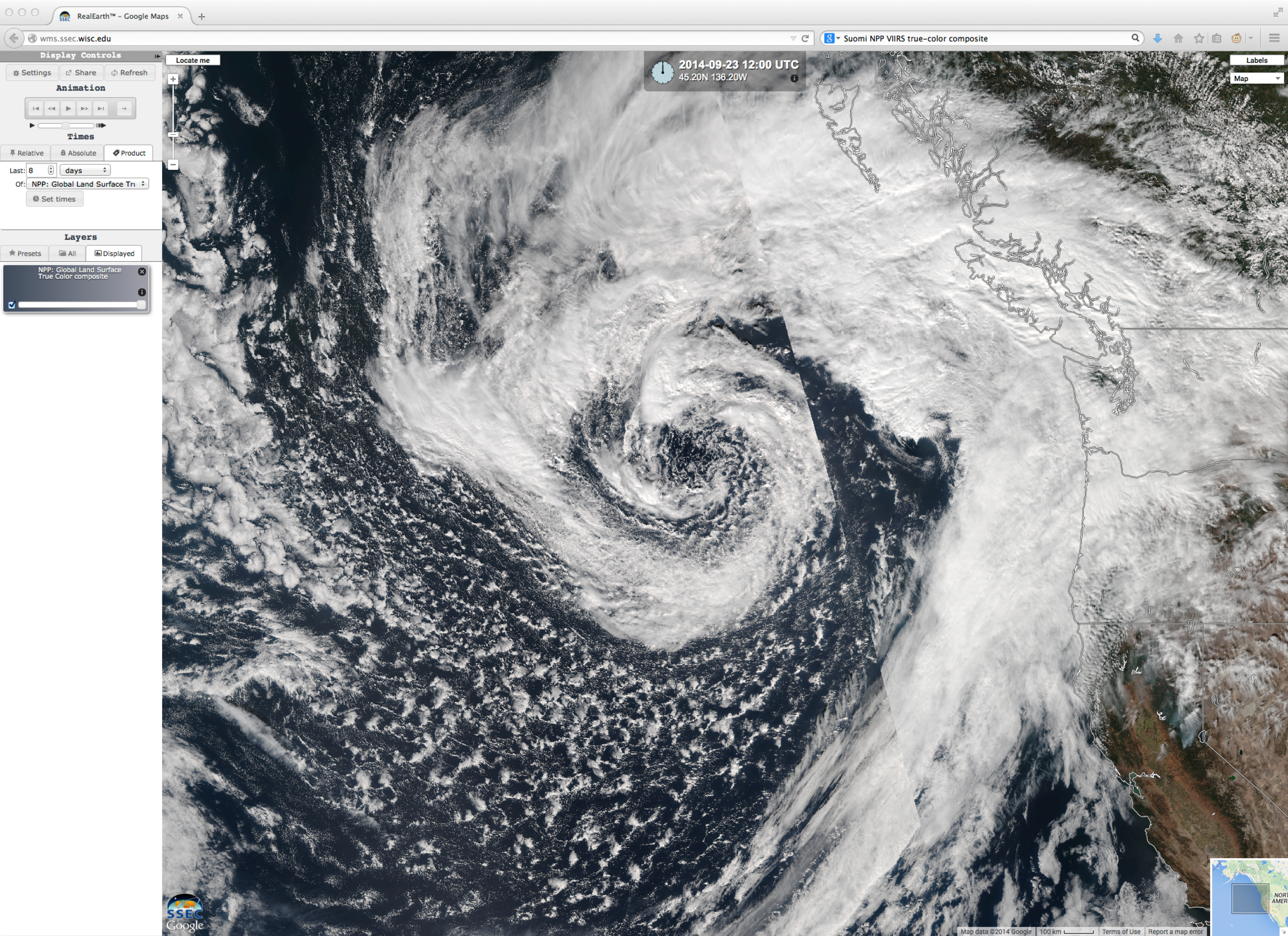
A Suomi NPP VIIRS true-color image from the SSEC RealEarth web map server, below, provided a good view of the lower-level clouds associated with the storm.
For a more detailed analysis of this event from the Ocean Prediction Center perspective, see the Satellite Liaison Blog.


