Long-range transport of Canadian wildfire smoke
On 08 July 2014 a comparison of GOES-15 (GOES-West) and GOES-13 (GOES-East) 0.63 µm visible channel images (above; click image to play animation; also available as an MP4 movie file) showed the southward and southeastward transport of dense smoke from wildfires that were burning in the Northwestern Territories of Canada. Over the Lower 48 states, the leading edge of the smoke made it as far south as Iowa and northern Illinois. The bulk of the dense smoke was aloft, but at the surface the visibility was reduced to 3-5 miles at some locations in North Dakota.The above example serves as a good demonstration of the principle of “forward scattering”: the smoke was more evident on visible imagery from GOES-15 early in the day (as the sun was rising), and more evident on visible imagery from GOES-13 later in the day (as the sun was setting).
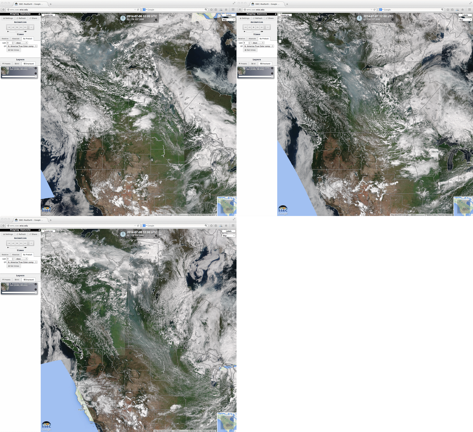
Suomi NPP VIIRS true-color Red/Green/Blue (RGB) images from the SSEC RealEarth web map server (below) showed the areal coverage of the hazy pall of smoke on 06 July, 07 July, and 08 July.
The IDEA-I forward airmass trajectory model applied to targets of high Aerosol Optical Depth (AOD) which were detected by the Terra MODIS instrument over Canada on 08 July are shown below. Such a tool can be used as an aid in air quality forecasting.
===== 09 July Update =====
The Terra MODIS AOD product (below; click to play animation) indicated that the leading edge of the Canadian wildfire smoke had advanced as far southward as northwestern Missouri. The bulk of the highest AOD values over the Dakotas was forecast to be transported slowly east-northeastward toward the Great Lakes region.


