Hurricane Cristina
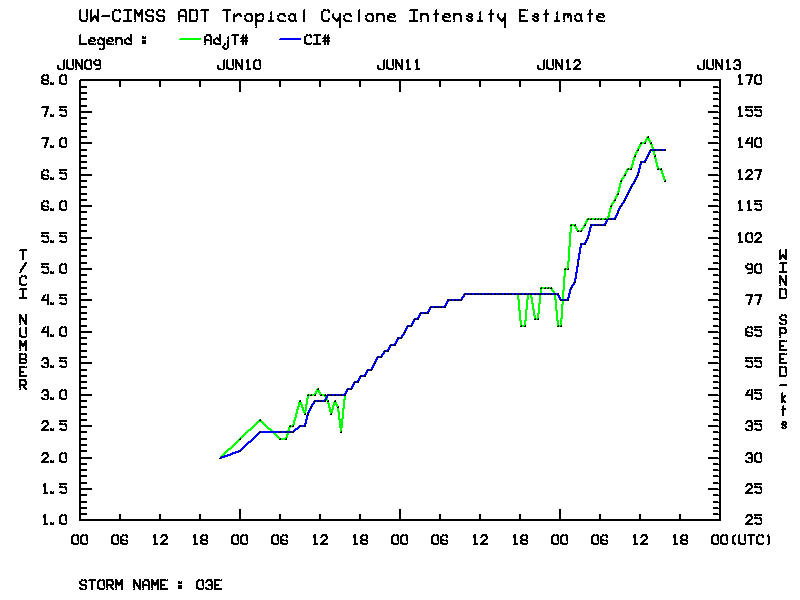
A tire series plot of the CIMSS Advanced Dvorak Technique (above) showed that Hurricane Cristina experienced a period of very rapid intensification during the day on 12 June 2014. Hurricane Cristina reached Category 4 status, making this the first time in the satellite era that there have been two Category 4 storms by the month of June in the East Pacific basin (the first this year was Hurricane Amanda).
McIDAS images of 4-km resolution GOES-15 10.7 µm IR channel data (below; click image to play animation) showed the rapid formation of the well-defined eye on 12 June.
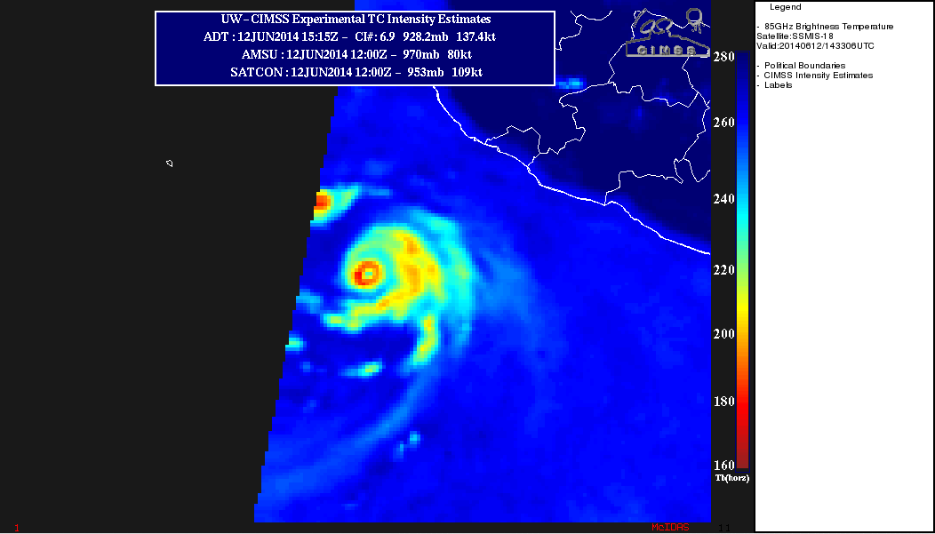
An SSMIS-18 satellite 85 GHz microwave image from the CIMSS Tropical Cyclones site (below) showed the well-defined eyewall at 14:33 UTC on 12 June.
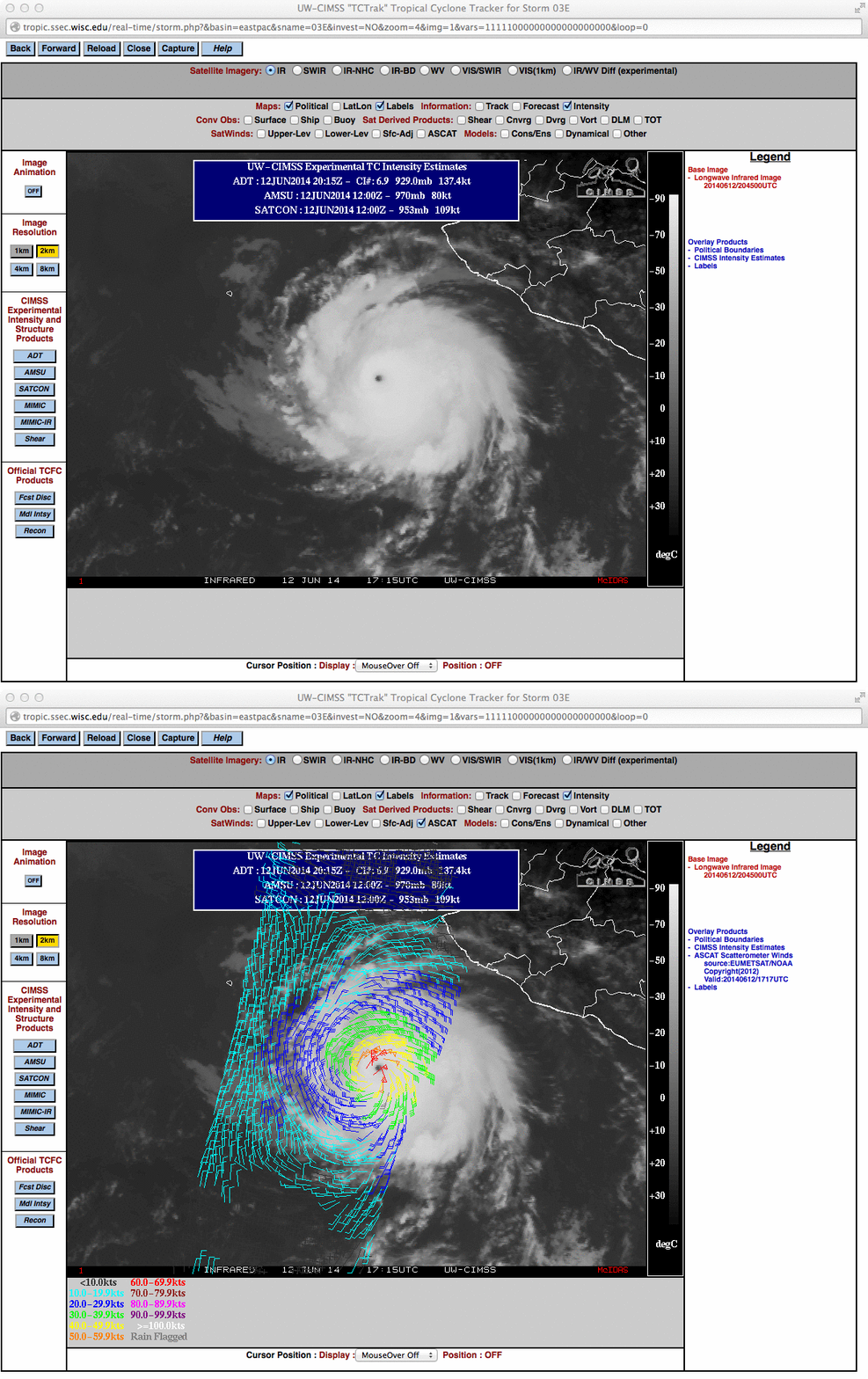
About 3 hours later, an overpass of a Metop satellite provided ASCAT surface scatterometer winds (below).


