Strong storm in the North Atlantic Ocean
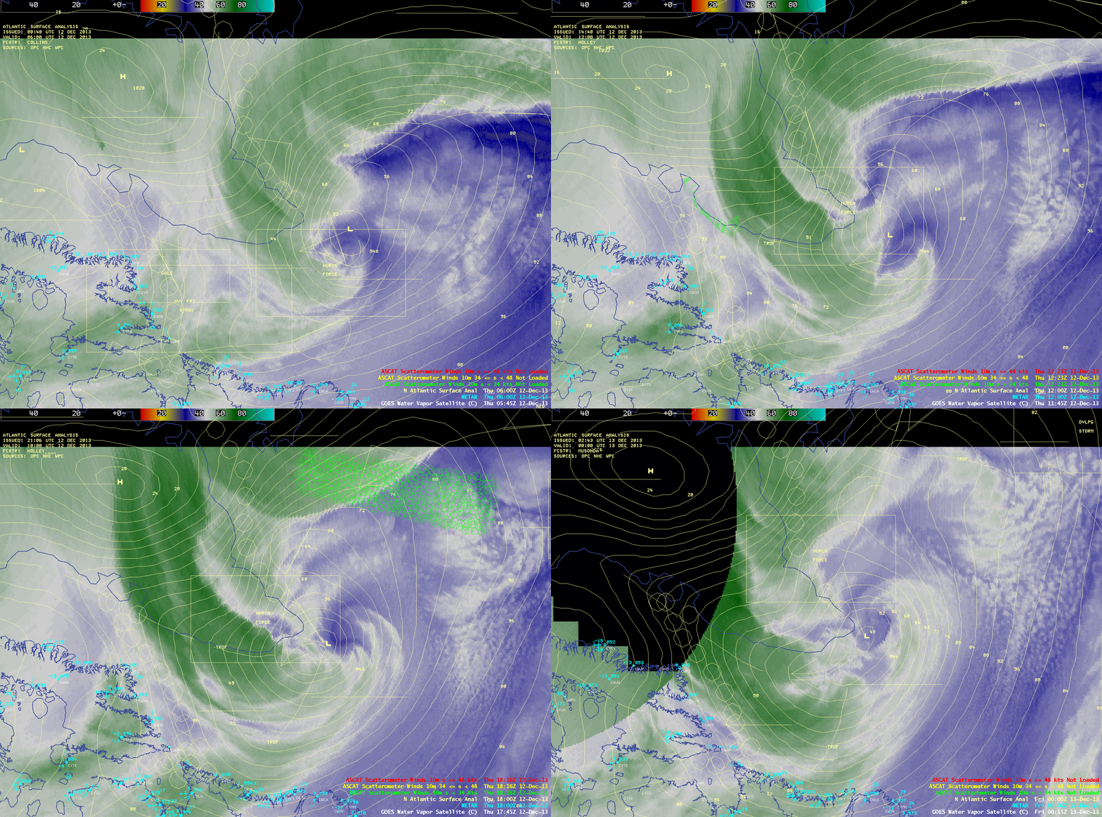
A large and strong cyclone was intensifying in the North Atlantic Ocean just south of Greenland on 12 December 2013. GOES-13 6.5 µm water vapor channel images with 06 UTC, 12 UTC, 18 UTC, and 00 UTC surface analyses and surface reports (above) showed that the central pressure of the storm deepened to 942 hPa at 18 UTC — and the strong pressure gradient between the low and a 1032 hPa high situated over northern Greenland was forecast to produce a broad region of hurricane-force winds.
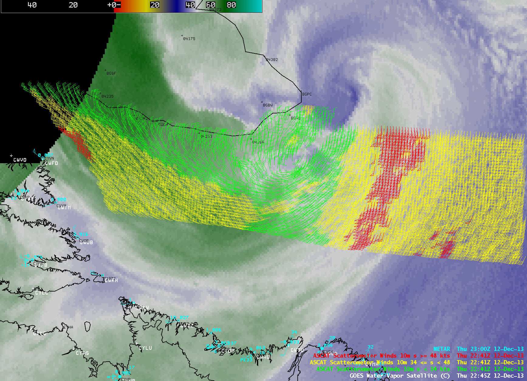
EUMETSAT Metop ASCAT scatterometer surface winds at 22:41 UTC (below) highlighted 3 areas over the water which contained a number of remotely-sensed winds of 50 knots or higher (red barbs). The strongest wind velocity within this ASCAT swath was 54 knots, located in the largest area of red wind barbs south of the storm center.
Near the time of the 22:41 UTC ASCAT data, surface winds were a steady 50 knots from the north-northwest at Cape Dyer, Nunavut, Canada (station idendifier CWFD) — and the peak wind gust at that station was 56 knots several hours prior at 18 UTC. In southern Greenland, the peak wind gust at Narsarsuaq (station identifier BGBW) was 71 knots, occcurring earlier in the day at 13 UTC (below).
GOES-13 6.5 µm water vapor images at 30-minute intervals (below; click image to play animation) displayed an interesting range of signatures as moisture wrapped around the very large storm.


