Thunderstorms producing heavy rain and flash flooding in Puerto Rico
McIDAS images of 4-km resolution GOES-13 10.7 µm IR channel images (above; click image to play animation) showed the development of large thunderstorms that produced heavy rainfall (including 5.18 inches at San Sebastian) which led to flash flooding over parts of Puerto Rico (Local Storm Report) on 07 May 2013. Since their primary Doppler radar was out of service due to an upgrade to Dual-Polarization technology, the National Weather Service forecast office at San Juan had requested that the GOES-13 (GOES-East) satellite be placed into Rapid Scan Operations (RSO), which provided images as frequently as every 5-10 minutes (instead of the nominal 15-minute image interval). The coldest cloud top IR brightness temperature seen on the GOES-13 IR image sequence above was -69º C at 17:10 UTC.
Due to a full-disk scan at 18:00 UTC, there was a 30-minute gap between the 17:45 UTC and 18:15 UTC GOES-13 images. A timely overpass of the NOAA-19 polar-orbiting satellite at 18:03 UTC provided a 1-km resolution AVHRR 10.8 µm IR image during this 30-minute GOES-13 gap (below), which revealed that a new convective cell had rapidly developed over the northwestern portion of Puerto Rico (exhibiting a cloud-top IR brightness temperature as cold as -79º C).
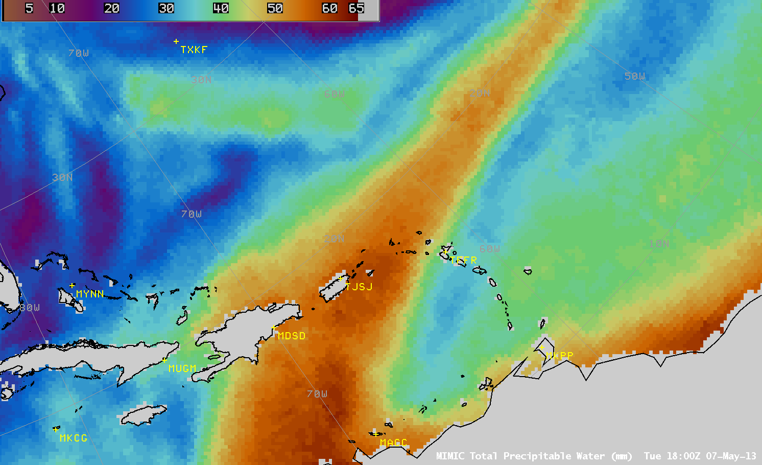
AWIPS images of the MIMIC Total Precipitable Water (TPW) product (below; click image to play animation) showed that an elongated plume of high TPW (50 to 60 mm or 2.0 to 2.4 inches, darker orange color enhancement) was rotating across the Puerto Rico region during this period, providing ample moisture to fuel the development of deep convection and heavy rainfall. Surface analyses suggest that the eastern portion of the TPWÂ plume was associated with the remnants of a cold frontal boundary, while an impulse over the Caribbean Sea was helping to transport higher TPW values from the south (TJSJ is the station identifier for San Juan, Puerto Rico).


