Pacific moisture plume and strong jet
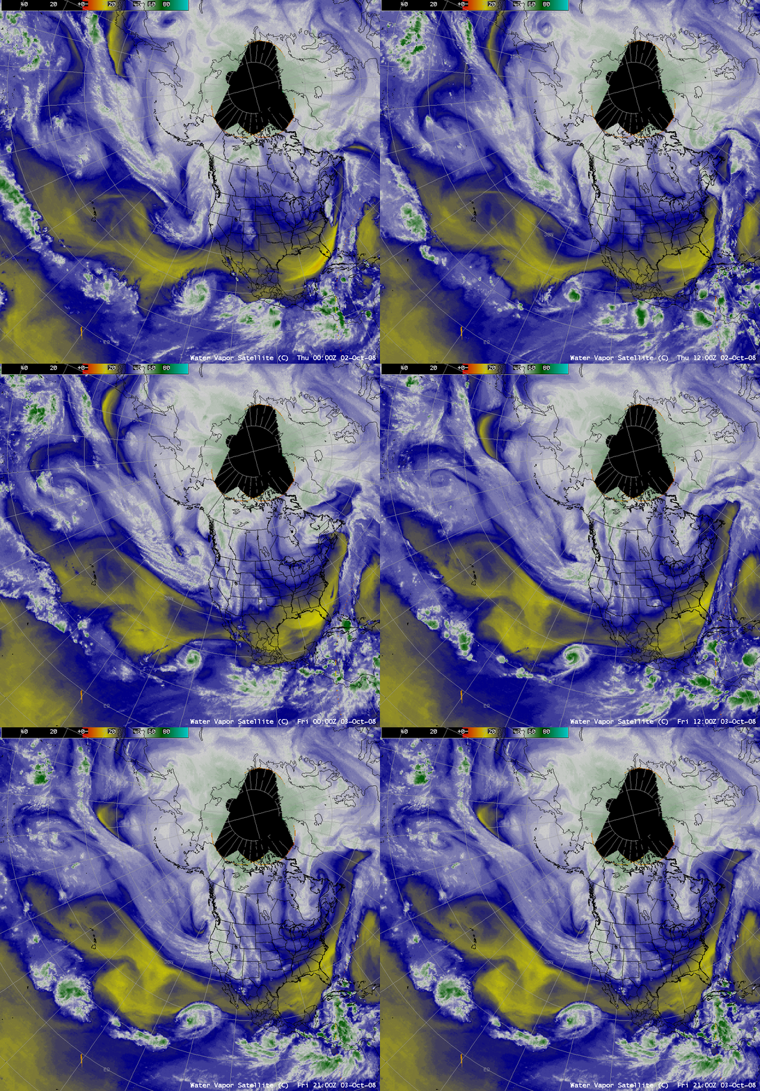
AWIPS images of geostationary satellite water vapor channel data (above) showed a long moisture plume moving across the Pacific Ocean toward the west coast of the US on 02-03 October 2008. A comparison of GOES-11 water vapor channel data with POES (AMSU) and SSM/I Total Precipitable Water (TPW) products (below) revealed that TPW values were as high as 50-60 mm (2.0-2.4 inches) within this moisture plume. The MIMIC TPW product suggested that this moisture plume originated over the western Pacific Ocean, southeast of Japan.
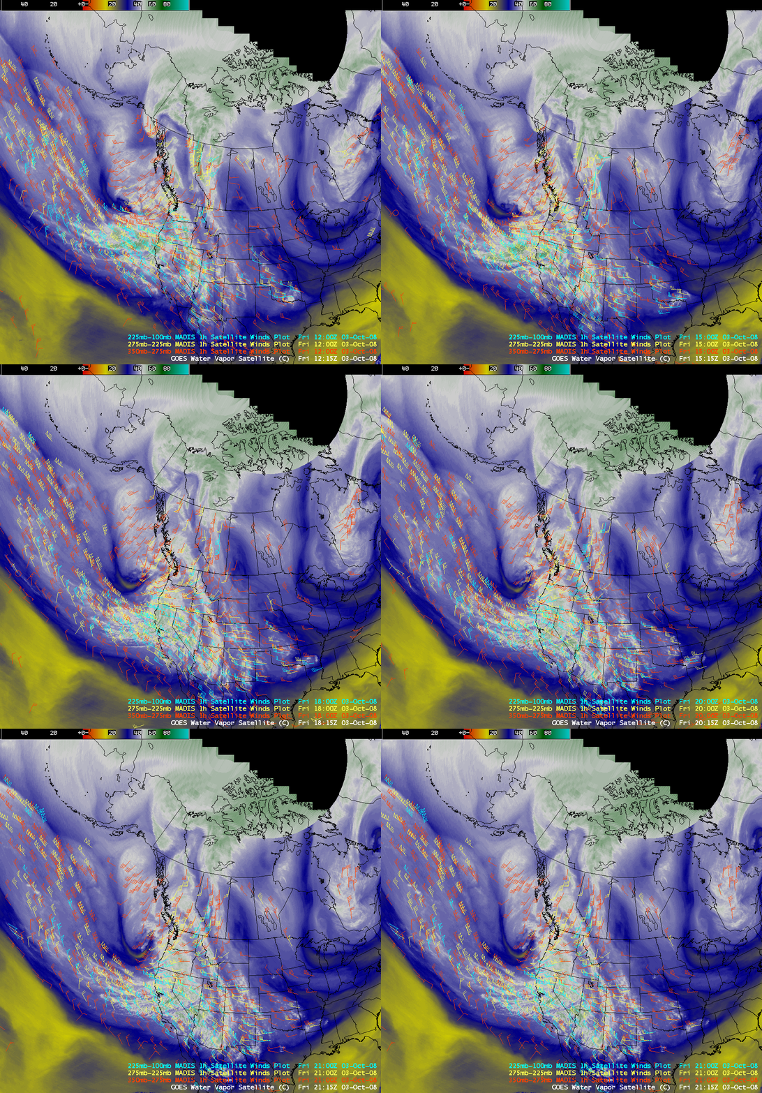
This moisture plume was associated with a strong polar jet stream, as seen by an overlay of hourly MADIS atmospheric motion vectors on GOES water vapor channel imagery (below).
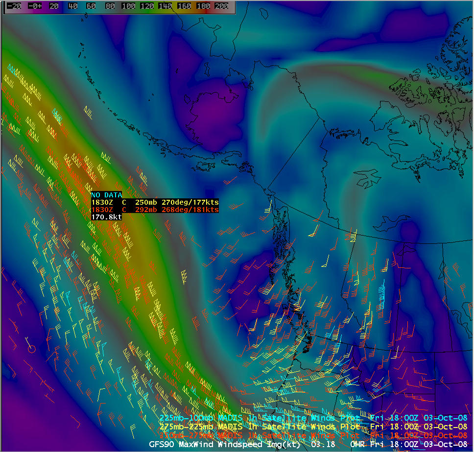
The 18 UTC GFS model fields were forecasting maximum winds in the core of the jet to reach 170 knots (below) — there were a few MADIS wind vectors with speeds of 177-181 knots around that time (and a MADIS wind vector with a speed of 191 knots was seen at 21 UTC).


