GOES-14 SRSOR: Tropical Storm Isaac
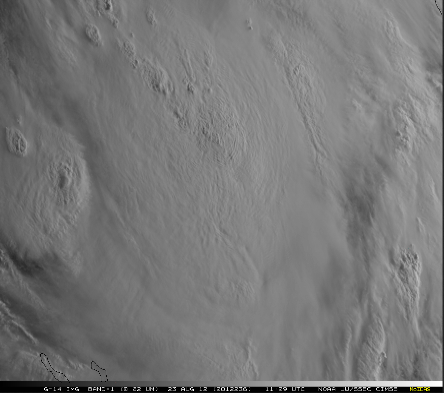
McIDAS images of GOES-14 1-minute interval Super Rapid Scan Operations for GOES-R (SRSOR) 1-km resolution 0.63 µm visible channel images (above; click image to play animation) showed overshooting tops and cloud-top gravity waves associated with a large convective burst located just to the southwest of the center of Tropical Storm Isaac on 23 August 2012.
The corresponding 4-km resolution GOES-14 10.7 µm IR channel images (below) revealed the fluctuation of cold cloud top IR brightness temperatures in the -80 to -90º C range (light to dark purple color enhancement). The white tropical cyclone symbol denotes the 12:00 UTC position of the center of Tropical Storm Isaac according to the National Hurricane Center.
===== 24 August Update =====
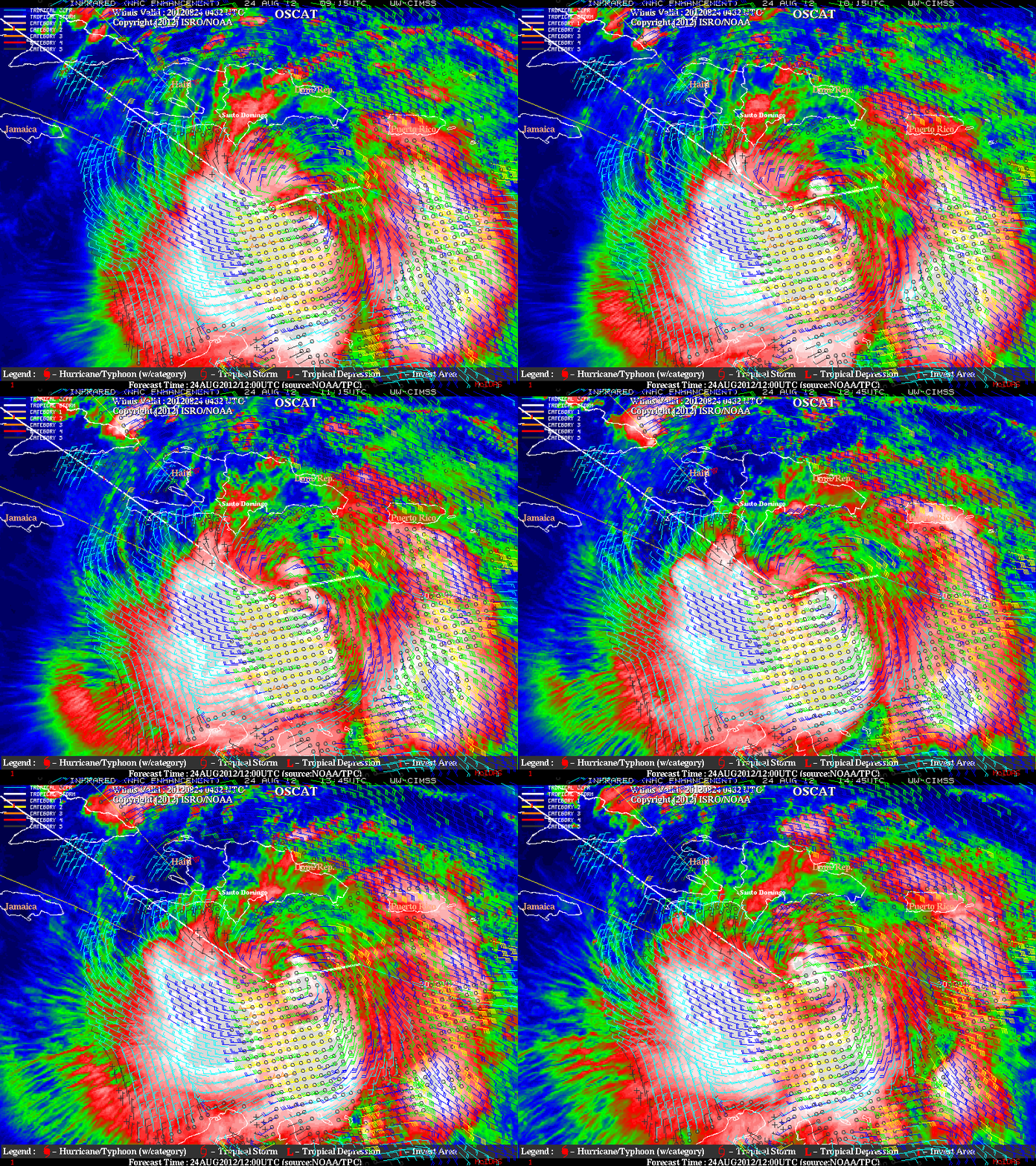
A GOES-14 visible image animation from early morning on August 24th (above; click image to play animation), about 24 hours after the animation at top, continues to show active convection, although the storm itself remains poorly organized with an elongated center of circulation as seen on OSCAT scatterometer surface winds (below). The presence of increasingly organized curved convective banding is obvious, however.

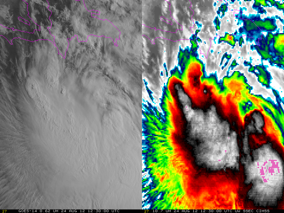
GOES-14 0.63 µm visible channel images and 10.7 µm images, 1200-1259 UTC 24 August 2012 (click image to play animation)
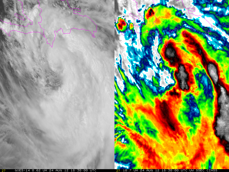
The animation above shows an hour of 1-minute visible (0.63 µm) and Infrared (10.7 µm) imagery starting at 1200 UTC on 24 Friday. The cold cloud tops of the active convection, and the episodic overshooting tops, are evident. Note that the slight flicker that is apparent in the 10.7 µm imagery may be due to the timing of space looks that the ‘cold end’ that is used in the IR calibration. An animation for the one hour starting 1800 UTC is below. Significant changes in the structure of the storm are apparent.

GOES-14 0.63 µm visible channel images and 10.7 µm images, 1800-1859 UTC 24 August 2012 (click image to play animation)
For more information on Isaac, refer to the CIMSS Tropical Cyclones site and the National Hurricane Center. One-minute imagery for the storm can be viewed in real time here.


