Tropical Storm Beryl
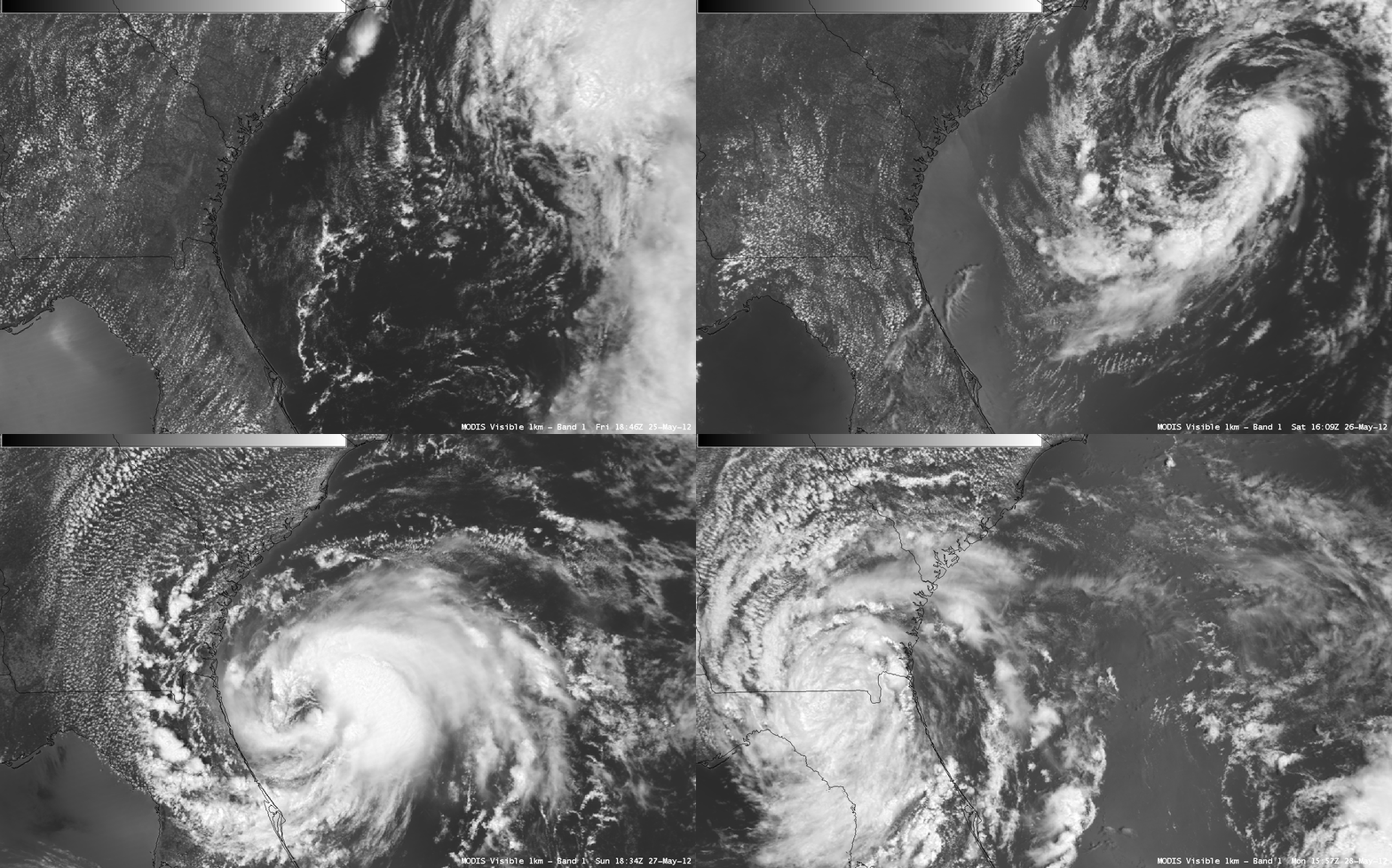
A sequence of four AWIPS images of 1-km resolution MODIS 0.65 µm visible channel data during the 25 May – 28 May 2012 period (above) showed the various stages of development of Subtropical/Tropical Storm Beryl as it slowly intensified over the far western Atlantic Ocean and eventually made landfall across northeastern Florida. Beryl was the first Tropical Storm to make landfall in the US during the month of May since Tropical Storm Arlene back in 1959.
As Beryl made the transition from Subtropical Storm to Tropical Storm on 27 May, McIDAS images of 1-km resolution GOES-13 0.63 µm visible channel data (below; click image to play animation) showed convective bands becoming more organized and wrapping around the center of the system.
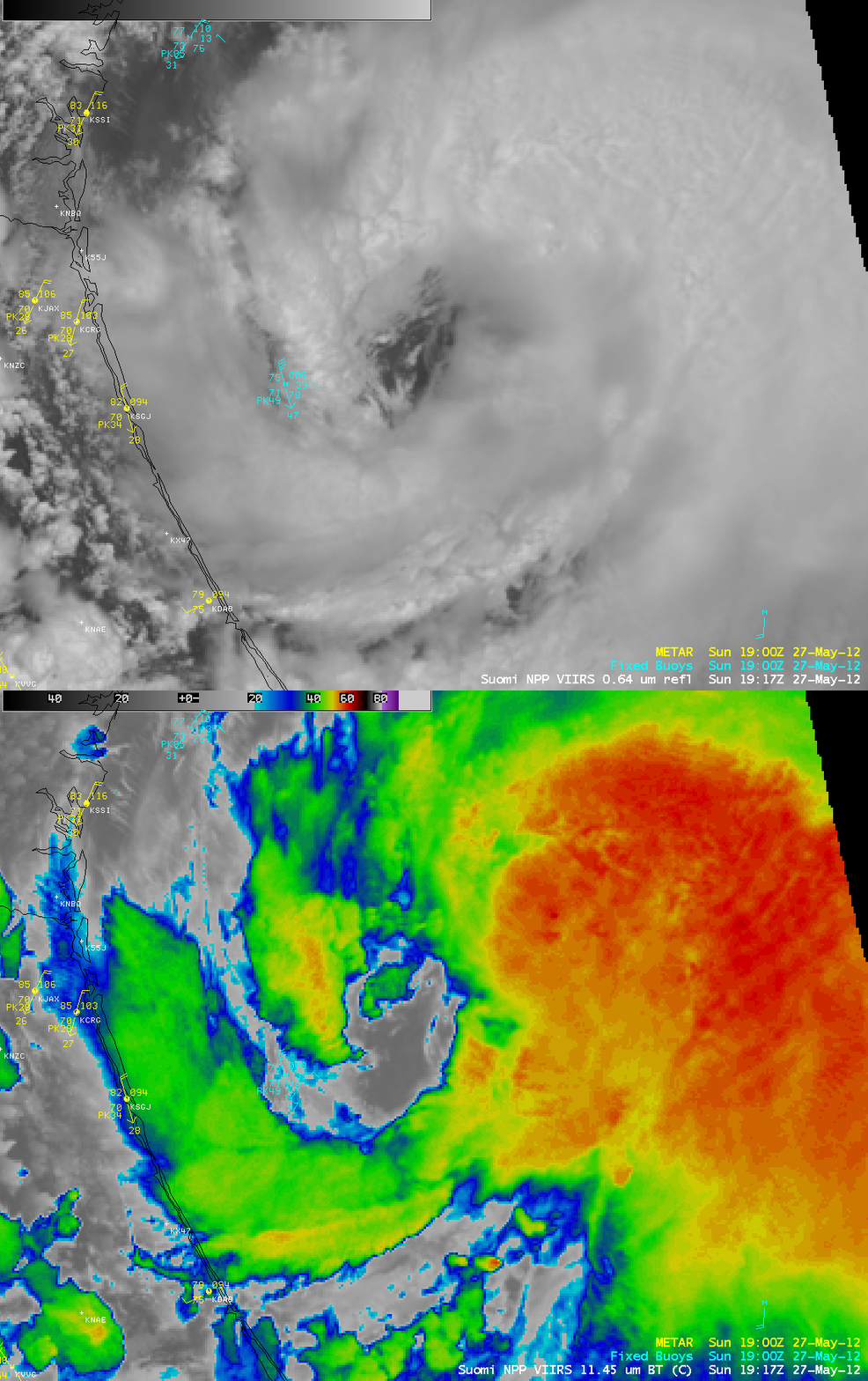
A comparison of AWIPS images of 1-km resolution Suomi NPP VIIRS 0.64 µm visible channel and 11.45 µm IR channel data (below) showed Beryl a few hours before it was classified a Tropical Storm on 27 May.


