Plume of blowing sand from the White Sands National Monument in New Mexico
Strong winds of 50-60 mph (with a peak gust of 74 mph at Fort Stanton, New Mexico) in the wake of a cold frontal passage caused widespread areas of blowing dust from New Mexico to Kansas on 28 February 2012. One notable feture that was apparent on both GOES-15 (GOES-West) and GOES-13 (GOES-East) 0.63 µm visible channel images (above; click image to play animation) was a long plume of blowing sand originating from the White Sands National Monument located in southern New Mexico. Note how the plumes of blowing dust/sand became easier to identify later in the day on the GOES-13 imagery, as the forward scattering angle increased during the afternoon hours.
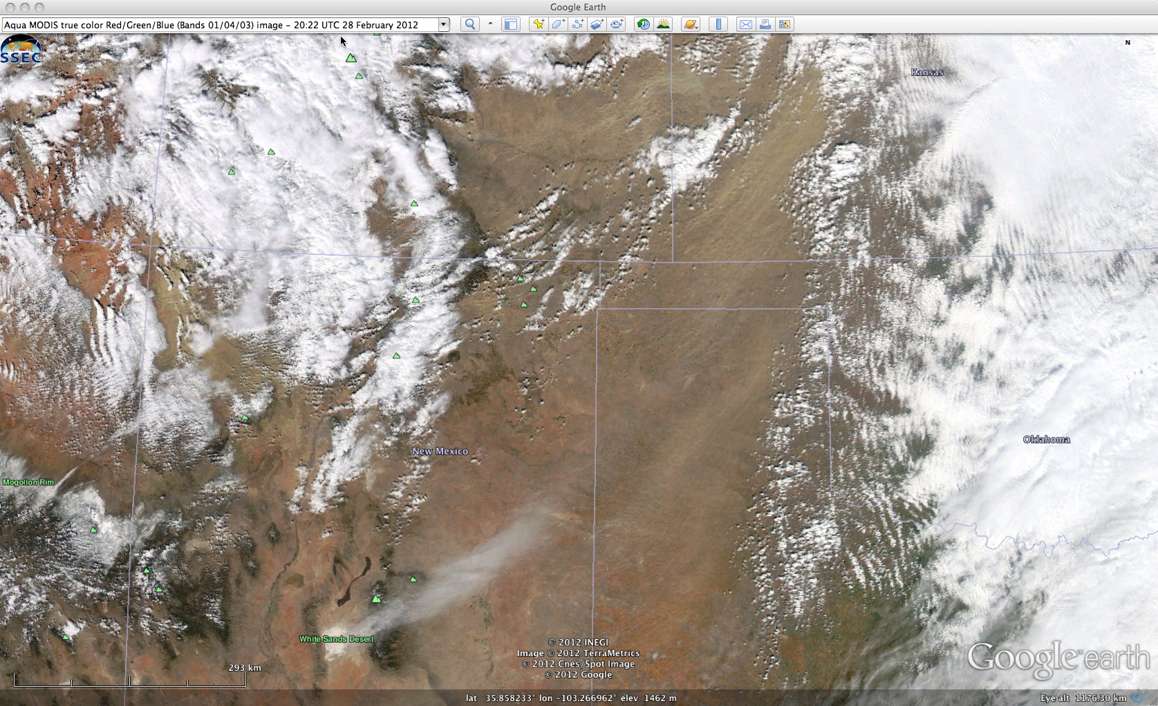
A 250-meter resolution Aqua MODIS true color Red/Green/Blue (RGB) image from the SSEC MODIS Today site (below; viewed using Google Earth) revealed how the gypsum sand from White Sands appeared white in color (full-resolution view), in contrast to the light brown colored blowing dust that was seen across the Texas and Oklahoma panhandle regions into southwestern Kansas.
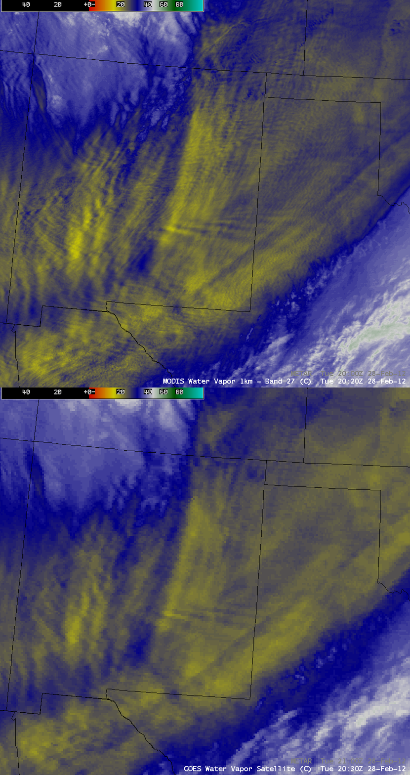
The interaction of the strong winds with the terrain could be seen in a comparison of 1-km resolution MODIS 6.7 µm and 4-km resolution GOES-13 6.5 µm water vapor channel images (below), which revealed a complex pattern of mountain waves across the region.
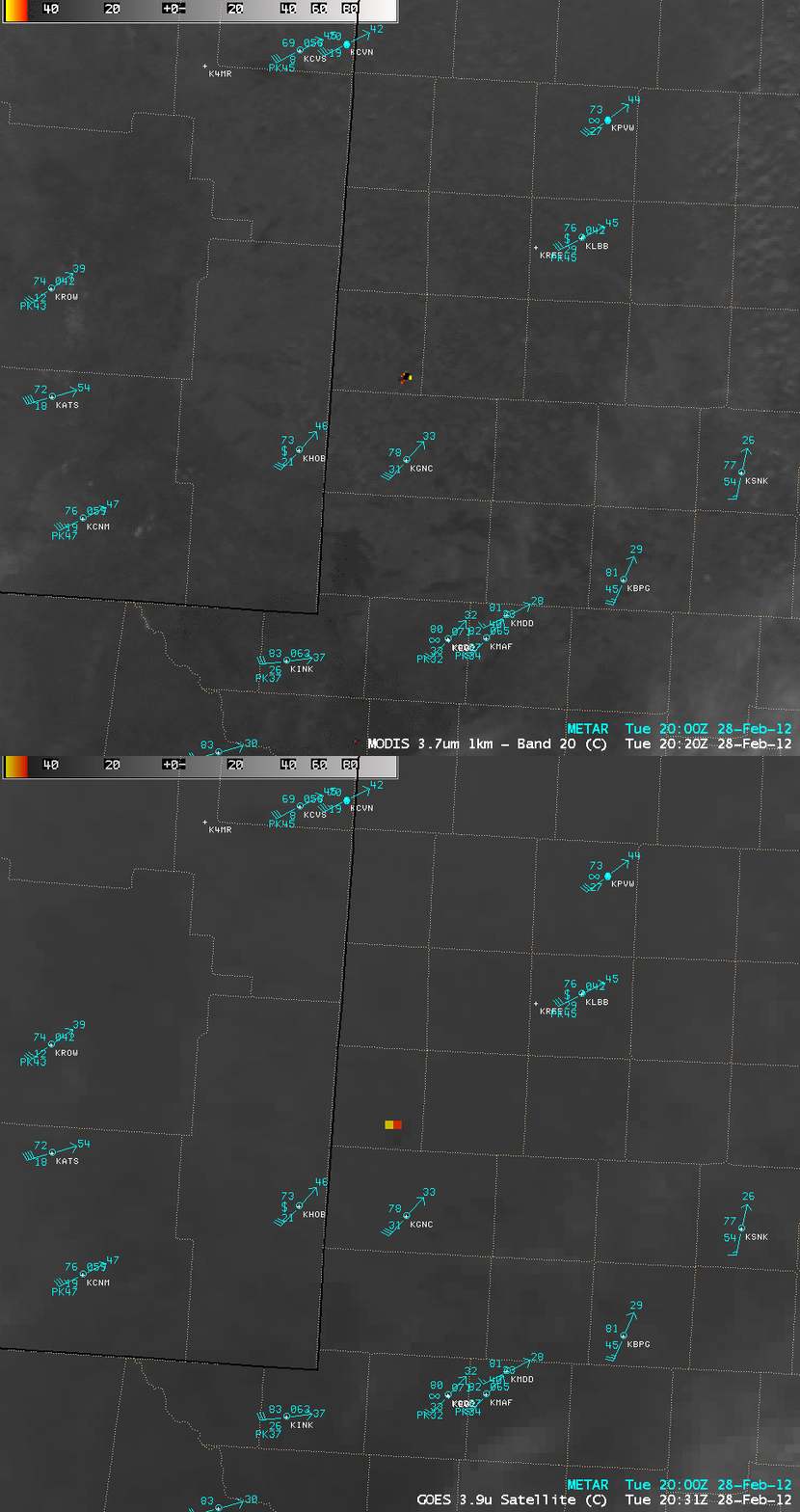
The strong surface winds in tandem with very dry air were creating conditions favorable for wildfire activity — one such fire could be seen in the southern Texas panhandle region in a comparison of 1-km resolution MODIS 3.7 µm and GOES-13 3.9 µm shortwave IR images (below).
Additional information and imagery from this event can be found on the Wide World of SPoRT blog.


