Blowing dust event in Texas and New Mexico
A major blowing dust event occurred in the wake of a strong cold frontal boundary that moved rapidly southward across western Texas and eastern New Mexico late in the day on 17 October 2011 — the blowing dust reduced surface visibilities to near zero in some locations as winds gusted as high as 75 mph (see NWS Lubbock story). McIDAS images of GOES-11 (GOES-West), GOES-15, and GOES-13 (GOES-East) visible channel data during the daylight hours and shortwave IR data after sunset (above; click image to play animation) showed the southward propagation of the well-defined arc of blowing dust (or “haboob”), along with the surge of cooler air behind the cold front. A few wildfire “hot spots” (darker black pixels) were also evident on the GOES shortwave IR images, a result of fires started by downed power lines.
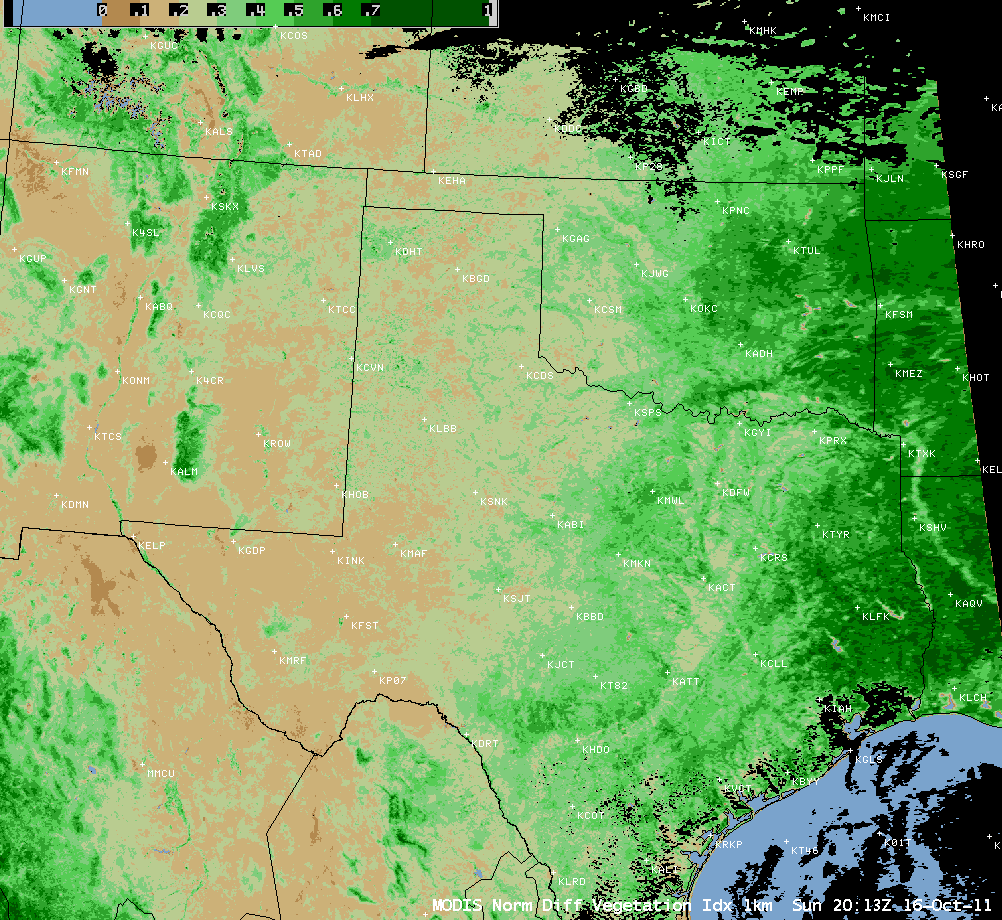
Much of that region had been experiencing long-term extreme to exceptional drought conditions — and an AWIPS image of the MODIS Normalized Difference Vegetation Index (below) showed very low NDVI values across much of western Texas the day before the dust storm.


