Hurricane Dean in the Gulf of Mexico
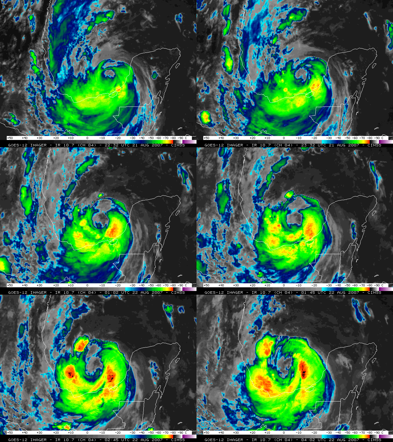
After crossing the Yucatan Peninsula of Mexico, Hurricane Dean emerged into the Gulf of Mexico as a Category 1 storm late in the day on 21 August 2007. GOES-12 10.7µm IR imagery (above) shows a ragged eye associated with Dean; also note the burst of convection to the north and northwest of the eye (beginning around 00:45 UTC on 22 August). This area of convection continued to increase in areal coverage, with IR brightness temperatures eventually cooling to -80º C / -112º F (black enhancement).
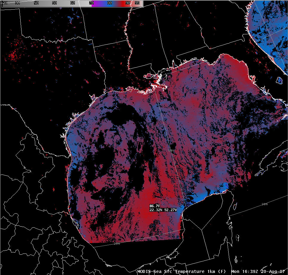
An AWIPS image of the MODIS Sea Surface Temperature (SST) product from 20 August (above) reveals a region of warmer SST values in the general area where the convective burst was seen to form on the IR imagery above. SST values were as warm as 86.7º F / 30.4º C (dark red enhancement), and this pocket of deep, warm water may have helped to fuel the burst of convection.
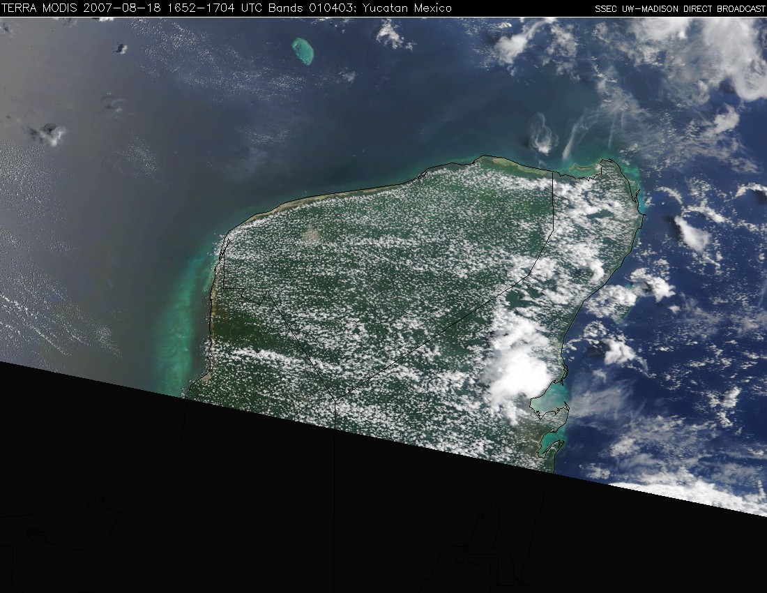
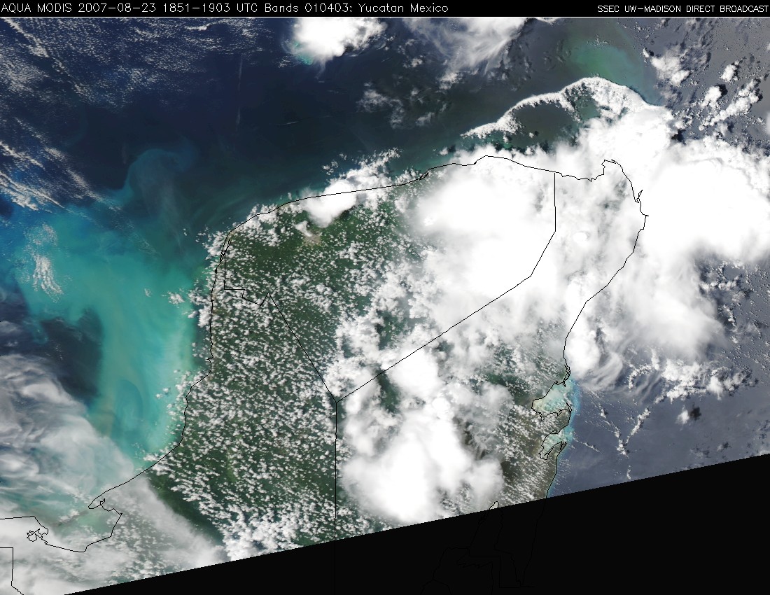
MODIS true color imagery of the Yucatan Peninsula before Dean (above) and after Dean (below) show that the hurricane winds increased the levels of turbidity in the waters of the Gulf of Mexico, leading to widespread areas of cyan and milky-colored water off the west coast of the Yucatan (due to a large amount of suspended particulate matter in the water).


