Lake Michigan “pneumonia front”
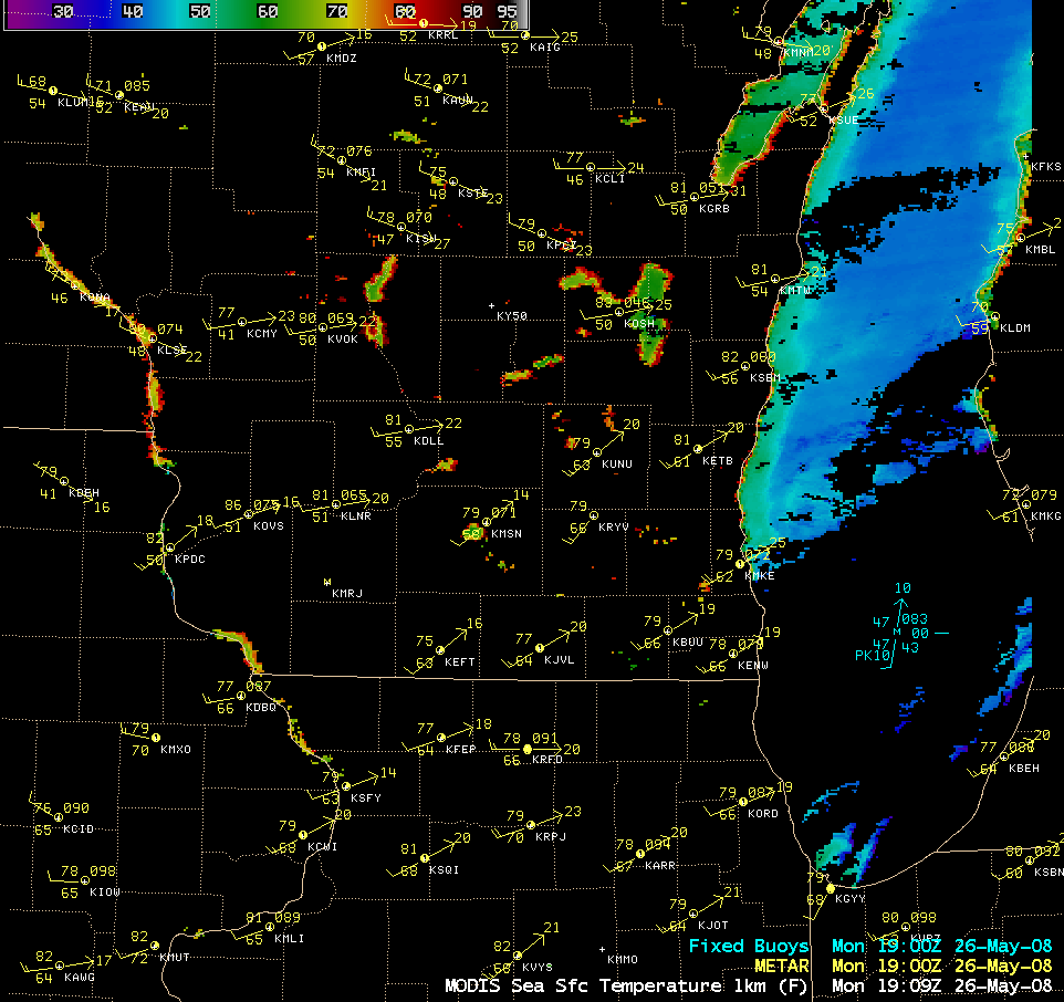
A strong cold front moved southward across the Upper Midwest and Great Lakes states on 26 May – 27 May 2008. During the preceding month, temperatures had been colder than normal at many sites across the region (mean air temperature departures for May 2008 included 3.0º F below normal at Milwaukee and 3.1º F below normal at Madison, Wisconsin, 3.2º F below normal at Chicago, Illinois, and 5.1º F below normal at Marquette, Michigan) — as a result, an AWIPS image of the MODIS Sea Surface Temperature (SST) product (above) showed that the water temperatures across much of central Lake Michigan were still in the rather cold 39-45º F range (blue colors). This cold lake water contributed to the formation of a well-defined “pneumonia front” (defined by Behnke (2005) as a lake-modified synoptic scale cold front that results in a rapid air temperature drop of at least 16º F in a 1 hour period) that moved inland across eastern Wisconsin during the evening and night-time hours.
Examining surface temperature data from Milwaukee and Madison in Wisconsin, Behnke (2005) documented 25 cases of pneumonia fronts during the period 1948-2003. It was found that reduced roughness over the north-south oriented Lake Michigan allowed for stronger impact of the pneumonia fronts over the southern portions of the lake and shoreline, and colder lake temperatures in the north helped to increase the nearshore temperature gradient and frontal propagation. Topography appeared to have little influence on pneumonia front generation and maintenance — the associated temperature falls were strongly dependent on diurnal landmass heating and Lake Michigan surface water temperatures.
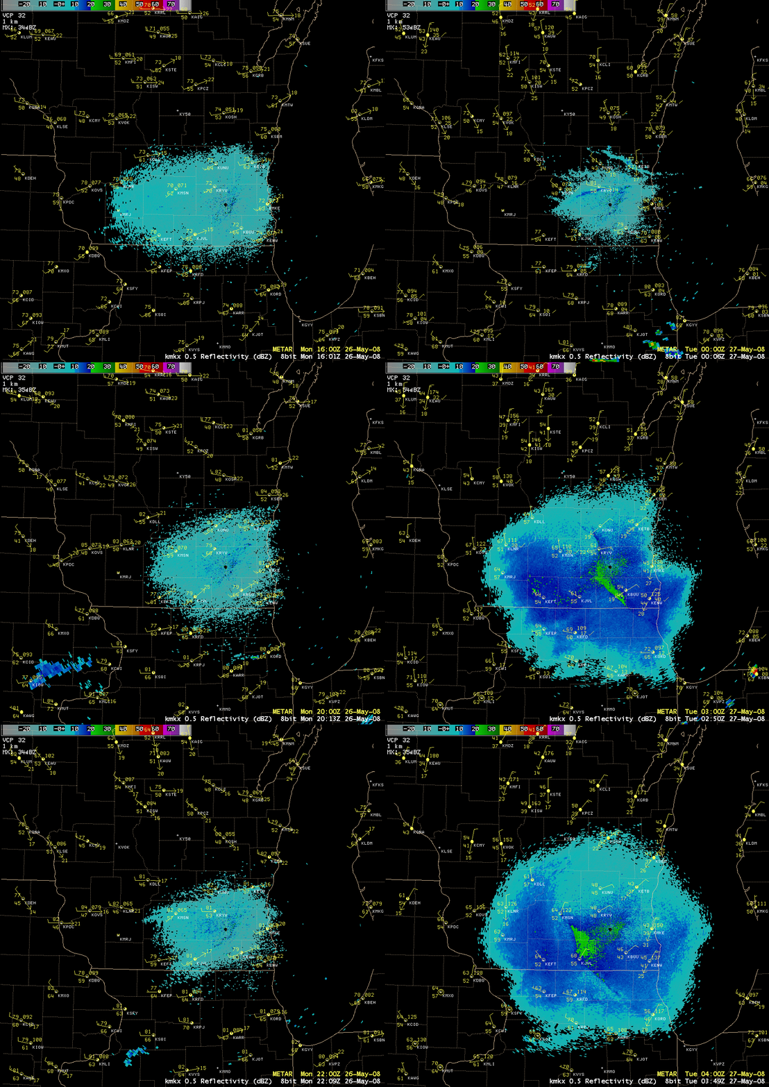
The inland progression of the “pneumonia front” boundary was clearly evident on Milwaukee (KMKX) base reflectivity radar data (above; QuickTime animation). Note that a sequence of 3 distinct boundaries could be seen: Boundaries 1 and 2 were likely the primary cold front (moving south-southeastward across south-central Wisconsin), and an initial “weak pulse” of lake-cooled air moving southward (roughly perpendicular to the lakeshore), respectively; then, Boundary 3 (the true “pneumonia front”) raced rapidly inland from east to west, with surface air temperatures quickly dropping from the 70s F to the 40s F across far eastern Wisconsin. At Milwaukee (KMKE, where the daytime maximum temperature was 81º F), the air temperature later dropped from 78º F to 49º F in one hour, with northerly winds gusting to 38 mph; even as far inland as Madison (KMSN, where the daytime maximum temperature was 82º F), the temperature later dropped from 64º F to 55º F in one hour, with northeasterly winds gusting to 24 mph as the pneumonia front passed.
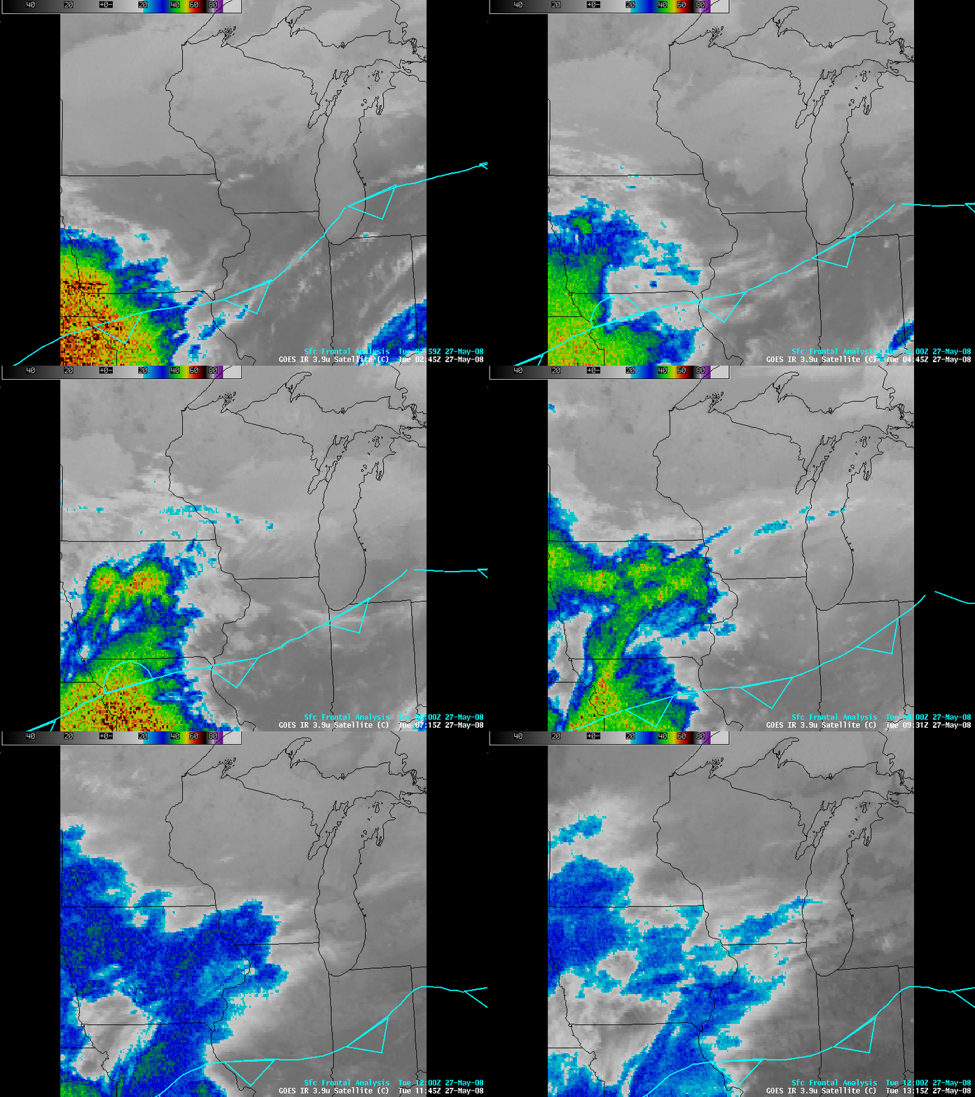
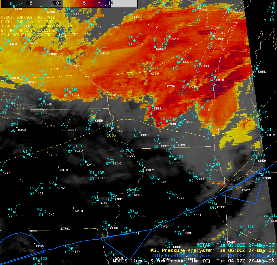
An extensive area of post-frontal stratus clouds could be seen moving southward and southwestward on 4-km resolution GOES-12 3.9 µm IR images (above), but the leading edge of the stratus clouds became masked by a veil of high cirrus clouds streaming eastward from convection across Iowa and Missouri. The 1-km resolution MODIS fog/stratus product (below) was more helpful in accurately locating the leading (southern) edge of the stratus clouds around 04:32 UTC (11:32 PM local time).
Additional reference:
Synoptic and Local Controls of the Lake Michigan Pneumonia Front, C. Behnke and P. Roebber, 16th Annual U.S./Canada Great Lakes Operation Meteorology Workshop, Milwaukee, WI, Sep. 5-7, 2007.


